A Quick Early Morning Update on Icy Conditions
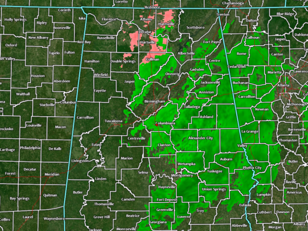
As of 5:45 am this morning, we still have some potential for freezing rain in the northern parts of North/Central Alabama mainly from around Cullman and Double Springs up to Athens, Huntsville, and Ardmore. Showers continue south of that mainly along and east of the I-65 corridor. The western parts of the area have already started drying out.
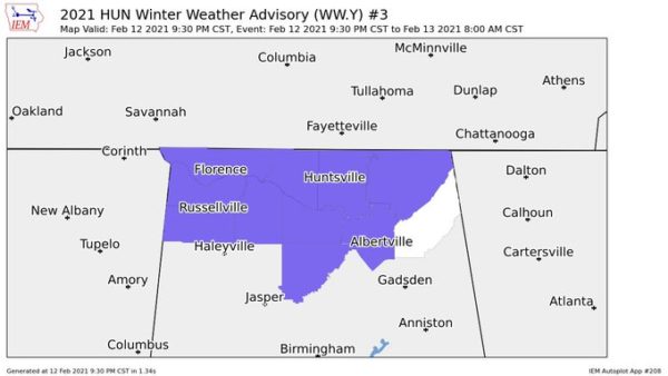
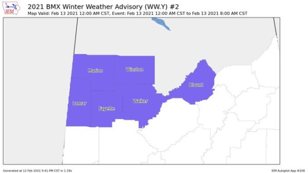
The Winter Weather Advisories that are in effect for North Alabama (Colbert, Cullman, Franklin, Jackson, Lauderdale, Lawrence, Limestone, Madison, Marshall, and Morgan counties) and for portions of Central Alabama (Blount, Fayette, Lamar, Marion, Walker, and Winston counties) has been extended until 10:00 am this morning due to the activity moving a little slower to the east and temperatures potentially staying below freezing just a little longer.
If you are having to drive this morning, leave early and slow down. Hazardous travel will persist through the morning in the advisory area. Icy bridges & overpasses have been reported along with light glaze of ice on elevated surfaces including vehicles. Only a few accidents are showing up on the map in Madison County, but it is unknown if they are weather-related.
Category: Alabama's Weather, ALL POSTS, Winter Weather
About the Author (Author Profile)
Scott Martin is an operational meteorologist, professional graphic artist, musician, husband, and father. Not only is Scott a member of the National Weather Association, but he is also the Central Alabama Chapter of the NWA president. Scott is also the co-founder of Racecast Weather, which provides forecasts for many racing series across the USA. He also supplies forecasts for the BassMaster Elite Series events including the BassMaster Classic.Subscribe
If you enjoyed this article, subscribe to receive more just like it.


