

Strong Storms Moving into Marshall, Madison, Cullman, & Morgan Counties
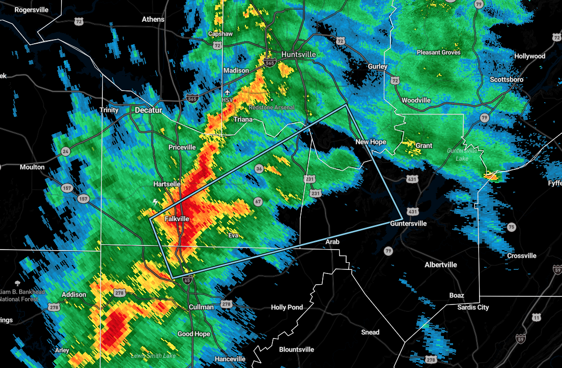
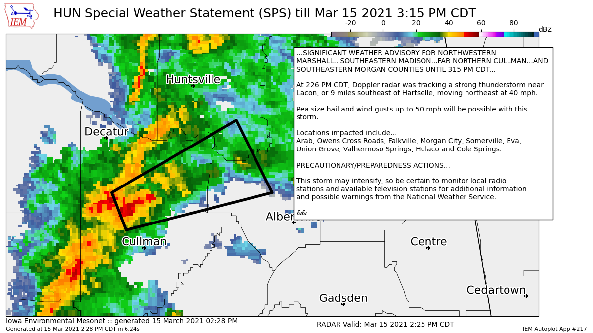
…SIGNIFICANT WEATHER ADVISORY FOR NORTHWESTERN
MARSHALL…SOUTHEASTERN MADISON…FAR NORTHERN CULLMAN…AND
SOUTHEASTERN MORGAN COUNTIES UNTIL 315 PM CDT…
At 226 PM CDT, Doppler radar was tracking a strong thunderstorm near
Lacon, or 9 miles southeast of Hartselle, moving northeast at 40 mph.
Pea size hail and wind gusts up to 50 mph will be possible with this
storm.
Locations impacted include…
Arab, Owens Cross Roads, Falkville, Morgan City, Somerville, Eva,
Union Grove, Valhermoso Springs, Hulaco and Cole Springs.
PRECAUTIONARY/PREPAREDNESS ACTIONS…
This storm may intensify, so be certain to monitor local radio
stations and available television stations for additional information
and possible warnings from the National Weather Service.
Category: Alabama's Weather, ALL POSTS, Severe Weather
About the Author (Author Profile)
Scott Martin is an operational meteorologist, professional graphic artist, musician, husband, and father. Not only is Scott a member of the National Weather Association, but he is also the Central Alabama Chapter of the NWA president. Scott is also the co-founder of Racecast Weather, which provides forecasts for many racing series across the USA. He also supplies forecasts for the BassMaster Elite Series events including the BassMaster Classic.Subscribe
If you enjoyed this article, subscribe to receive more just like it.


