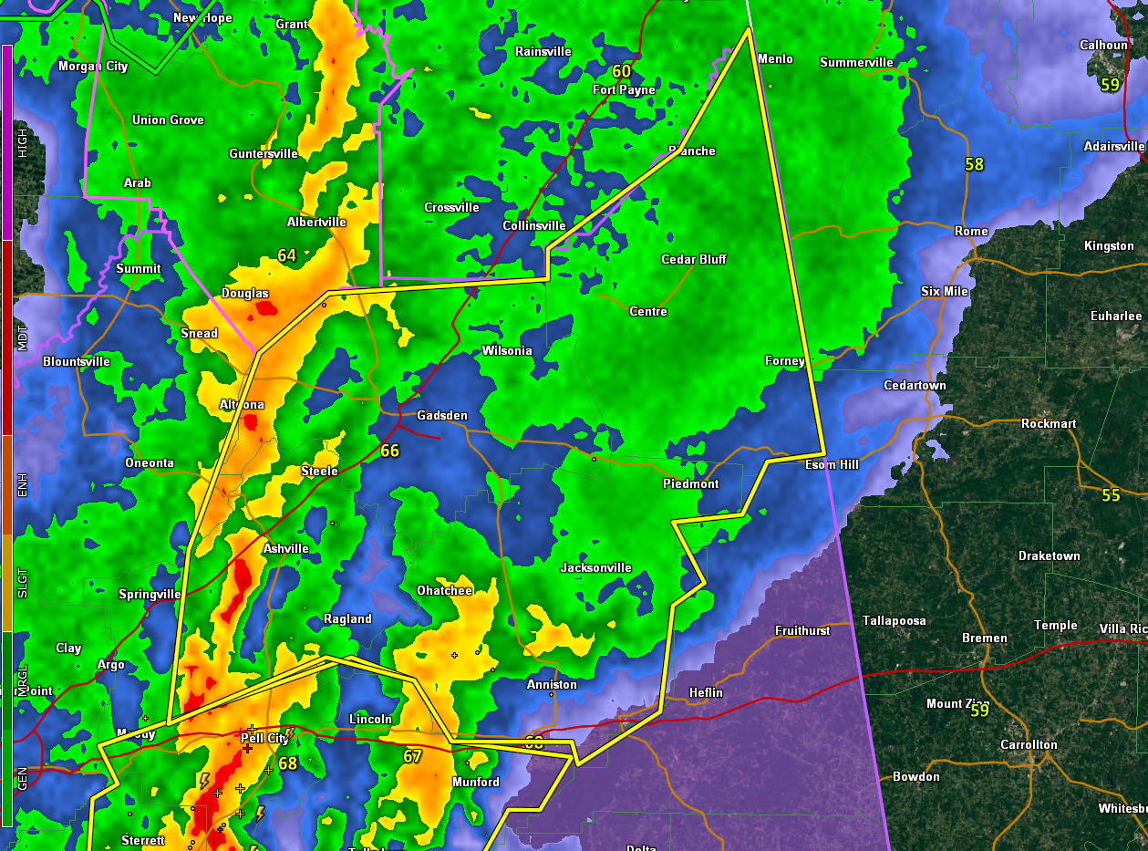
EXPIRED Severe Thunderstorm Warning for Parts of Calhoun, Etowah, St. Clair, and Cherokee Counties until 1130 pm
The National Weather Service in Birmingham has issued a
* Severe Thunderstorm Warning for…
Calhoun County in east central Alabama…
Etowah County in northeastern Alabama…
Northeastern St. Clair County in central Alabama…
Cherokee County in northeastern Alabama…
* Until 1130 PM CDT.
* At 1022 PM CDT, severe thunderstorms were located along a line
extending from near Albertville to near Pell City, moving east at
50 mph.
HAZARD…60 mph wind gusts.
SOURCE…Radar indicated.
IMPACT…Expect damage to roofs, siding, and trees.
* Locations impacted include…
Gadsden, Anniston, Oxford, Jacksonville, Rainbow City, Attalla,
Piedmont, Hokes Bluff, Springville, Odenville, Centre, Cedar Bluff,
Cobb Town, Fort McClellan, Saks, Little River Canyon National
Preserve, Forney, West End-Cobb Town, Centre Municipal Airport and
Glencoe.
Category: Alabama's Weather, ALL POSTS, Severe Weather
About the Author (Author Profile)
Bill Murray is the President of The Weather Factory. He is the site's official weather historian and a weekend forecaster. He also anchors the site's severe weather coverage. Bill Murray is the proud holder of National Weather Association Digital Seal #0001 @wxhistorianSubscribe
If you enjoyed this article, subscribe to receive more just like it.


