New Tornado Watch to Our West
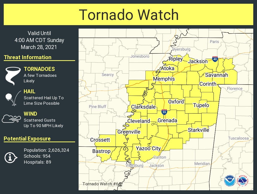
A new tornado watch has been issued this evening for parts of Arkansas, Louisiana, Mississippi, and Tennessee.
Storms continue tonight across southeastern Arkansas, western Mississippi, and southwestern Tennessee. Tornado warnings continue for some of them, and there have been several reports of tornadoes across northeastern Texas, southeastern Arkansas, and southwestern Tennessee this afternoon and evening.
The airmass is still moderately unstable across the watch area, with CAPE values over 1,500 joules/kg, and dewpoints in the middle and upper 60s.
Strong winds aloft, including an increasing low-level jet, are producing significant speed shear, and some southerly and even southeasterly surface winds are producing enough low-level directional shear to produce tornadoes.
The storms are expected to congeal into a line of thunderstorms overnight. This line of storms will push southeastward ahead of a cold front that is gathering steam to our northwest tonight.
The line of storms will push into Northwest Alabama after midnight, reaching the I-59 Corridor around daybreak. The storms will continue southeast through the morning, pushing out of Central Alabama by mid-afternoon. There will be a severe weather threat with them throughout their journey across Alabama.
Category: Alabama's Weather, ALL POSTS, Severe Weather
About the Author (Author Profile)
Bill Murray is the President of The Weather Factory. He is the site's official weather historian and a weekend forecaster. He also anchors the site's severe weather coverage. Bill Murray is the proud holder of National Weather Association Digital Seal #0001 @wxhistorianSubscribe
If you enjoyed this article, subscribe to receive more just like it.


