Mesoscale Discussion from the NWS BIrmingham
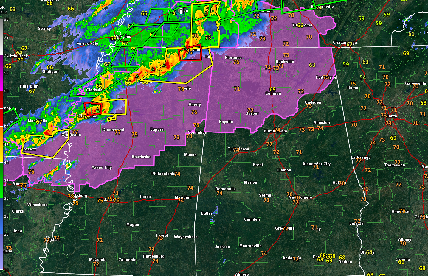
A tornado watch continues for the counties shown in magenta on this map. There are a couple of tornado warnings across northern Mississippi, shown as red polygons. Severe thunderstorm warnings are shown in yellow, flash flood and flood warnings in green.
A new tornado warning was just issued for a possible tornado near Corinth. This warning includes Iuka and Corinth.
Here is the latest thinking from the NWS Birmingham:
Strong warm advection is holding temperatures in the
70s with dewpoints currently in the mid/upper 60s across Central
AL. A complex of intense thunderstorms are ongoing from western
Tennessee southwest into eastern Arkansas along a cold front which
is situated over the Mississippi River. Based on current storm
motions and hi-res guidance, expect the line to reach our
northwestern counties by 3 AM or perhaps an hour earlier where
strong eff. bulk shear of 50- 60 kts and MLCAPE ~1000-1500 J/kg
will support a continued risk of damaging winds within organized
bowing structures as the primary threat. Current sfc obs in our
northwest indicate southerly to south-southwesterly surface winds
with progged 850mb winds out of the southwest to west-southwest.
This slight low-level clockwise turning with height will yield a
low-end threat for embedded tornadoes within the line. We expect
surface winds to veer and instability to slowly decrease after the
line moves into northwestern Central AL with the overall tornado
threat decreasing with time as the line nears the I-20/59
corridor.
Category: Alabama's Weather, ALL POSTS, Severe Weather
About the Author (Author Profile)
Bill Murray is the President of The Weather Factory. He is the site's official weather historian and a weekend forecaster. He also anchors the site's severe weather coverage. Bill Murray is the proud holder of National Weather Association Digital Seal #0001 @wxhistorianSubscribe
If you enjoyed this article, subscribe to receive more just like it.


