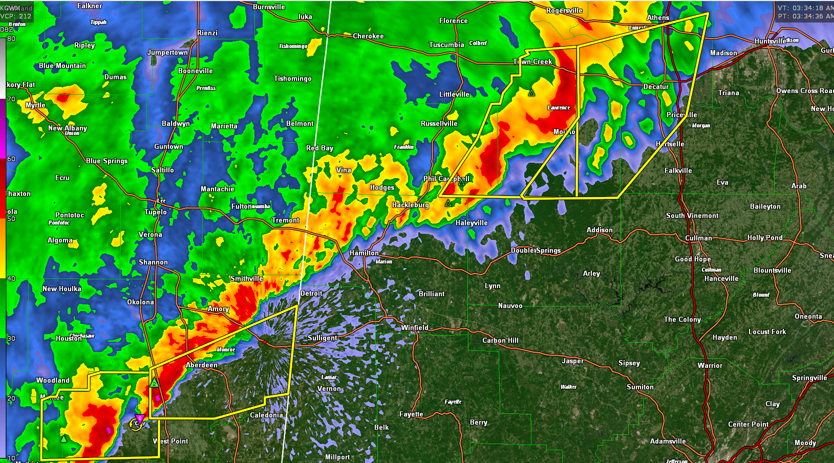
Severe Thunderstorm Warning for Parts of Limestone, Morgan, and Lawrence Counties Until 4 am
Severe thunderstorm warning is being extended eastward to include Athens, Decatur, and Priceville at this hour.
In addition, new severe thunderstorm warnings in northeastern Mississippi in the Aberdeen area adjacent to Lamar County in West Alabama. The storm southwest of Aberdeen is showing some rotation.
In addition to damaging winds, conditions are still favorable for tornadoes over Northwest Alabama. A tornado watch remains in effect for much of North and North Central Alabama until 6 a.m.
The National Weather Service in Huntsville Alabama has issued a
* Severe Thunderstorm Warning for…
Southern Limestone County in north central Alabama…
Northwestern Morgan County in north central Alabama…
Eastern Lawrence County in northwestern Alabama…
* Until 400 AM CDT.
* At 333 AM CDT, severe thunderstorms were located along a line
extending from 6 miles east of Courtland to near Moulton to near
Needmore, moving east at 50 mph.
HAZARD…60 mph wind gusts.
SOURCE…Radar indicated.
IMPACT…Expect damage to roofs, siding, and trees.
* Locations impacted include…
Decatur, Athens, Hartselle, Moulton, Priceville, Trinity, Tanner,
Hillsboro, Mooresville and Belle Mina.
Category: Alabama's Weather, ALL POSTS, Severe Weather
About the Author (Author Profile)
Bill Murray is the President of The Weather Factory. He is the site's official weather historian and a weekend forecaster. He also anchors the site's severe weather coverage. Bill Murray is the proud holder of National Weather Association Digital Seal #0001 @wxhistorianSubscribe
If you enjoyed this article, subscribe to receive more just like it.


