Severe Thunderstorm Warning Issued for Parts of Fayette, Walker, and Winston Until 530 am
The National Weather Service in Birmingham has issued a
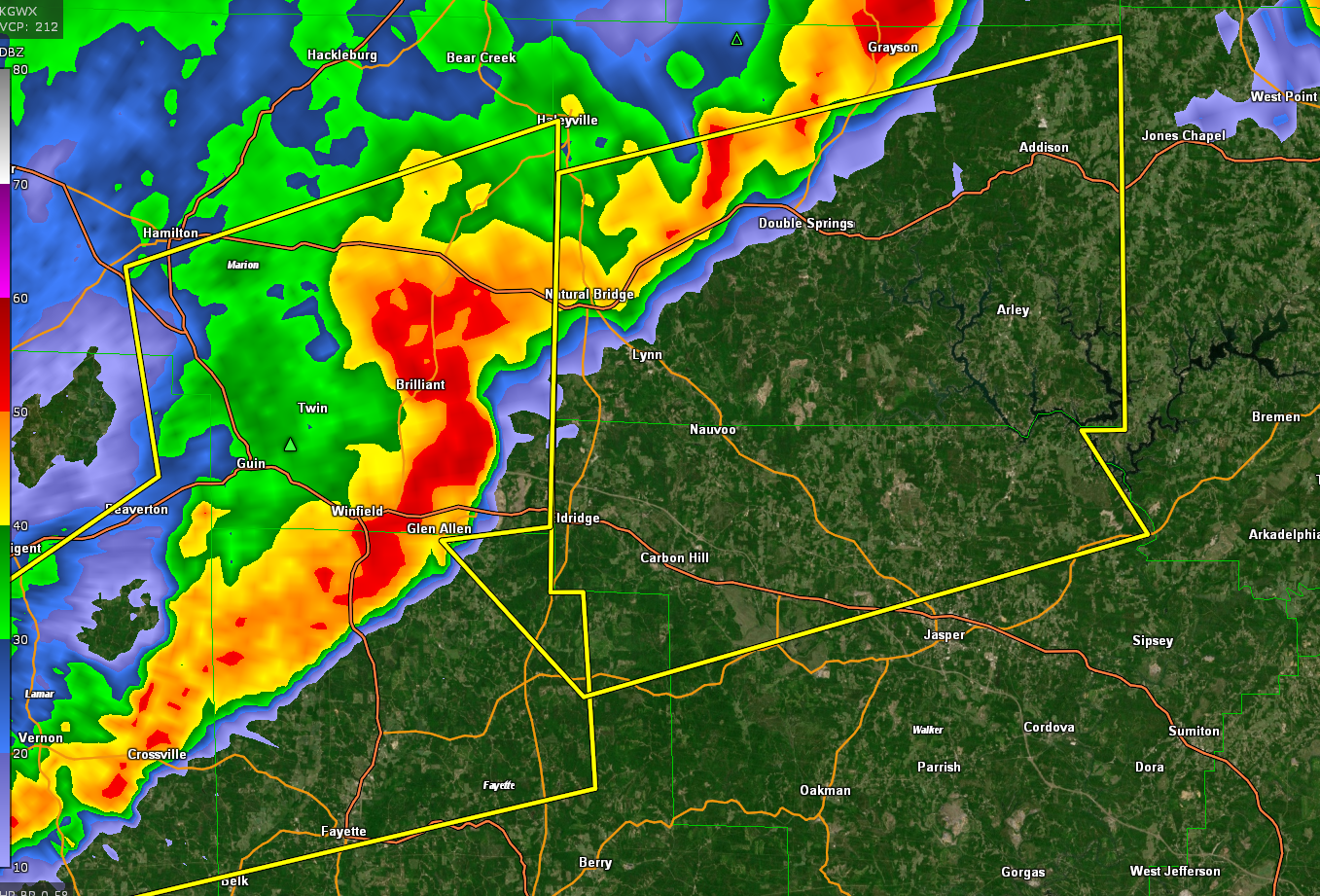
* Severe Thunderstorm Warning for…
Northwestern Walker County in central Alabama…
Winston County in northwestern Alabama…
Northeastern Fayette County in west central Alabama…
* Until 530 AM CDT.
* At 431 AM CDT, a severe thunderstorm was located near Brilliant, or
near Winfield, moving east at 65 mph.
HAZARD…70 mph wind gusts and nickel size hail.
SOURCE…Radar indicated.
IMPACT…Expect considerable tree damage. Damage is likely to
mobile homes, roofs, and outbuildings.
* Locations impacted include…
Jasper, Carbon Hill, Lynn, Arley, Double Springs, Addison, Glen
Allen, Kansas, Nauvoo, Eldridge, Curry, Houston Recreational Area,
Camp McDowell, Nesmith, Ashbank, Poplar Springs, Falls City,
Moreland, Smith Lake and Helicon.
Category: Alabama's Weather, ALL POSTS, Severe Weather
About the Author (Author Profile)
Bill Murray is the President of The Weather Factory. He is the site's official weather historian and a weekend forecaster. He also anchors the site's severe weather coverage. Bill Murray is the proud holder of National Weather Association Digital Seal #0001 @wxhistorianSubscribe
If you enjoyed this article, subscribe to receive more just like it.


