

New Severe Thunderstorm Warning for Jackson County Until 545 am
Here is the radar and two warnings that are now in effect:
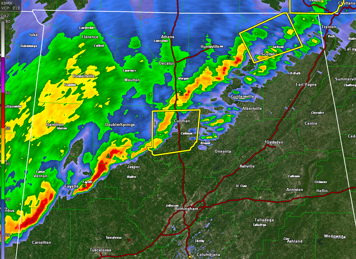
The National Weather Service in Huntsville Alabama has issued a
* Severe Thunderstorm Warning for…
Central Jackson County in northeastern Alabama…
* Until 545 AM CDT.
* At 520 AM CDT, a severe thunderstorm was located near Gurley, or 14
miles southeast of Moores Mill, moving east at 60 mph.
HAZARD…60 mph wind gusts and penny size hail.
SOURCE…Radar indicated.
IMPACT…Expect damage to roofs, siding, and trees.
* Locations impacted include…
Scottsboro, Stevenson, Hollywood, Skyline, Pleasant Groves, Hytop,
Bass, Martintown, Lim Rock and Princeton.
Category: Alabama's Weather, ALL POSTS, Severe Weather
About the Author (Author Profile)
Bill Murray is the President of The Weather Factory. He is the site's official weather historian and a weekend forecaster. He also anchors the site's severe weather coverage. Bill Murray is the proud holder of National Weather Association Digital Seal #0001 @wxhistorianSubscribe
If you enjoyed this article, subscribe to receive more just like it.


