Late Morning Check on Our Severe Weather Threat for Today
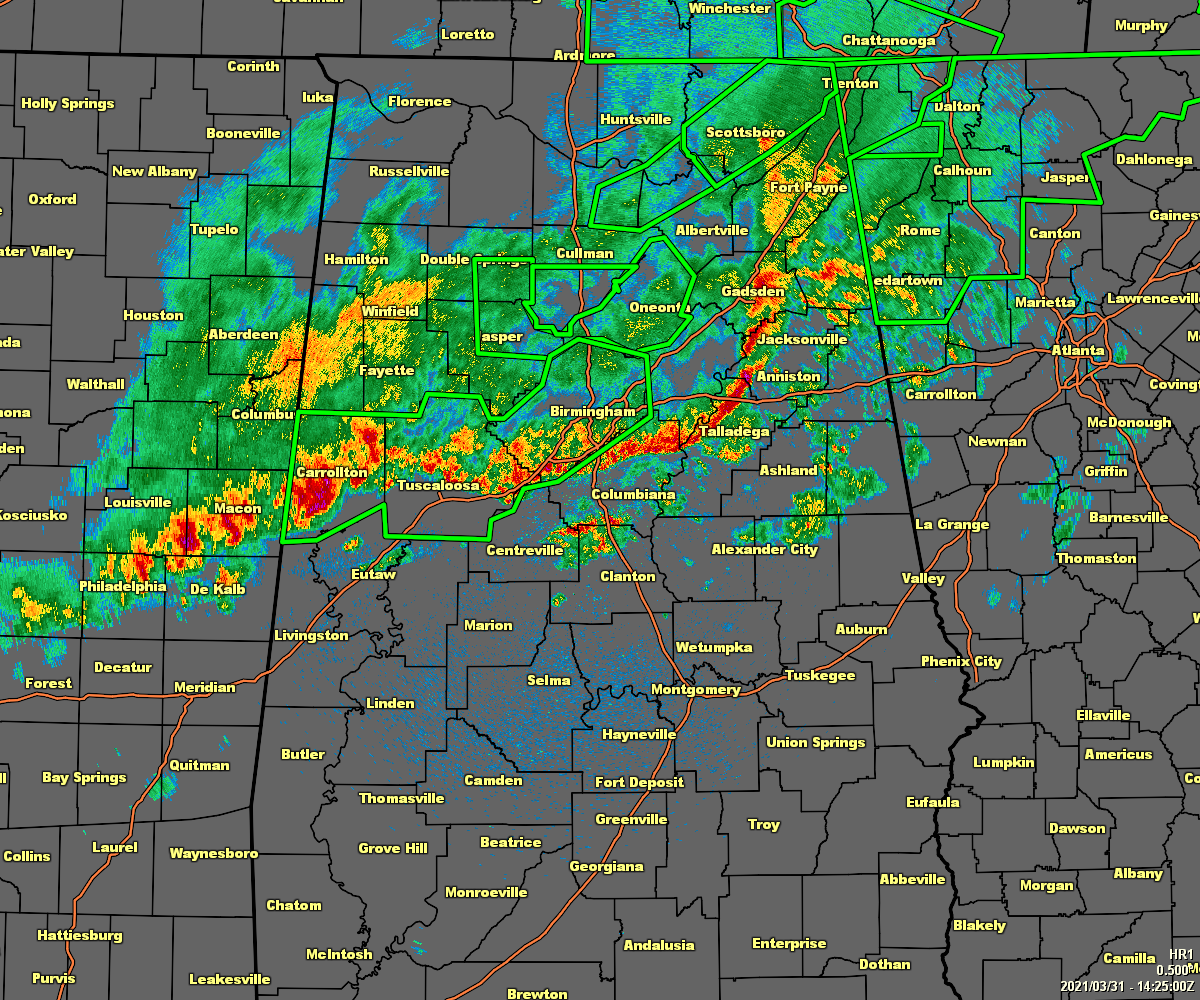
As of 9:25 am, the ragged line of rain and thunderstorms stretches across North/Central Alabama from roughly Fort Payne to Pelham to Carrollton. Some gusty winds and heavy rainfall is occurring with the line, but none of the embedded cells warrant a severe weather warning at this point.
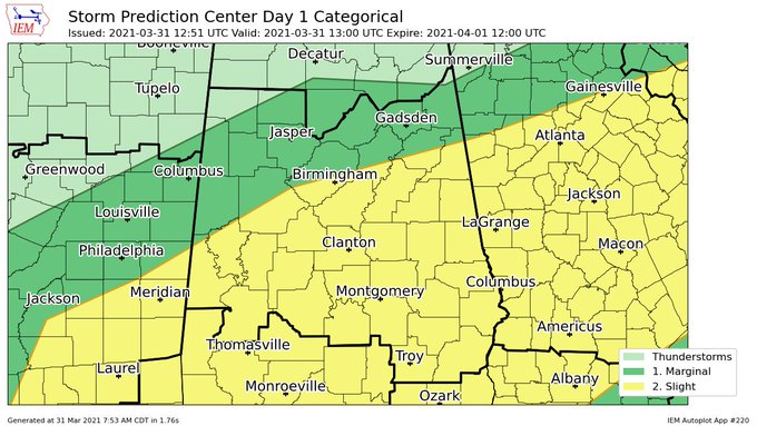
A Slight Risk for severe storms continues for the southern half of North/Central Alabama through the remainder of the day. Damaging winds up to 60 mph and quarter size hail remain possible, but we can’t rule out a brief spin-up tornado or two. Timing from northwest to southeast is from now through 8 pm tonight.
The good news is that the severe weather threat for those locations north of the line of storms is over for today, and those temperatures will begin falling fast. Troy is the warm spot at 75 at this time, while it has already dropped to 54 degrees in Muscle Shoals. Birmingham was at 64 degrees.
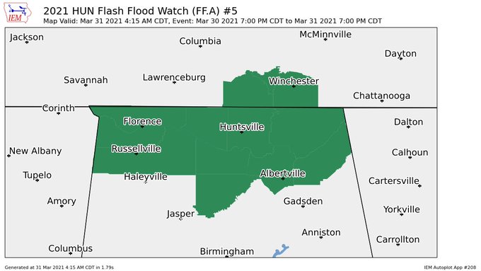
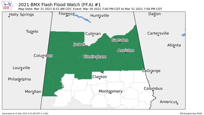
Flash Flood Watches continue for all of North Alabama until 7 pm tonight, and for Blount, Calhoun, Cherokee, Cleburne, Etowah, Fayette, Jefferson, Lamar, Marion, St. Clair, Walker, Winston, Bibb, Clay, Greene, Pickens, Randolph, Shelby, Sumter, Talladega, Tuscaloosa, and Hale counties in Central Alabama until 7 pm tonight.
Several counties are under Flash Flood Warnings and those will continue for a while longer until the heavier rainfall moves out of those areas. Be careful if out on the roadways. We have seen reports of several roadways under water, along with at least one roadway that has been washed away in the Jasper area.
US 278 west of Guin… photo from Regina Abbott pic.twitter.com/SU2ghktzvc
— James Spann (@spann) March 31, 2021
Flooding among AL Highway 17 in Beaverton… photo from Erin Reeves pic.twitter.com/yaNehSff2z
— James Spann (@spann) March 31, 2021
Windham Loop, Jasper. Photo from Abbey Cordes pic.twitter.com/3yz0eReOBx
— James Spann (@spann) March 31, 2021
There may have been a small tornado that touched down earlier this morning in the Neismith community near the Winston/Cullman county line. Some trees have also been reported down near Hayden in Blount county.
Looks like a small tornado touched down in the Nesmith community near the Winston/Cullman county line around 4am today pic.twitter.com/6vQ0j0zyhe
— James Spann (@spann) March 31, 2021
Trees down in Hayden… photos from Haleigh Worley pic.twitter.com/C8o2NYngol
— James Spann (@spann) March 31, 2021
Category: Alabama's Weather, ALL POSTS, Severe Weather
About the Author (Author Profile)
Scott Martin is an operational meteorologist, professional graphic artist, musician, husband, and father. Not only is Scott a member of the National Weather Association, but he is also the Central Alabama Chapter of the NWA president. Scott is also the co-founder of Racecast Weather, which provides forecasts for many racing series across the USA. He also supplies forecasts for the BassMaster Elite Series events including the BassMaster Classic.Subscribe
If you enjoyed this article, subscribe to receive more just like it.


