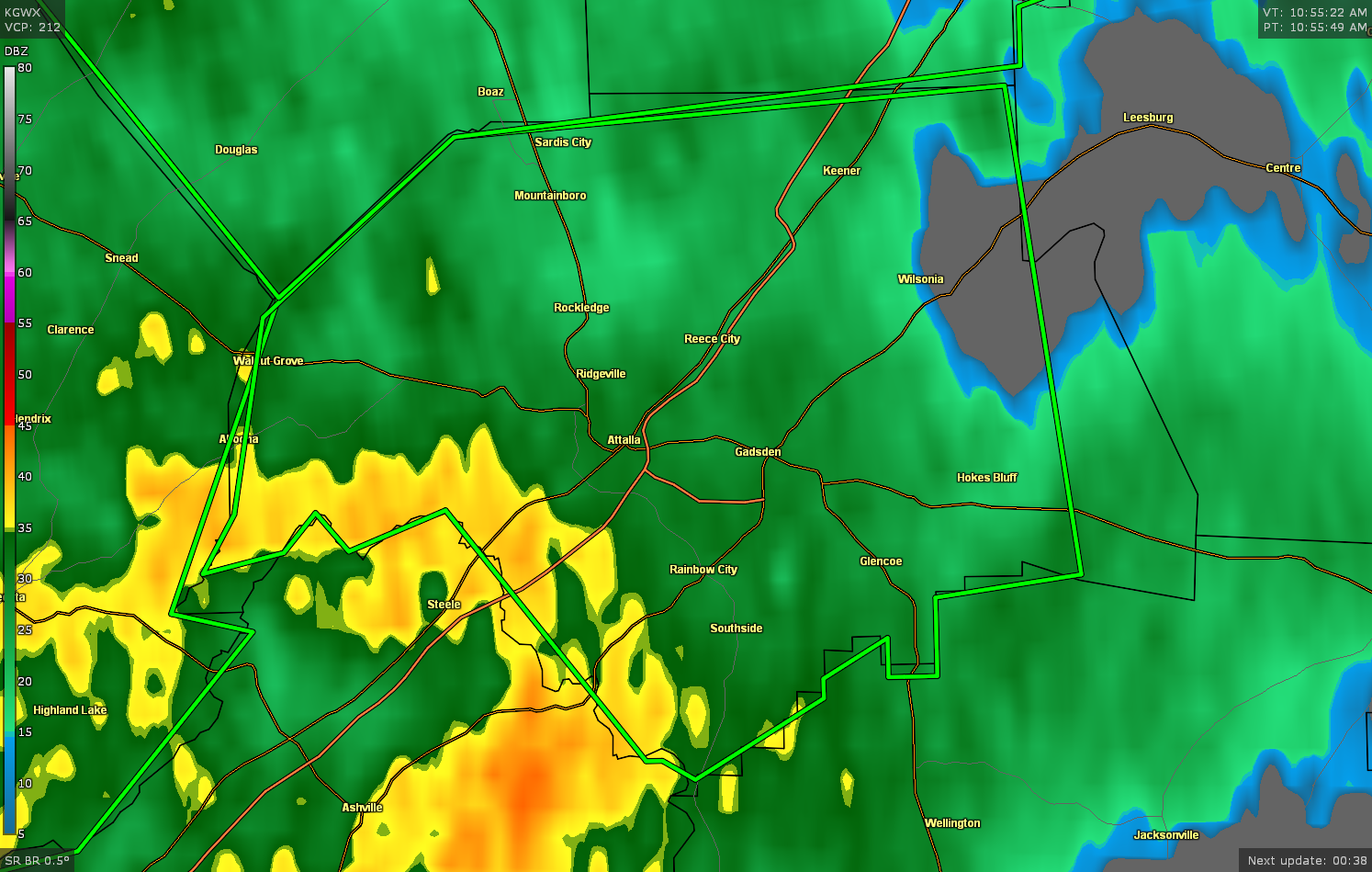
Flash Flood Warning for Etowah Co. Until 2:15 pm
The National Weather Service in Birmingham has issued a
* Flash Flood Warning for…
Etowah County in northeastern Alabama…
* Until 215 PM CDT.
* At 1056 AM CDT, Doppler radar and automated rain gauges indicated
thunderstorms producing heavy rain across the warned area. Flash
flooding is ongoing or expected to begin shortly.
HAZARD…Flash flooding caused by thunderstorms.
SOURCE…Doppler radar and automated gauges.
IMPACT…Flooding of small creeks and streams, urban areas,
highways, streets and underpasses as well as other
drainage and low lying areas.
* Some locations that will experience flash flooding include…
Gadsden, Rainbow City, Attalla, Hokes Bluff, Glencoe, Sardis City,
Steele, Altoona, Walnut Grove, Reece City, Noccalula Falls,
Gadsden Mall, Aurora, Neely Henry Lake, Tabor Road, Southside,
Crudup, Northside, Rockledge and Big Wills Creek.
PRECAUTIONARY/PREPAREDNESS ACTIONS…
Turn around, don’t drown when encountering flooded roads. Most flood
deaths occur in vehicles.
A Flash Flood Warning means that flooding is imminent or occurring.
If you are in the warned area move to higher ground immediately.
Residents living along streams and creeks should take immediate
precautions to protect life and property.
Category: Alabama's Weather, ALL POSTS, Severe Weather
About the Author (Author Profile)
Scott Martin is an operational meteorologist, professional graphic artist, musician, husband, and father. Not only is Scott a member of the National Weather Association, but he is also the Central Alabama Chapter of the NWA president. Scott is also the co-founder of Racecast Weather, which provides forecasts for many racing series across the USA. He also supplies forecasts for the BassMaster Elite Series events including the BassMaster Classic.Subscribe
If you enjoyed this article, subscribe to receive more just like it.


