Mesoscale Discussion Posted for South Central Alabama: Storms Will be Increasing; Watch May Be Necessary Later this Morning
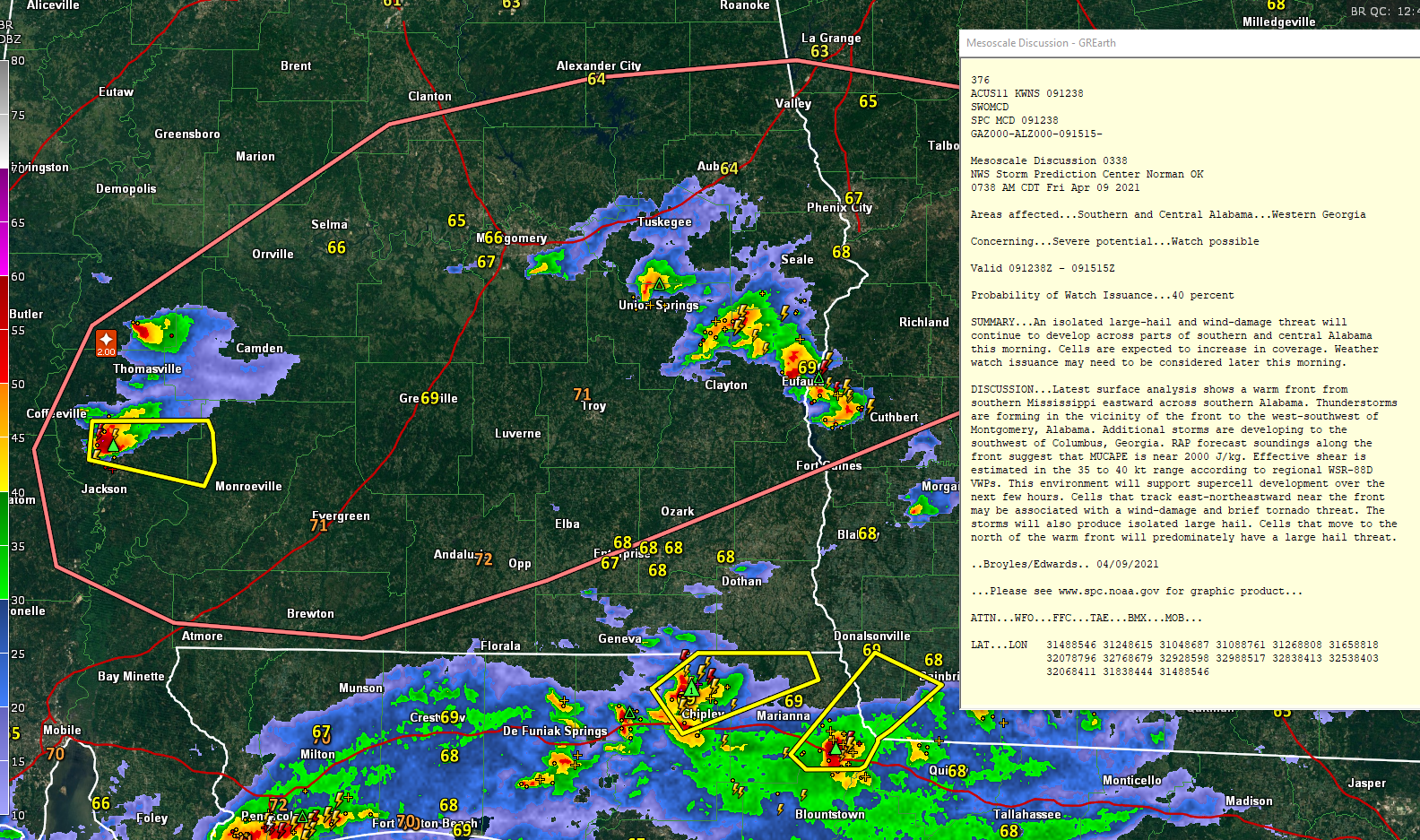
The Storm Prediction Center has issued a Mesoscale Discussion on the storms lifting northward along a warm front over South Central Alabama. Large hail and wind damage threat continues with the storms.
A new severe thunderstorm warning has just been issued for parts of Clarke and Monroe Counties in South Alabama. This is the more southern storm that is between Jackson and Thomasville. The northern storm weakened and is now passing north of Thomasville.
Egg-sized hail was reported earlier near Holtamville in Marengo County around 7:17 a.m. this morning from the storm that eventually weakened.
Mesoscale Discussion 0338
NWS Storm Prediction Center Norman OK
0738 AM CDT Fri Apr 09 2021
Areas affected…Southern and Central Alabama…Western Georgia
Concerning…Severe potential…Watch possible
Valid 091238Z – 091515Z
Probability of Watch Issuance…40 percent
SUMMARY…An isolated large-hail and wind-damage threat will
continue to develop across parts of southern and central Alabama
this morning. Cells are expected to increase in coverage. Weather
watch issuance may need to be considered later this morning.
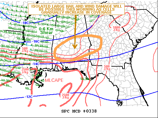
DISCUSSION…Latest surface analysis shows a warm front from
southern Mississippi eastward across southern Alabama. Thunderstorms
are forming in the vicinity of the front to the west-southwest of
Montgomery, Alabama. Additional storms are developing to the
southwest of Columbus, Georgia. RAP forecast soundings along the
front suggest that MUCAPE is near 2000 J/kg. Effective shear is
estimated in the 35 to 40 kt range according to regional WSR-88D
VWPs. This environment will support supercell development over the
next few hours. Cells that track east-northeastward near the front
may be associated with a wind-damage and brief tornado threat. The
storms will also produce isolated large hail. Cells that move to the
north of the warm front will predominately have a large hail threat.
..Broyles/Edwards.. 04/09/2021
Category: Alabama's Weather, ALL POSTS, Severe Weather
About the Author (Author Profile)
Bill Murray is the President of The Weather Factory. He is the site's official weather historian and a weekend forecaster. He also anchors the site's severe weather coverage. Bill Murray is the proud holder of National Weather Association Digital Seal #0001 @wxhistorianSubscribe
If you enjoyed this article, subscribe to receive more just like it.


