

An Early Evening Look at Our Severe Weather Threat for Tonight/Early Saturday
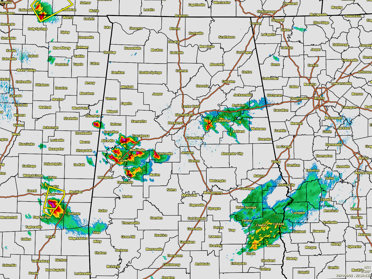
As of 5:38 pm, we do not have any active warnings across North/Central Alabama, but a Severe Thunderstorm Watch continues until 7 pm for Autauga, Bibb, Blount, Chilton, Coosa, Dallas, Elmore, Fayette, Greene, Hale, Jefferson, Lamar, Lowndes, Marengo, Marion, Montgomery, Perry, Pickens, Shelby, St. Clair, Sumter, Talladega, Tuscaloosa, Walker, and Winston counties in Central Alabama. Any storms out there continue to have the risk of gusty winds and hail. We still have plenty of unstable air over the western half of North/Central Alabama for any storms to work with. Much of the eastern half has lost most of the instability from earlier, but enough remains that thunderstorms that could pack a punch will still be possible.
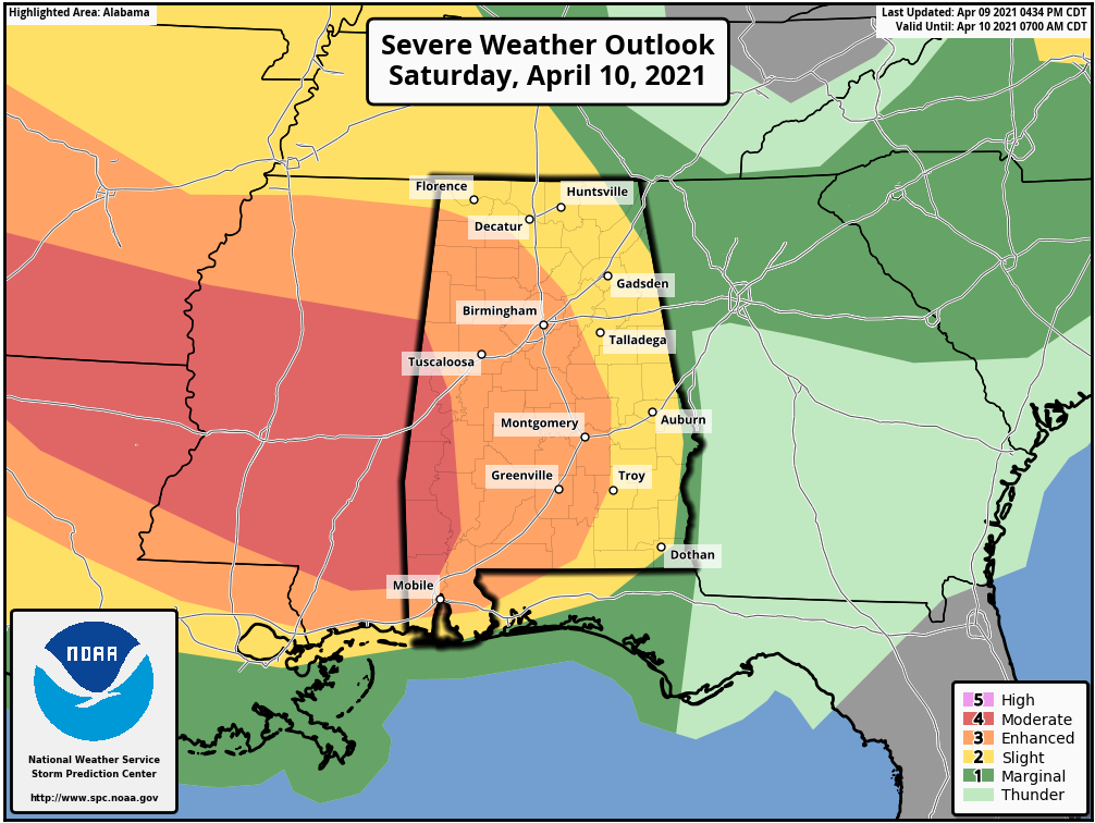
Much of Central Alabama continues under a level 3/5 Enhanced Risk for severe storms through the rest of your Friday and until 7 am Saturday, which includes Russellville, Hamilton, Birmingham, Hoover, Tuscaloosa, Clanton, Demopolis, Selma, and Montgomery. A Slight Risk covers nearly the rest of North/Central Alabama including Florence, Decatur, Athens, Hartselle, Cullman, Huntsville, Guntersville, Scottsboro, Rainsville in North Alabama, and Gadsden, Anniston, Talladega, Alexander City, Auburn, Eufaula, and Troy in Central Alabama. The western portions of Pickens, Greene, and much of Sumter County have been included in a level 4/5 Moderate Risk.
Damaging winds up to or exceeding 70 mph, large hail up to quarter size, and a couple brief spin-up tornadoes will be possible, mainly for the second wave of storms that will move in during the overnight and pre-dawn hours on Saturday. Large hail and damaging wind gusts remain possible from now until around midnight tonight with this first round of scattered storms some of us are experiencing at this moment.
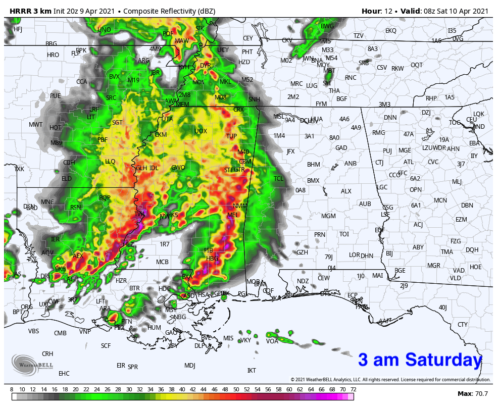
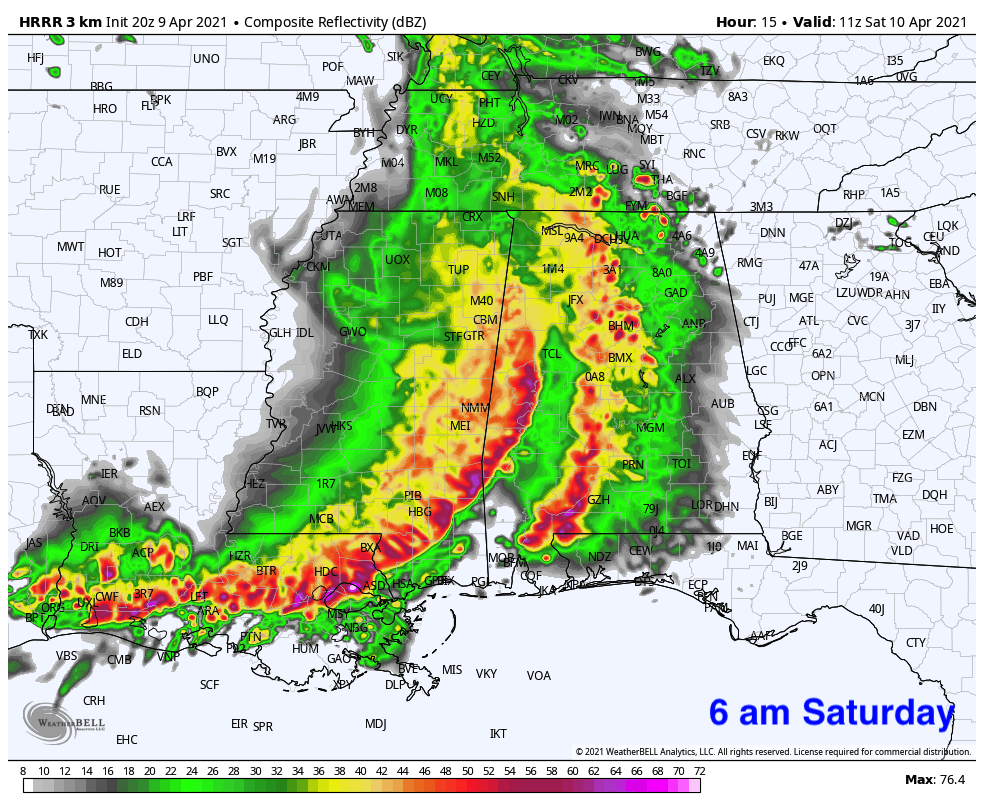
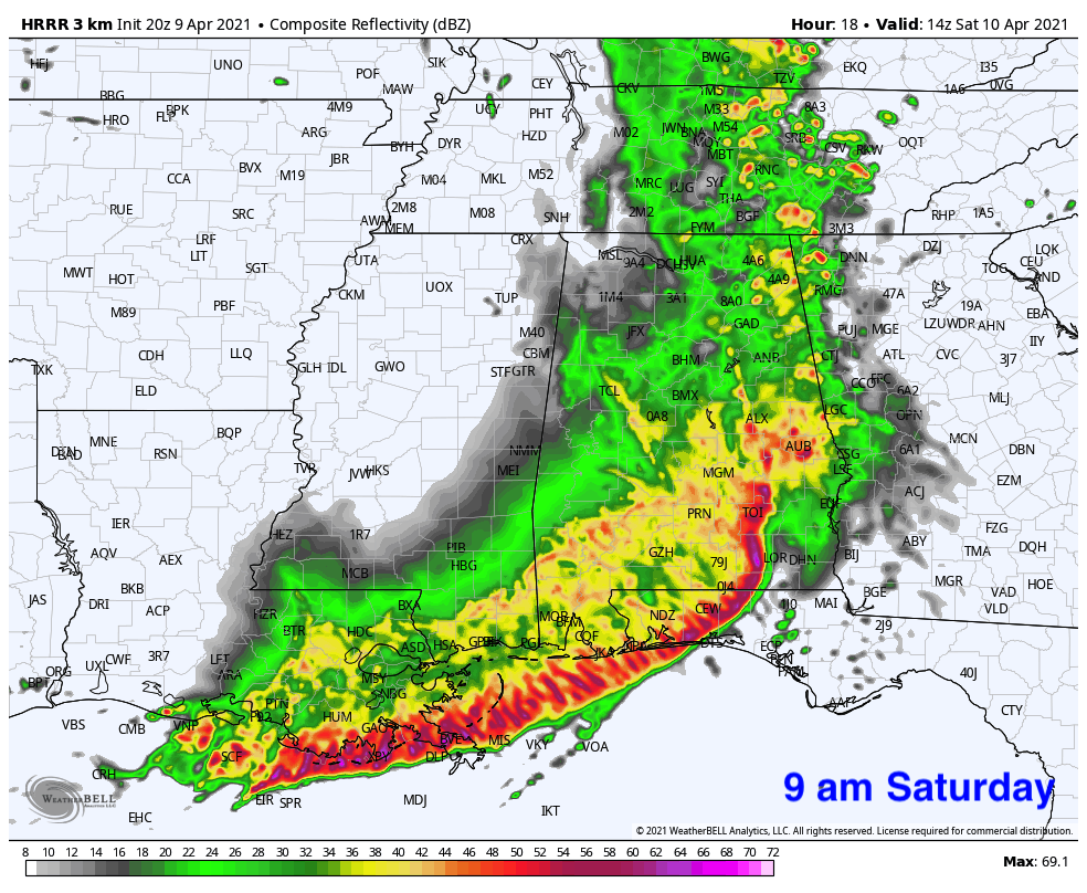
The latest run of the HRRR has the worst of the storms with the main squall line moving over the southern parts of the area and down into South Alabama, which if this is the case, locations in the northern half of North/Central Alabama will have a less likely chance of severe weather. So far, two runs of the HRRR shows this trend.
The highest instability values are projected to be mainly south of a line from Livingston to Wetumpka to Troy through the overnight and into the morning hours on Saturday. There is very limited instability projected for the northern half of the area, which means much of the activity may be elevated.
At this point, we’ll continue to say that there will be a risk of strong to severe storms for nearly everyone in the area until we start to see radar returns trending in that direction.
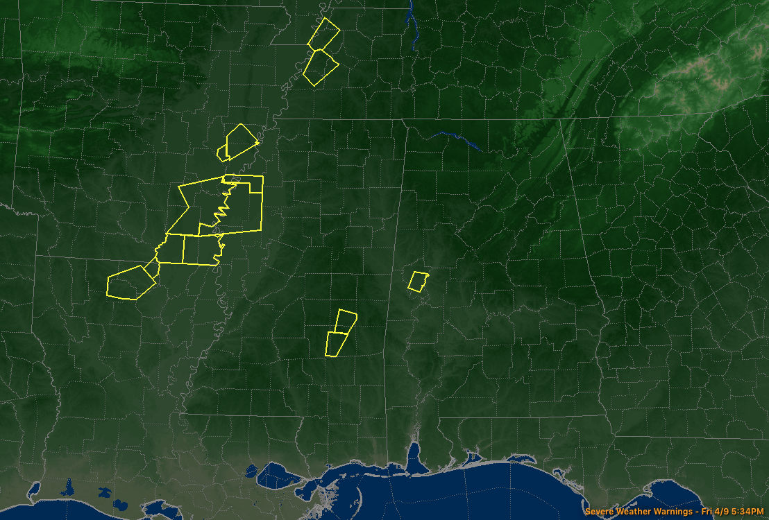
Unfortunately, most of the Severe Thunderstorm Warnings off to our west remain over the northern portions of Louisiana, the southern portions of Arkansas, and the northwestern portions of Mississippi. We’ll keep an eye on all of the action to see what will happen over the next 12 to 15 hours.
Category: Alabama's Weather, ALL POSTS, Severe Weather
About the Author (Author Profile)
Scott Martin is an operational meteorologist, professional graphic artist, musician, husband, and father. Not only is Scott a member of the National Weather Association, but he is also the Central Alabama Chapter of the NWA president. Scott is also the co-founder of Racecast Weather, which provides forecasts for many racing series across the USA. He also supplies forecasts for the BassMaster Elite Series events including the BassMaster Classic.Subscribe
If you enjoyed this article, subscribe to receive more just like it.


