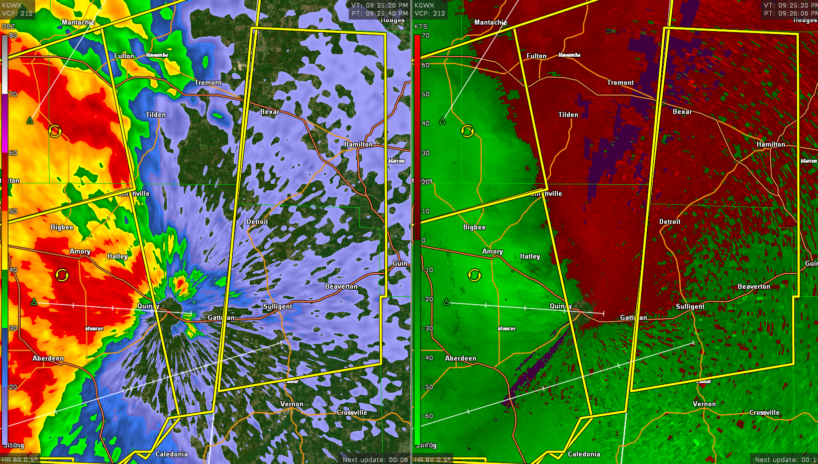
Severe Thunderstorm Warning for Parts of Marion and Lamar Counties Until 1015 pm
Damaging winds are the main threat from the strong storms moving into these counties. They could have small hail and torrential rains as well. Of course, they definitely have lots of dangerous lightning.
These storms have a history of producing wind damage in eastern Mississippi’s Chickasaw County.
The National Weather Service in Birmingham has issued a
* Severe Thunderstorm Warning for…
Western Marion County in northwestern Alabama…
Northern Lamar County in west central Alabama…
* Until 1015 PM CDT.
* At 925 PM CDT, severe thunderstorms were located along a line
extending from near Fulton to 8 miles northwest of Bedford, moving
east at 40 mph.
HAZARD…60 mph wind gusts.
SOURCE…Radar indicated.
IMPACT…Expect damage to roofs, siding, and trees.
* Locations impacted include…
Hamilton, Sulligent, Detroit, Beaverton, Lamar County Airport,
Weston, Crews, Bedford, Henson Springs, Shottsville, Rankin Fite
Airport, Byrd, Pine Springs, Bexar, Marion County Public Lake and
Pikeville.
Category: Alabama's Weather, ALL POSTS, Severe Weather
About the Author (Author Profile)
Bill Murray is the President of The Weather Factory. He is the site's official weather historian and a weekend forecaster. He also anchors the site's severe weather coverage. Bill Murray is the proud holder of National Weather Association Digital Seal #0001 @wxhistorianSubscribe
If you enjoyed this article, subscribe to receive more just like it.


