

Midday Nowcast: Tons of Sunshine
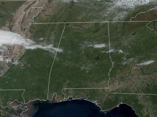
After the cold start to the day, today feature tons of sunshine with highs generally in the 60s. Tomorrow will be another dry day with highs closer to 70°, but clouds will increase through the day as a surface low will be getting its act together off to our west.
WET & STORMY SATURDAY: A dynamic storm system will approach from the west, and will bring widespread rain and thunderstorms back to Alabama very late Friday night and through the day on Saturday. The SPC maintains a “slight risk” (level 2/5) of severe thunderstorms for the southern two-thirds of Alabama, essentially along and south of the Interstate 20 corridor (Tuscaloosa, Birmingham, and Anniston), and a “marginal risk” (level 1/5) as far north as Cullman.
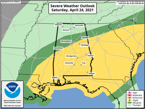
It still looks like we could have to deal with two potential rounds of storms…an early Saturday morning round with a northward moving warm front, then a potential round of afternoon storms.
Round one looks to arrive into Alabama around 2AM Saturday and push east through the predawn hours, before exiting the state around 8AM. This looks to be the main event and this round of storms could produce all three types of severe weather, including some tornadoes, damaging winds, and large hail.
Round two is conditional threat, meaning it may or may not happen, and depends on if the atmosphere can destabilize after the morning storms. We will see a lull in the activity through the late morning and midday hours, but as we head into the afternoon, if the air becomes unstable, additional showers and storms will likely form ahead of a cold front. These storms could produce large hail and strong straight line winds, the wind profiles become somewhere unidirectional by afternoon, so for now the tornado threat looks low with this round of storms.
For now, we will continue to mention the potential for both rounds of storms. Also, all of the state will see a good soaking, with rain amounts of 1-2 inches likely, and some isolated higher amounts as well. Some isolated flooding issues could develop during the day; Saturday’s high will be in the mid to upper 70s.
BEACH FORECAST CENTER: Get the latest weather and rip current forecasts for the beaches from Fort Morgan to Panama City on our Beach Forecast Center page. There, you can select the forecast of the region that you are interested in visiting.
WORLD TEMPERATURE EXTREMES: Over the last 24 hours, the highest observation outside the U.S. was 113.0F at Kayes, Mali. The lowest observation was -94.5F at Amundsen-Scott South Pole Station, Antarctica.
CONTIGUOUS TEMPERATURE EXTREMES: Over the last 24 hours, the highest observation was 93F at Death Valley, CA and Phoenix, AZ. The lowest observation was -8F at Burgess Junction, WY.
Category: Alabama's Weather, ALL POSTS
About the Author (Author Profile)
Macon, Georgia Television Chief Meteorologist, Birmingham native, and long time Contributor on AlabamaWX. Stormchaser. I did not choose Weather, it chose Me. College Football Fanatic. @Ryan_StinnetSubscribe
If you enjoyed this article, subscribe to receive more just like it.


