A Mid-Afternoon Look at Our Severe Weather Threat on Saturday
The newest update from the Storm Prediction has most of Central Alabama in a level 3/5 Enhanced Risk for severe storm for Saturday, especially for locations east and south of a line from York (Sumter Co.) to Parrish (Walker Co.) to Highland Lake (Blount Co.) to Abernathy (Cleburne Co.). The rest of Central Alabama and all of North Alabama has been upgraded to a level 2/5 Slight Risk for severe storms.
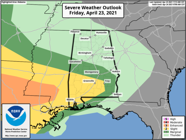
Also, for the rest of today through 7 am Saturday morning, SPC has the extreme southwestern portions of Central Alabama in a level 2/5 Slight Risk with much of the rest of the southern half of Central Alabama in a level 1/5 Marginal Risk for severe storms.
We are continuing to see that two rounds of storms will affect the area, starting with the first round of storms that will open the window for strong to severe storms around 3 am Saturday morning. This threat will stay over the southern half of the area and will affect the western parts during the 3 am – 5 am time frame, the central parts during the 4 am to 7 am time frame, and the eastern parts during the 6am – 10 am time frame. The main threats will be from damaging winds, but with the amount of shear that will be present due to a strong low-level jet, a few brief tornadoes will be possible.
For the second round of storms, these continue to look to be scattered in nature as the atmosphere will recover and become highly unstable during the afternoon hours. The big change is that there will be a threat for tornadoes as an outflow boundary from the morning storms will retreat northward across the area, mixing with an incoming shortwave trough, and a nearby vorticity maximum. There will be plenty of instability and bulk shear with a good bit of helicity to start the afternoon, but the higher helicity will be moving off to our east during the latter half of the afternoon and into the evening. All modes of severe weather will be possible across all of North/Central Alabama to start with, but the tornado risk will be reducing throughout the afternoon hours. That will leave the large hail and damaging wind threat until the cold front finally moves through the area and exits during the late-night hours.
You know the drill… have your severe weather safety plans, safety kits, and place of safety ready to go just in case your location goes under a warning. Have multiple ways to receive weather alerts, stay up-to-date with the latest weather updates through the rest of today, and be sure that your friends, family, neighbors, and co-workers know about the upcoming potential for severe weather.
Category: Alabama's Weather, ALL POSTS, Severe Weather


