An Update to Our Severe Weather Threat as of 10:30 am
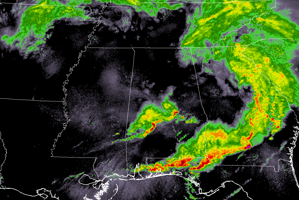
As of 10:03 am, much of North/Central Alabama is dry except for light rain falling over the extreme northeast corner of North Alabama, a cluster of storms stretching from Linden and Marion to Clanton, Tuskegee, and Montgomery, and for the extreme eastern parts of Barbour County where light rain is falling.
As mentioned earlier, the rain that moved through the area earlier this morning has pretty much stabilized the air over the northern half of North/Central Alabama and latest thoughts are now keeping the threat of any severe weather mostly south of the I-20 corridor throughout the remainder of the day. Drier air is being pulled into the area, and along with the stable air, is keeping the warm front from advancing northward.
There are no showers and storms back to our west in Mississippi, with the only activity upstream from us will be the showers that are rapping around the north side of a surface low that is located over Northeast Arkansas.
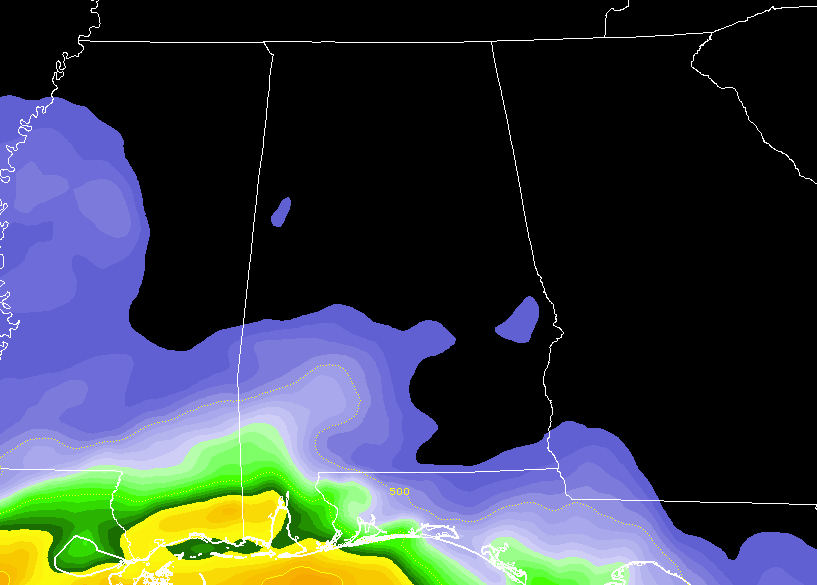
Surface-based instability continues to be confined to the southern parts of the state and is very limited over the southwestern counties in Central Alabama, below 500 J/kg. We do expect some instability to work northward throughout the day and some thunderstorms may develop across the area with the heating of the day.
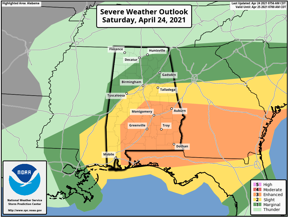
The latest update from the SPC has an Enhanced Risk up for the southeastern portions of the area, including Selma, Clanton, Auburn, Montgomery, Troy, and Eufaula. A Slight Risk is up for locations north and west of that, which includes Demopolis, Tuscaloosa, Birmingham, Talladega, and Alexander City. A Marginal Risk is up for nearly the rest of Central Alabama and for a good portion of North Alabama, including Gadsden, Anniston, Hartselle, Cullman, Scottsboro, Guntersville, and Rainsville.
Damaging winds, quarter size hail, and a brief tornado or two are possible in the Enhanced Risk area, while damaging winds and hail are possible in the Slight and Marginal Risk areas. The severe threat will start around noon in those risk areas, coming to an end in the Marginal and Slight Risk locations by 7 pm this evening, and in the Enhanced Risk area by 9 pm tonight.
Category: Alabama's Weather, ALL POSTS, Severe Weather
About the Author (Author Profile)
Scott Martin is an operational meteorologist, professional graphic artist, musician, husband, and father. Not only is Scott a member of the National Weather Association, but he is also the Central Alabama Chapter of the NWA president. Scott is also the co-founder of Racecast Weather, which provides forecasts for many racing series across the USA. He also supplies forecasts for the BassMaster Elite Series events including the BassMaster Classic.Subscribe
If you enjoyed this article, subscribe to receive more just like it.


