

Severe T-Storm Watch Issued for Southern Parts of Central Alabama Until 9:00 pm Tonight
The Storm Prediction Center has issued a Severe Thunderstorm Watch effective immediately for the southern portions of Central Alabama and all of South Alabama. The Central Alabama counties included in the watch are Autauga, Barbour, Bullock, Dallas, Elmore, Lee, Lowndes, Macon, Marengo, Montgomery, Pike, and Russell. The watch is set to expire at 9 pm tonight. Here is the text from the SPC:
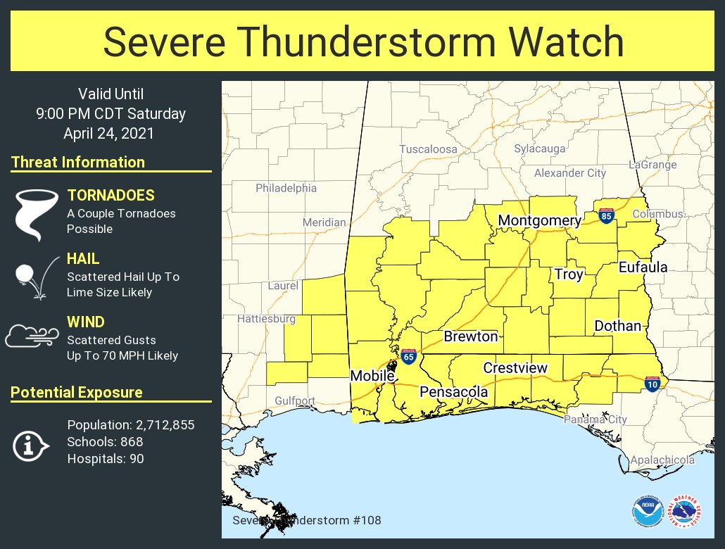
The NWS Storm Prediction Center has issued a
* Severe Thunderstorm Watch for portions of
Southern Alabama
Florida Panhandle
Southeast Mississippi
Coastal Waters
* Effective this Saturday afternoon and evening from 115 PM until 900 PM CDT.
* Primary threats include…
Scattered large hail likely with isolated very large hail events to 2 inches in diameter possible
Scattered damaging wind gusts to 70 mph likely
A tornado or two possible
SUMMARY… Scattered strong to severe thunderstorms are expected to develop across the watch area through the afternoon. The strongest storms will pose a risk of large hail and gusty/damaging wind gusts. An isolated tornado or two is also possible.
Category: Alabama's Weather, ALL POSTS, Severe Weather
About the Author (Author Profile)
Scott Martin is an operational meteorologist, professional graphic artist, musician, husband, and father. Not only is Scott a member of the National Weather Association, but he is also the Central Alabama Chapter of the NWA president. Scott is also the co-founder of Racecast Weather, which provides forecasts for many racing series across the USA. He also supplies forecasts for the BassMaster Elite Series events including the BassMaster Classic.Subscribe
If you enjoyed this article, subscribe to receive more just like it.


