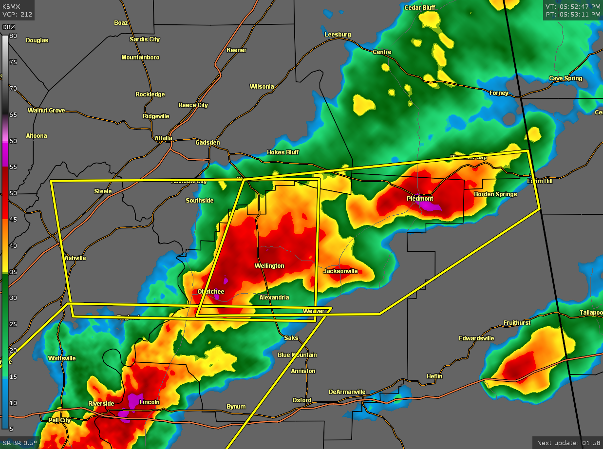
Severe Thunderstorm Warning for Calhoun, Cherokee, Cleburne, Etowah Co. Until 6:45 pm
The National Weather Service in Birmingham has issued a
* Severe Thunderstorm Warning for…
Northern Calhoun County in east central Alabama…
Southeastern Etowah County in northeastern Alabama…
North central Cleburne County in east central Alabama…
Southeastern Cherokee County in northeastern Alabama…
* Until 645 PM CDT.
* At 552 PM CDT, severe thunderstorms were located along a line
extending from near Piedmont to near Ohatchee, moving east at 35
mph.
HAZARD…Ping pong ball size hail and 60 mph wind gusts.
SOURCE…Radar indicated.
IMPACT…People and animals outdoors will be injured. Expect hail
damage to roofs, siding, windows, and vehicles. Expect
wind damage to roofs, siding, and trees.
* Locations impacted include…
Jacksonville, Piedmont, Hokes Bluff, Glencoe, Weaver, Ohatchee,
Pleasant Gap, Alexandria, Jacksonville State University, Spring
Garden, Cobb City, Knightens Crossroads, Liberty Hill, Sulphur
Springs, Borden Springs and Wellington.
PRECAUTIONARY/PREPAREDNESS ACTIONS…
For your protection move to an interior room on the lowest floor of a
building.
Category: Alabama's Weather, ALL POSTS, Severe Weather
About the Author (Author Profile)
Scott Martin is an operational meteorologist, professional graphic artist, musician, husband, and father. Not only is Scott a member of the National Weather Association, but he is also the Central Alabama Chapter of the NWA president. Scott is also the co-founder of Racecast Weather, which provides forecasts for many racing series across the USA. He also supplies forecasts for the BassMaster Elite Series events including the BassMaster Classic.Subscribe
If you enjoyed this article, subscribe to receive more just like it.


