

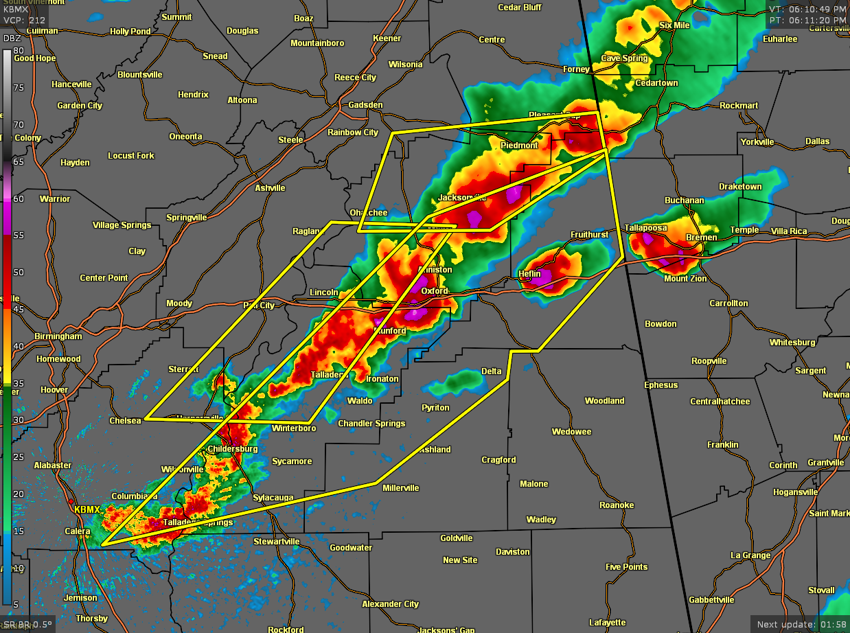
Severe T-Storm Warning for Calhoun, Clay, Cleburne, Shelby, Talladega Co. Until 7:00 pm
The National Weather Service in Birmingham has issued a
* Severe Thunderstorm Warning for…
Talladega County in east central Alabama…
Southeastern Calhoun County in east central Alabama…
Southeastern Shelby County in central Alabama…
Cleburne County in east central Alabama…
Northern Clay County in east central Alabama…
* Until 700 PM CDT.
* At 609 PM CDT, severe thunderstorms were located along a line
extending from near Weaver to near Wilsonville, moving east at 50
mph.
HAZARD…60 mph wind gusts and half dollar size hail.
SOURCE…Radar indicated.
IMPACT…Hail damage to vehicles is expected. Expect wind damage
to roofs, siding, and trees.
* Locations impacted include…
Anniston, Oxford, Talladega, Sylacauga, Jacksonville, Childersburg,
Columbiana, Heflin, Wilsonville, Talladega Springs, West End-Cobb
Town, Cobb Town, Fort McClellan, Saks, Weaver, Harpersville,
Munford, Hobson City, Fruithurst and Waldo.
PRECAUTIONARY/PREPAREDNESS ACTIONS…
For your protection move to an interior room on the lowest floor of a
building.
To report severe weather, contact your nearest law enforcement
agency. They will send your report to the National Weather Service
office in Birmingham.
Category: Alabama's Weather, ALL POSTS, Severe Weather
About the Author (Author Profile)
Scott Martin is an operational meteorologist, professional graphic artist, musician, husband, and father. Not only is Scott a member of the National Weather Association, but he is also the Central Alabama Chapter of the NWA president. Scott is also the co-founder of Racecast Weather, which provides forecasts for many racing series across the USA. He also supplies forecasts for the BassMaster Elite Series events including the BassMaster Classic.Subscribe
If you enjoyed this article, subscribe to receive more just like it.


