Brief Update as of 6:45 pm; More Counties Removed from the Severe Thunderstorm Watches
NWS Birmingham has canceled the Severe Thunderstorm Watch for Bullock, Lee, Macon, Montgomery, Russell counties, and for Bibb, Calhoun, Cherokee, Chilton, Etowah, Shelby, St. Clair, and Talladega counties. The severe weather threat has come to an end for these counties.
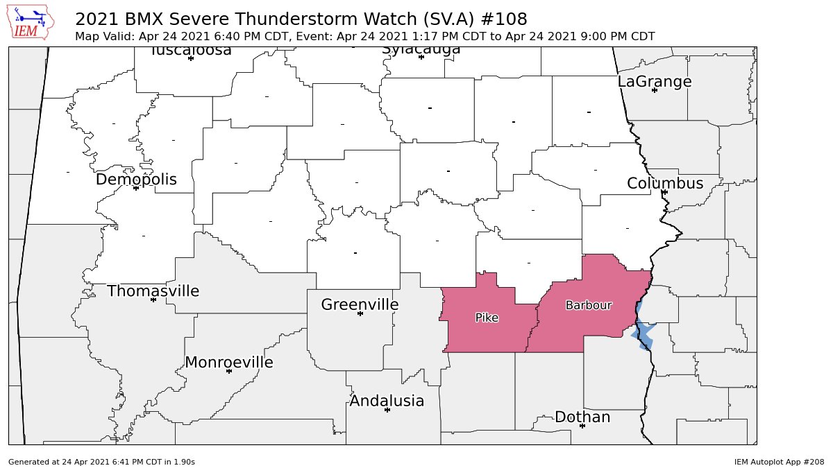
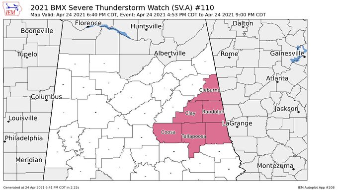
NWS Birmingham continues the Severe Thunderstorm Watches until 9:00 pm for Pike and Barber counties, along with Chambers, Clay, Cleburne, Coosa, Randolph, and Tallapoosa counties.
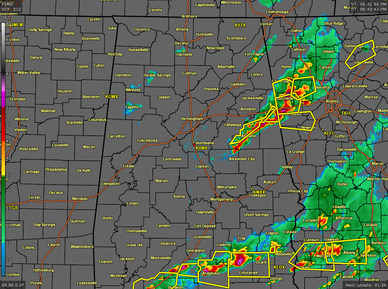
Much of the western half of North/Central Alabama is dry with only a couple of light showers falling over Fayette, Winfield, and Double Springs. The main action are two clusters of storms that are making their way across the extreme eastern and southeastern parts of the area and moving into Georgia. Large hail continue to be the main threats with these storms, but isolated damaging winds gusts are also possible. A brief tornado cannot be completely ruled out, but odds for one occurring are highly unlikely at this point.
Category: Alabama's Weather, ALL POSTS, Severe Weather
About the Author (Author Profile)
Scott Martin is an operational meteorologist, professional graphic artist, musician, husband, and father. Not only is Scott a member of the National Weather Association, but he is also the Central Alabama Chapter of the NWA president. Scott is also the co-founder of Racecast Weather, which provides forecasts for many racing series across the USA. He also supplies forecasts for the BassMaster Elite Series events including the BassMaster Classic.Subscribe
If you enjoyed this article, subscribe to receive more just like it.


