

Severe T-Storm Warning for Chambers, Clay, Randolph, Tallapoosa Co. Until 7:45 pm
The National Weather Service in Birmingham has issued a
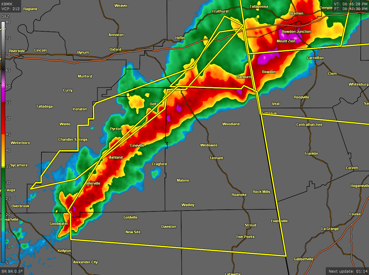
* Severe Thunderstorm Warning for…
Randolph County in east central Alabama…
Northern Tallapoosa County in east central Alabama…
Northern Chambers County in east central Alabama…
Southeastern Clay County in east central Alabama…
* Until 745 PM CDT.
* At 647 PM CDT, severe thunderstorms were located along a line
extending from near Ranburne to Ashland to Goodwater, moving east
at 50 mph.
HAZARD…60 mph wind gusts and penny size hail.
SOURCE…Radar indicated.
IMPACT…Expect damage to roofs, siding, and trees.
* Locations impacted include…
Roanoke, Lineville, Ashland, Wedowee, Stroud, Lake Wedowee, New
Site, Wadley, Woodland, Goldville, Corinth, Crystal Lake, Sparkling
Springs, Malone, Post Oak Forks, Morrison Cross Roads, Barfield,
Amity Park, Abanda and Standing Rock.
PRECAUTIONARY/PREPAREDNESS ACTIONS…
For your protection move to an interior room on the lowest floor of a
building.
Category: Alabama's Weather, ALL POSTS, Severe Weather
About the Author (Author Profile)
Scott Martin is an operational meteorologist, professional graphic artist, musician, husband, and father. Not only is Scott a member of the National Weather Association, but he is also the Central Alabama Chapter of the NWA president. Scott is also the co-founder of Racecast Weather, which provides forecasts for many racing series across the USA. He also supplies forecasts for the BassMaster Elite Series events including the BassMaster Classic.Subscribe
If you enjoyed this article, subscribe to receive more just like it.


