A Brief Check on Our Weather Just After 6:00 pm
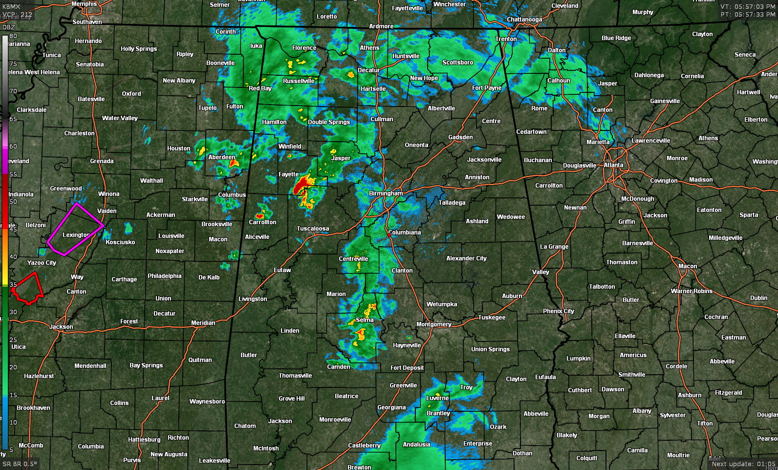
The shower activity now has moved north of the unstable air mass that was allowing some of the heavier cells to rotate and to bring out a few surprise tornado warnings. At this point, the higher instability remains along and south of the warm front over the southwestern counties of Central Alabama.
Showers and storms continue over the western parts of Mississippi in an unstable air mass where a couple of tornado warnings are in effect. That activity will eventually move into the western parts of Central Alabama later tonight.
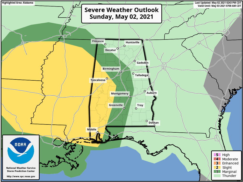
A Slight Risk continues for the west and southwestern parts of the area which includes the cities of Carrollton, Tuscaloosa, Livingston, Eutaw, Greensboro, Demopolis, and Marion.
A Marginal Risk continues east of that that includes the central and east-central parts of the area, including Hamilton, Birmingham, Hoover, Clanton, Selma, and Montgomery.
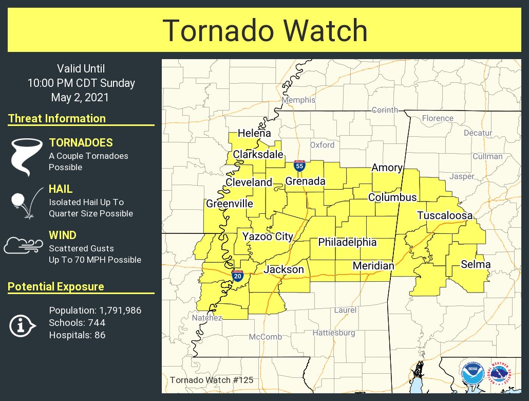
A Tornado Watch continues until 10 pm for Bibb, Dallas, Fayette, Greene, Hale, Lamar, Marengo, Perry, Pickens, Sumter, and Tuscaloosa counties.
Category: Alabama's Weather, ALL POSTS, Severe Weather
About the Author (Author Profile)
Scott Martin is an operational meteorologist, professional graphic artist, musician, husband, and father. Not only is Scott a member of the National Weather Association, but he is also the Central Alabama Chapter of the NWA president. Scott is also the co-founder of Racecast Weather, which provides forecasts for many racing series across the USA. He also supplies forecasts for the BassMaster Elite Series events including the BassMaster Classic.Subscribe
If you enjoyed this article, subscribe to receive more just like it.


