Tornado Warning South of Jackson MS
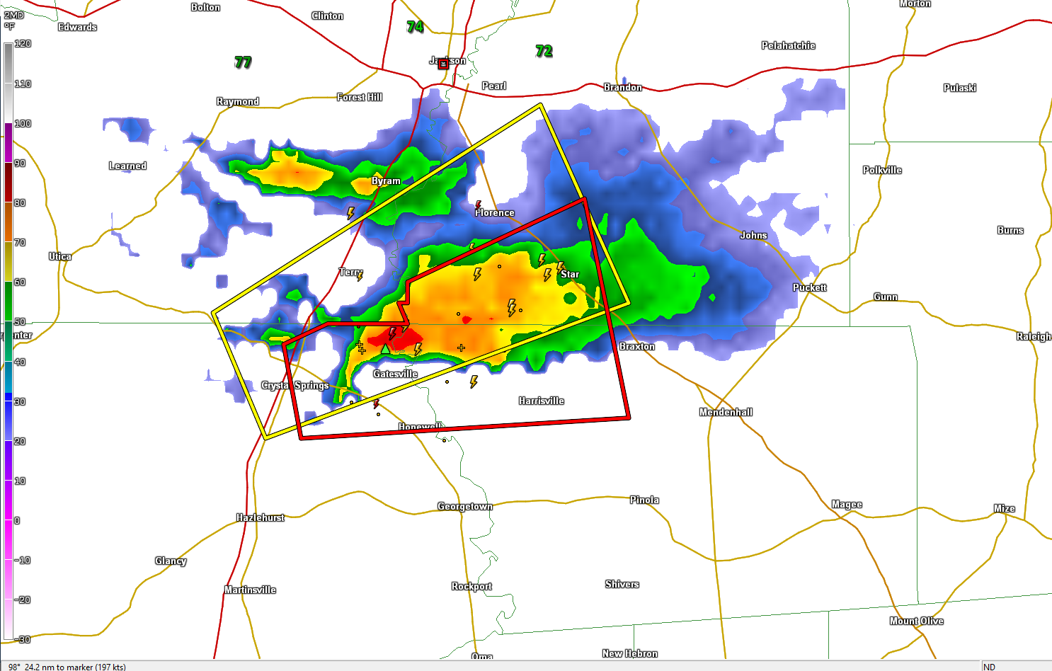
An isolated, strong thunderstorm is east of I-55 about 20 miles south of Jackson MS at this hour. It quickly became severe after forming, and NWS meteorologists issued a tornado warning after observing tight rotation in the storm.
Instability values are very high across the southern half of Mississippi into West and Northwest Alabama with values exceeding 3,000 joules/kg over South Mississippi and southwest Alabama, with values to 2,000 joules/kg all the way to the Tennessee border in Northwest Alabama.
There is plenty of bulk shear (winds changing speed with height) over all of Alabama and Mississippi (greater than 35-40 knots) for organized thunderstorms.
0-1 km helicity values are still not indicative of tornado formation, but in the lowest 500m of the atmosphere, we see values exceeding 100 m2/s2 in the area along I-59 in southern Mississippi and West Central Alabama, so this storm is probably taking advantage of that low-level directional wind shear to rotate.
We will be watching storm development over Louisiana and Mississippi through the morning because these storms will intensify and move into Alabama later today when widespread damaging, hail and tornadoes are possible.
Category: Alabama's Weather, ALL POSTS, Severe Weather
About the Author (Author Profile)
Bill Murray is the President of The Weather Factory. He is the site's official weather historian and a weekend forecaster. He also anchors the site's severe weather coverage. Bill Murray is the proud holder of National Weather Association Digital Seal #0001 @wxhistorianSubscribe
If you enjoyed this article, subscribe to receive more just like it.


