

Watch May Be Needed Soon for Areas from Louisiana across Mississippi to Western Alabama
The SPC says that a watch (probably a tornado watch) will be needed soon in areas from eastern Louisiana across southern Mississippi into West Central Alabama.
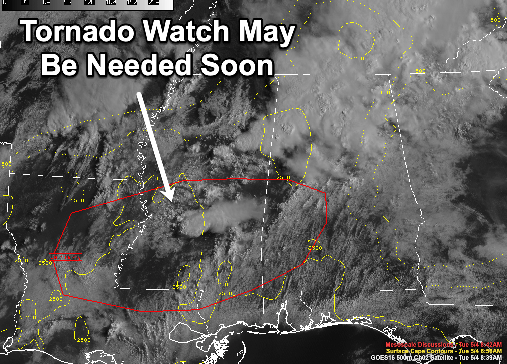
Mesoscale Discussion 0523
NWS Storm Prediction Center Norman OK
0833 AM CDT Tue May 04 2021
Areas affected…East Louisiana…Southern Mississippi…and
southwest Alabama
Concerning…Severe potential…Watch likely
Valid 041333Z – 041530Z
Probability of Watch Issuance…80 percent
SUMMARY…Thunderstorm development is ongoing across portions of the
lower Mississippi river valley region, and will likely continue
through the late morning and early afternoon hours. Strong to severe
storms are expected, and a watch is likely to address this concern.
DISCUSSION…Recent regional radar and satellite trends show
thunderstorm development underway across south-central MS with a
robust supercell noted near the Jackson, MS area. Visible imagery
shows additional agitated cumulus across the region within a broad
warm advection regime. Morning soundings show only minimal capping
in place with MLCAPE values between 2000-2500 J/kg. Additionally,
favorable wind profiles are noted with 30-40 knots of effective bulk
shear and 100-200 m2/s2 0-1 km SRH in regional soundings and VWPs.
These trends and observations suggest that additional thunderstorm
development is likely in the coming hours and should support at
least a few robust severe storms with all severe hazards possible.
(though storm mode and coverage remain somewhat uncertain). A watch
will likely be needed to address this potential.
..Moore/Grams.. 05/04/2021
Category: Alabama's Weather, ALL POSTS, Severe Weather
About the Author (Author Profile)
Bill Murray is the President of The Weather Factory. He is the site's official weather historian and a weekend forecaster. He also anchors the site's severe weather coverage. Bill Murray is the proud holder of National Weather Association Digital Seal #0001 @wxhistorianSubscribe
If you enjoyed this article, subscribe to receive more just like it.


