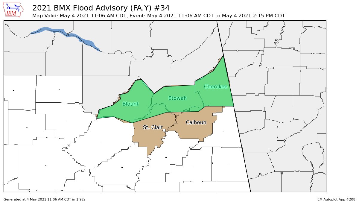
Areal Flood Advisory for Parts of Blount, St. Clair, Calhoun, Cherokee, Etowah Co. Until 2:15 pm
The National Weather Service in Birmingham has issued a
* Urban and Small Stream Flood Advisory for…
Blount County in central Alabama…
Northeastern St. Clair County in central Alabama…
Northwestern Calhoun County in east central Alabama…
Cherokee County in northeastern Alabama…
Etowah County in northeastern Alabama…
* Until 215 PM CDT.
* At 1106 AM CDT, Doppler radar indicated heavy rain due to
thunderstorms. This will cause urban and small stream flooding.
Some locations that will experience flooding include…
Gadsden, Rainbow City, Oneonta, Attalla, Piedmont, Hokes Bluff,
Springville, Centre, Cedar Bluff, Blountsville, Cleveland, Centre
Municipal Airport, Little River Canyon National Preserve, Forney,
Dallas, Glencoe, Warrior, Ashville, Sardis City and Locust Fork.
Additional rainfall of 1 to 2 inches is expected over the area over
the next few hours. This additional rain will result in minor
flooding.
PRECAUTIONARY/PREPAREDNESS ACTIONS…
A Flood Advisory means river or stream flows are elevated, or
ponding of water in urban or other areas is occurring or is imminent.
Turn around, don’t drown when encountering flooded roads. Most flood
deaths occur in vehicles.
Please report flooding to your local law enforcement agency when you
can do so safely.
Category: Alabama's Weather, ALL POSTS, Severe Weather
About the Author (Author Profile)
Scott Martin is an operational meteorologist, professional graphic artist, musician, husband, and father. Not only is Scott a member of the National Weather Association, but he is also the Central Alabama Chapter of the NWA president. Scott is also the co-founder of Racecast Weather, which provides forecasts for many racing series across the USA. He also supplies forecasts for the BassMaster Elite Series events including the BassMaster Classic.Subscribe
If you enjoyed this article, subscribe to receive more just like it.


