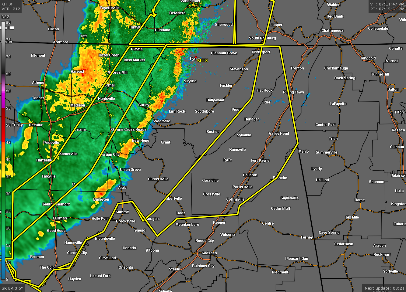
EXPIRED Severe T-Storm Warning for Parts of Cullman, DeKalb, Jackson, Madison, Marshall, Morgan Co. Until 8:15 pm
The National Weather Service in Huntsville Alabama has issued a
* Severe Thunderstorm Warning for…
Jackson County in northeastern Alabama…
Marshall County in northeastern Alabama…
Southeastern Madison County in north central Alabama…
DeKalb County in northeastern Alabama…
Cullman County in north central Alabama…
Southeastern Morgan County in north central Alabama…
* Until 815 PM CDT.
* At 711 PM CDT, severe thunderstorms were located along a line
extending from 8 miles north of Skyline to 8 miles east of Morgan
City to near Good Hope, moving east at 55 mph.
HAZARD…60 mph wind gusts.
SOURCE…Emergency management and Doppler radar.
IMPACT…Expect damage to roofs, siding, and trees.
* Locations impacted include…
Southern Huntsville, Albertville, Cullman, Scottsboro, Fort Payne,
Boaz, Guntersville, Arab, Rainsville and Bridgeport.
PRECAUTIONARY/PREPAREDNESS ACTIONS…
This is a DANGEROUS SITUATION. These storms are producing widespread
wind damage across northern Alabama. SEEK SHELTER NOW inside a
sturdy structure and stay away from windows!
If on or near the Tennessee River or Lake Guntersville, get away
from the water and move indoors or inside a vehicle. Move to safe
shelter now! Do not be caught on the water in a thunderstorm.
Category: Alabama's Weather, ALL POSTS, Severe Weather
About the Author (Author Profile)
Scott Martin is an operational meteorologist, professional graphic artist, musician, husband, and father. Not only is Scott a member of the National Weather Association, but he is also the Central Alabama Chapter of the NWA president. Scott is also the co-founder of Racecast Weather, which provides forecasts for many racing series across the USA. He also supplies forecasts for the BassMaster Elite Series events including the BassMaster Classic.Subscribe
If you enjoyed this article, subscribe to receive more just like it.


