Watching Storms Upstream from West Alabama for Organized Wind Damage Threat
We are starting to focus on a cluster of storms over North Mississippi that may pose a damaging wind and possibly even a tornado threat as they move southeastward toward West Alabama over the next couple of hours.
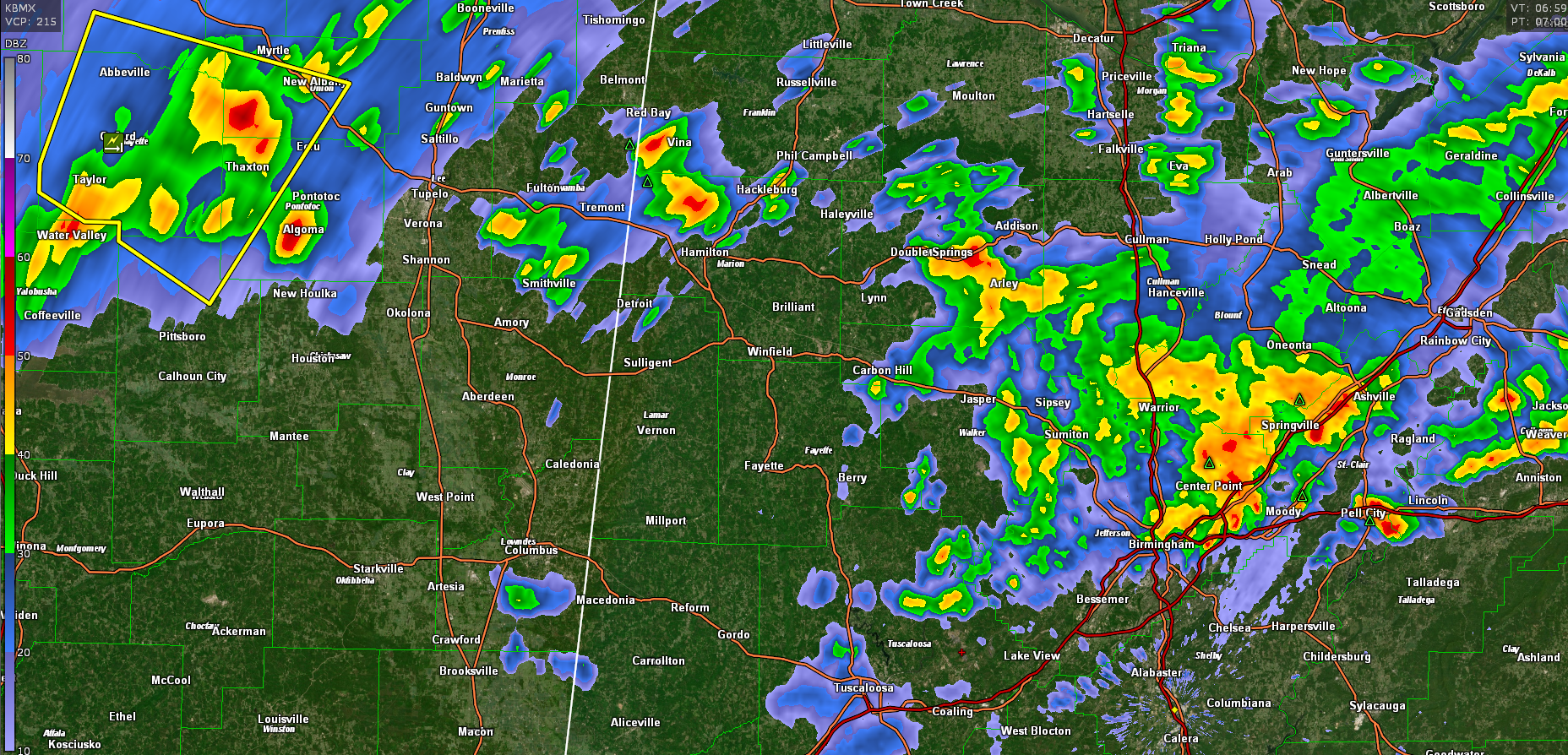
The storms are now located from east of Oxford to west of New Albany. They are beginning to show a bowing structure, indicative of a high wind threat. A large severe thunderstorm warning continues for parts of Lafayette, Calhoun, Union, Pontotoc, and Marshall Counties.
A tornado warning was in effect until just now for the same storms covering parts of Lafayette, Union, Pontotoc, and Marshall Counties.
There is decent instability and bulk shear ahead of the storms in Mississippi so they should maintain their organization and could intensify as well.
These storms could reach Marion and Lamar Counties within the next 90 minutes.
The SPC is considering a downstream severe thunderstorm watch.
Elsewhere across Alabama, strong storms extend along I-59 from the Tarrant and Woodlawn areas of Birmingham northeast to near Ashville in St. Clair County. Other storms extend across parts of St. Clair, Calhoun, and Cleburne Counties along I_20 to the east of Birmingham.
Category: Alabama's Weather, ALL POSTS, Severe Weather
About the Author (Author Profile)
Bill Murray is the President of The Weather Factory. He is the site's official weather historian and a weekend forecaster. He also anchors the site's severe weather coverage. Bill Murray is the proud holder of National Weather Association Digital Seal #0001 @wxhistorianSubscribe
If you enjoyed this article, subscribe to receive more just like it.


