A Very Nice Weekend; Heat Begins to Build Back on Memorial Day
After the cold front and rain moved through the area last night, a cool, refreshing, and less humid day awaits for your Saturday. Skies will feature a mix of sun and clouds with afternoon highs reaching the upper 60s to the mid-80s across the area from northwest to southeast.
A cool and dry flow from the north will continue over the area on Sunday that will lead to another very comfortable day. Skies will be sunny and afternoon highs will be in the mid-70s to the lower 80s across the area.
The heat will start to build back in as the flow flattens out across Central Alabama on Memorial Day. Skies will be sunny throughout the daylight hours, but a few clouds will move in during the evening and overnight hours. Highs will be in the lower 80s to the lower 90s across the area.
A system will start to develop off to our west on Tuesday, the first day of Meteorological Summer, that will help bring higher moisture levels to Central Alabama. At this point, we look to stay dry, but humidity and heat levels will be rising. Skies will be partly to mostly cloudy with highs reaching the mid-80s to the lower 90s.
As that system moves closer to the area on Wednesday, advection from the south will continue to pull more moisture up from the Gulf. We can expect a few isolated to scattered showers and thunderstorms, mainly during the afternoon hours. Otherwise, skies will be partly to mostly cloudy. High will range from the lower 80s in the northwest to the lower 90s in the southeast.
The system moves into the area on Thursday, which will bring mostly cloudy skies with showers and thunderstorms likely throughout the day. It will be quite muggy with afternoon highs ranging from the lower 80s in the northwest to the upper 80s in the southeast.
Not much change for Friday as plenty of moisture will continue to be available over Central Alabama along with the higher possibility of scattered to numerous showers and thunderstorms. Afternoon highs look to range from the lower 80s in the northwest to the upper 80s in the southeast.
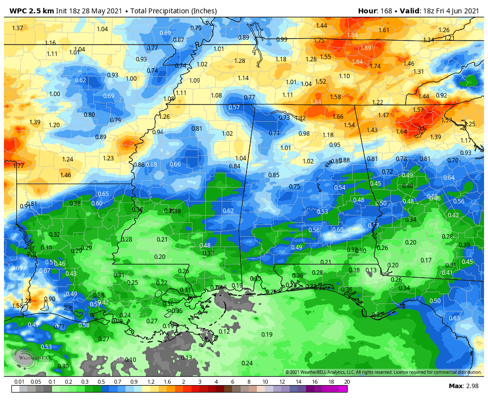
Forecast rainfall amounts across Central Alabama for this forecast period ending at midday on Friday shows that totals will be around 1/2″ to 1″, with higher totals along and north of the Tennessee River.
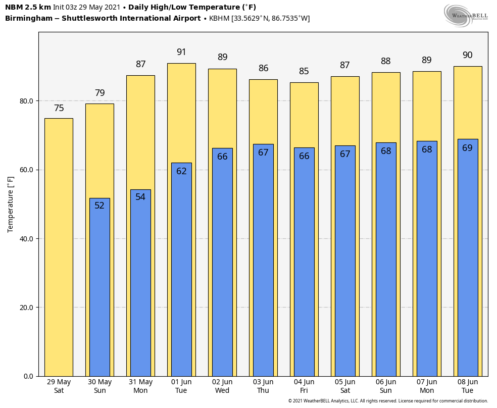
You’ve heard about the highs through Friday, but we’re starting to get into the summertime pattern and highs will be close to 90 degrees each day from June 5th-8th.
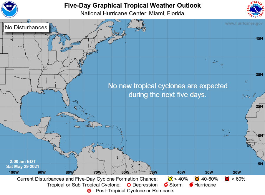
And the tropics are all quiet at this time and no new tropical systems are expected to develop throughout the next five days.
Category: Alabama's Weather, ALL POSTS, Tropical, Weather Xtreme Videos
About the Author (Author Profile)
Scott Martin is an operational meteorologist, professional graphic artist, musician, husband, and father. Not only is Scott a member of the National Weather Association, but he is also the Central Alabama Chapter of the NWA president. Scott is also the co-founder of Racecast Weather, which provides forecasts for many racing series across the USA. He also supplies forecasts for the BassMaster Elite Series events including the BassMaster Classic.Subscribe
If you enjoyed this article, subscribe to receive more just like it.


