Midday Nowcast: Air You Can Wear
A very muggy air mass remains in place and will continue to fuel showers and storms across the state today and tomorrow, especially during the afternoon and evening hours, when daytime heating peaks. Of course in such an air mass, rain and storms are possible at anytime including early in the morning. At the midday hours, areas out showers are developing and these will continue to expand in coverage through the afternoon.
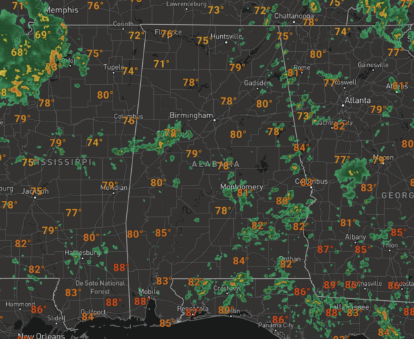
Rainfall totals will vary greatly with some locations staying dry, while others could receive a couple of inches, and some stronger storms are possible as well with gusty winds, and frequent lightning, which tends to be to most dangerous threat this time of year. When it is not raining, the sky will be mainly cloudy and temperatures will be in the 80s across much of the state.
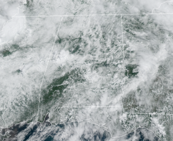
WEDNESDAY-FRIDAY: Rain chances will decrease some by midweek as the upper-low lifts towards the Ohio Valley, but the overall pattern really won’t change much. Moist, unstable air will stay in place, and we will have some risk of showers and thunderstorms on a daily basis. The best chance of rain each day will come during the afternoon and evening hours, but we can’t rule out a few late night or morning showers along the way. The sun will be out at times, but the sky will be generally cloudy with highs in the mid 80s on most days.
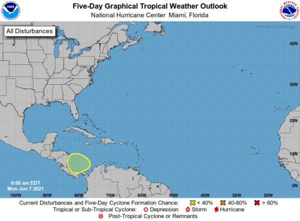
IN THE TROPICS: An area of low pressure is expected to develop over the southwestern Caribbean Sea by Thursday or Friday. Some gradual development will be possible thereafter as the system moves slowly northwestward toward Central America. Formation chance through 5 days…low…20 percent.
BEACH FORECAST CENTER: Get the latest weather and rip current forecasts for the beaches from Fort Morgan to Panama City on our Beach Forecast Center page. There, you can select the forecast of the region that you are interested in visiting.
WORLD TEMPERATURE EXTREMES: Over the last 24 hours, the highest observation outside the U.S. was 123.3F at Nuwasib, Kuwait. The lowest observation was -108.9F at Vostok, Antarctica.
CONTIGUOUS TEMPERATURE EXTREMES: Over the last 24 hours, the highest observation was 114F at Stovepipe Wells, CA. The lowest observation was 23F at Sand Creek Station, OR.
WEATHER ON THIS DATE IN 1816: A famous June snow occurred in the northeastern U.S. Danville VT reported drifts of snow and sleet twenty inches deep. The Highlands were white all day, and flurries were observed as far south as Boston MA.
Category: Alabama's Weather, ALL POSTS
About the Author (Author Profile)
Macon, Georgia Television Chief Meteorologist, Birmingham native, and long time Contributor on AlabamaWX. Stormchaser. I did not choose Weather, it chose Me. College Football Fanatic. @Ryan_StinnetSubscribe
If you enjoyed this article, subscribe to receive more just like it.


