

Alabama Weather Update at 7:30 p.m.
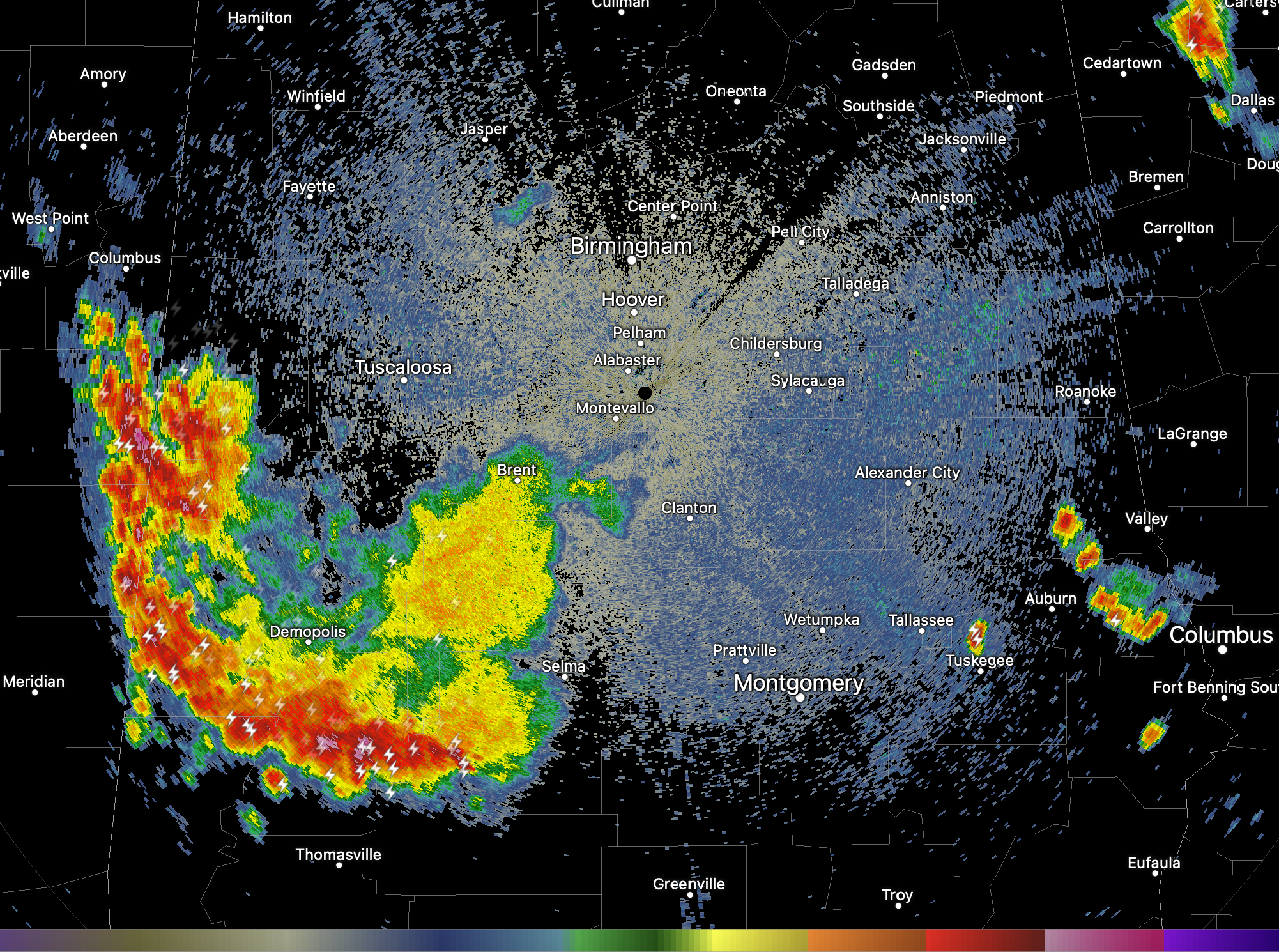
Strong storms continue this evening over West Central Alabama from Aliceville in Pickens County to Emelle and Livingston in Sumter County to Demopolis and Linden in Marengo County to southwest of Orrville in Dallas County.
The storms are packing quite a punch with torrential rains, gusty winds, and lots of lightning, but they are no longer severe.
There are severe storms near the Alabama/Florida border over parts of Escambia and Covington Counties. A pretty impressive three-body scatter spike signature showed up on the BMX radar from those storms, indicating some possible large hail.
There is a smaller concentration of storms over East Central Alabama including Cambers and Lee County including areas from Lafayette to east and southeast of Opelika.
There is some lingering but diminishing light rain northwest of Birmingham and in the Huntsville area.
Everything is moving south.
The rest of the evening should be quiet after the storms diminish. More storms will develop tomorrow, a lot like today.
An approaching cold front will push through Alabama on Monday, pushing the storms to the south and letting some drier air filter into the northern half of Alabama.
Category: Alabama's Weather, ALL POSTS
About the Author (Author Profile)
Bill Murray is the President of The Weather Factory. He is the site's official weather historian and a weekend forecaster. He also anchors the site's severe weather coverage. Bill Murray is the proud holder of National Weather Association Digital Seal #0001 @wxhistorianSubscribe
If you enjoyed this article, subscribe to receive more just like it.


