Tropical Depression Two Forms Offshore of the North Carolina Coast
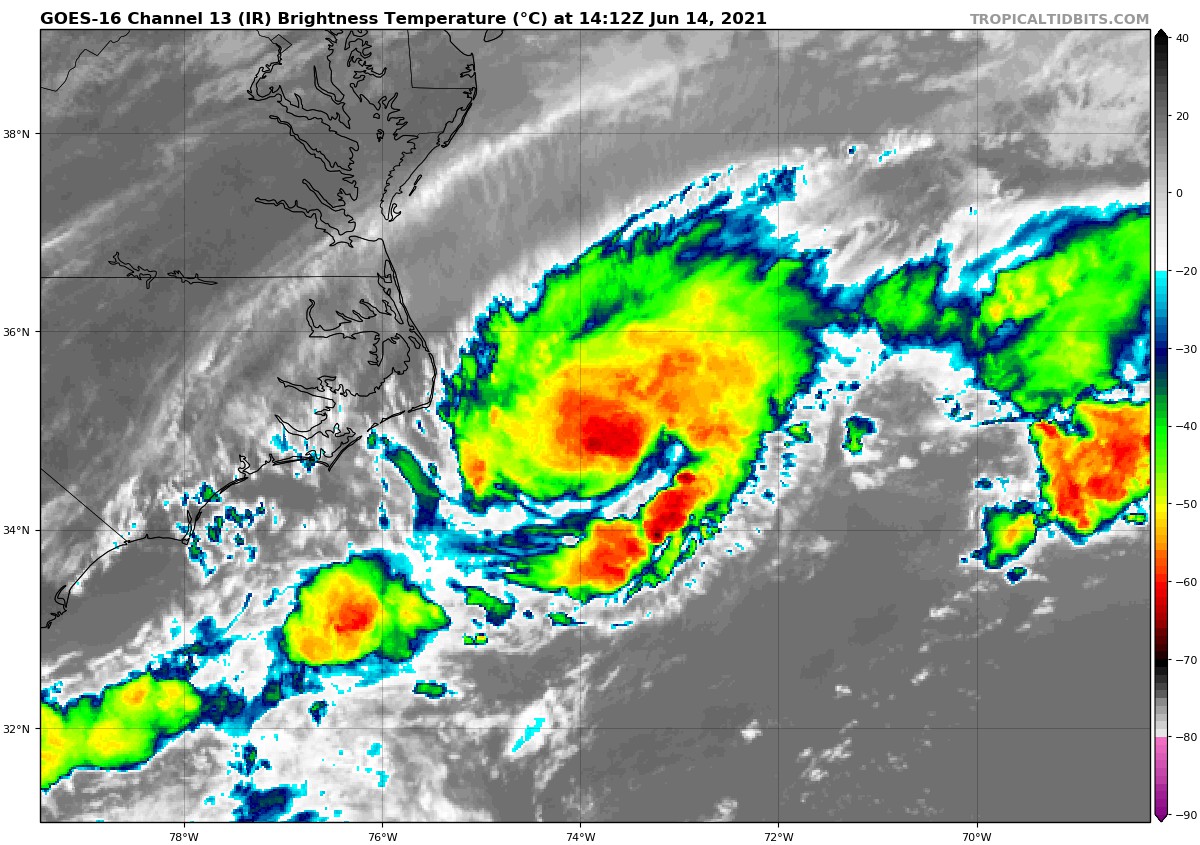
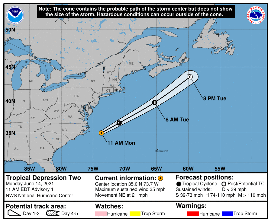
A low that quickly formed off of the coast of North Carolina has become well-defined and organized enough to become our second tropical depression of the 2021 Atlantic Hurricane Season. While it is in close proximity to the shore, it is forecast to move in a northeasterly direction away from the United States. Here is the latest from the National Hurricane Center:
SUMMARY OF 1100 AM EDT…1500 UTC…INFORMATION
———————————————–
LOCATION…35.0N 73.7W
ABOUT 105 MI…165 KM E OF CAPE HATTERAS NORTH CAROLINA
MAXIMUM SUSTAINED WINDS…35 MPH…55 KM/H
PRESENT MOVEMENT…NE OR 50 DEGREES AT 21 MPH…33 KM/H
MINIMUM CENTRAL PRESSURE…1006 MB…29.71 INCHES
WATCHES AND WARNINGS
——————–
THERE ARE NO COASTAL WATCHES OR WARNINGS IN EFFECT.
DISCUSSION AND OUTLOOK
———————-
AT 1100 AM EDT (1500 UTC), THE CENTER OF TROPICAL DEPRESSION TWO WAS LOCATED NEAR LATITUDE 35.0 NORTH, LONGITUDE 73.7 WEST. THE DEPRESSION IS MOVING TOWARD THE NORTHEAST NEAR 21 MPH (33 KM/H), AND THIS GENERAL MOTION IS EXPECTED THROUGH WEDNESDAY WITH INCREASING FORWARD SPEED.
MAXIMUM SUSTAINED WINDS ARE NEAR 35 MPH (55 KM/H) WITH HIGHER GUSTS. THE DEPRESSION IS EXPECTED TO BECOME A TROPICAL STORM BY TONIGHT AND COULD CONTINUE TO STRENGTHEN ON TUESDAY. THE SYSTEM SHOULD BEGIN TO WEAKEN BY TUESDAY NIGHT AND IS EXPECTED TO DISSIPATE ON WEDNESDAY.
THE ESTIMATED MINIMUM CENTRAL PRESSURE IS 1006 MB (29.71 INCHES).
About the Author (Author Profile)
Scott Martin is an operational meteorologist, professional graphic artist, musician, husband, and father. Not only is Scott a member of the National Weather Association, but he is also the Central Alabama Chapter of the NWA president. Scott is also the co-founder of Racecast Weather, which provides forecasts for many racing series across the USA. He also supplies forecasts for the BassMaster Elite Series events including the BassMaster Classic.Subscribe
If you enjoyed this article, subscribe to receive more just like it.


