At 7:00 pm, PTC-3 Not Quite Organized Enough to Be a Depression Yet
For now, Potential Tropical Cyclone Three has not quite become organized enough to be classified as a depression, but it remains likely that a depression will form later tonight. Here is the latest update from the NHC:
POTENTIAL TROPICAL CYCLONE MOVING NORTHWARD OVER THE SOUTHWESTERN GULF OF MEXICO; EXPECTED TO BRING HEAVY RAINFALL AND FLOODING TO THE NORTHERN GULF COAST.
SUMMARY OF 700 PM CDT…0000 UTC…INFORMATION
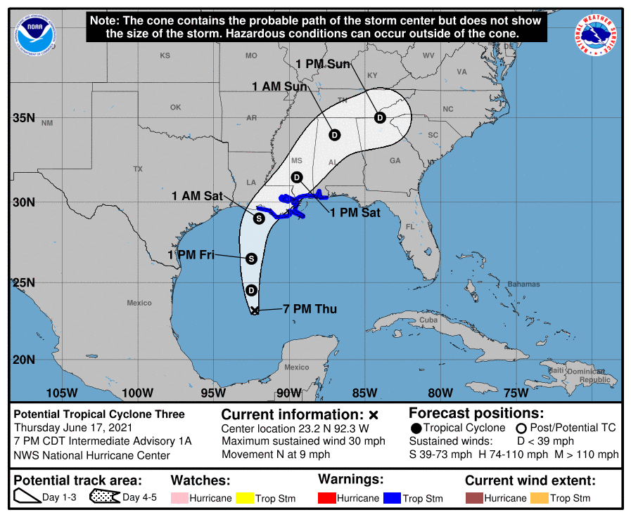
LOCATION…23.2N 92.3W
ABOUT 455 MI…730 KM S OF MORGAN CITY LOUISIANA
MAXIMUM SUSTAINED WINDS…30 MPH…45 KM/H
PRESENT MOVEMENT…N OR 010 DEGREES AT 9 MPH…15 KM/H
MINIMUM CENTRAL PRESSURE…1007 MB…29.74 INCHES
SUMMARY OF WATCHES AND WARNINGS IN EFFECT
A Tropical Storm Warning is in effect for…
* Intracoastal City Louisiana to the Alabama/Florida border
* Lake Pontchartrain, Lake Maurepas, and Metropolitan New Orleans
A Tropical Storm Warning means that tropical storm conditions are expected somewhere within the warning area within 36 hours.
Interests elsewhere along the northern Gulf Coast should monitor the progress of this system.
DISCUSSION AND OUTLOOK
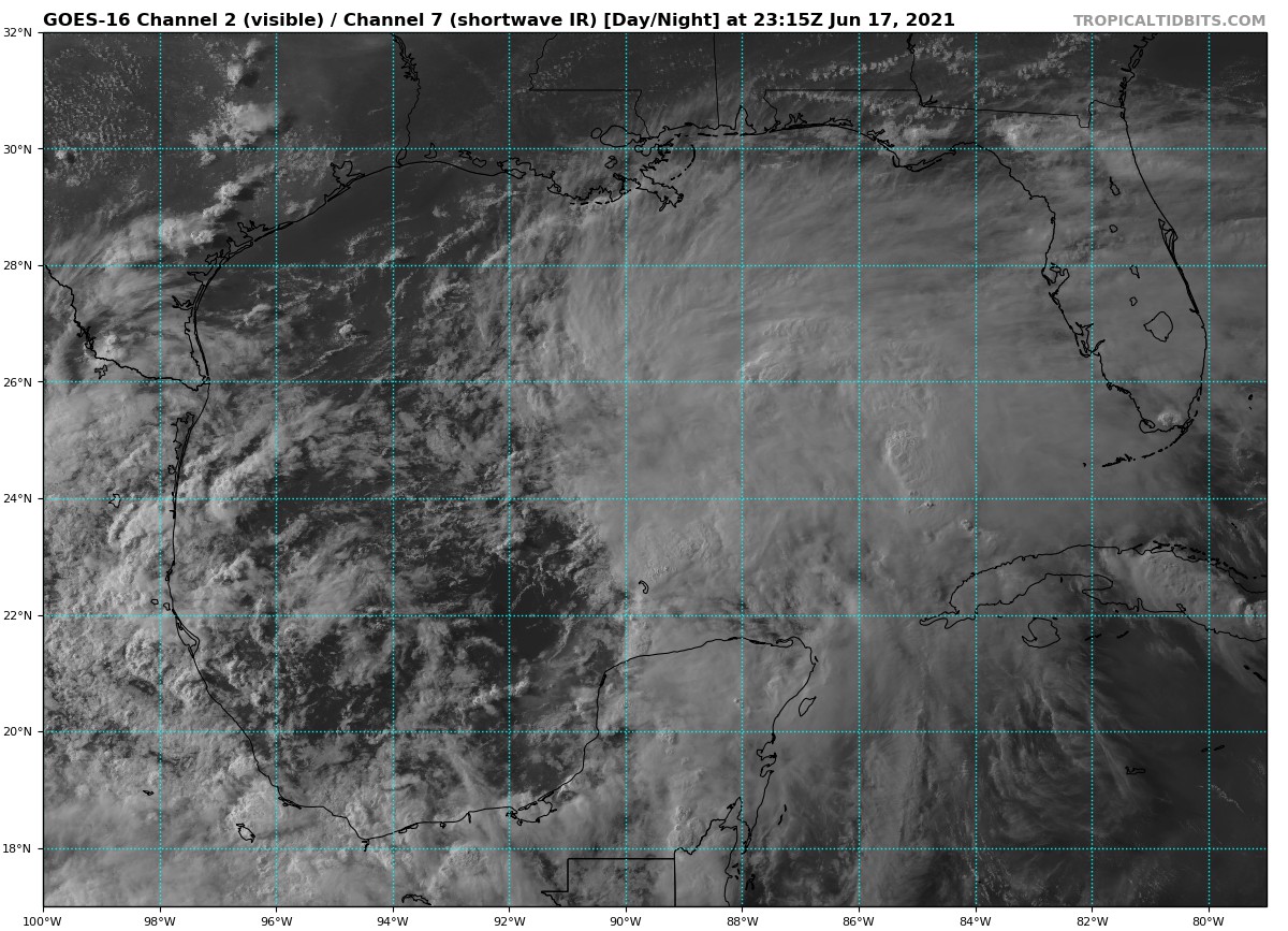
At 700 PM CDT (0000 UTC), the disturbance was centered near latitude 23.2 North, longitude 92.3 West. The system is moving toward the north near 9 mph (15 km/h) and this motion with some increase in forward speed is expected for the next day or so. On the forecast track, the system will approach the north-central Gulf Coast late Friday or early Saturday. A northeastward motion across the southeastern United States is likely after landfall.
Maximum sustained winds are near 30 mph (45 km/h) with higher gusts. Some strengthening is forecast tonight and Friday. A subtropical or tropical depression or storm is likely to form over the west-central Gulf of Mexico tonight or early Friday.
* Formation chance through 48 hours…high…90 percent.
* Formation chance through 5 days…high…90 percent.
The minimum central pressure estimated from Air Force Reserve Hurricane Hunter data and surface observations is 1007 mb (29.74 inches).
HAZARDS AFFECTING LAND
RAINFALL: The potential tropical cyclone is expected to produce total rainfall of 3 to 6 inches with isolated amounts of 8 inches across the Yucatan Peninsula of Mexico. Rainfall totals of 4 to 8 inches with isolated maximum amounts of 12 inches are possible beginning Friday and continuing through the weekend from the Central Gulf coast northeastward into the Southern Appalachians. This will likely produce areas of flash, urban, and small stream flooding as well as minor to isolated moderate river flooding with new and renewed rises on already elevated rivers.
STORM SURGE: The combination of storm surge and the tide will cause normally dry areas near the coast to be flooded by rising waters moving inland from the shoreline. The water could reach the following heights above ground somewhere in the indicated areas if the peak surge occurs at the time of high tide…
Intracoastal City, LA to MS/AL Border…2-3 ft
Vermilion Bay and Lake Borgne…2-3 ft
Lake Pontchartrain and Lake Maurepas…1-2 ft
MS/AL border to AL/FL border including Mobile Bay…1-3 ft
Cameron, LA to Intracoastal City, LA…1-2 ft
Surge-related flooding depends on the relative timing of the surge and the tidal cycle, and can vary greatly over short distances.
WIND: Tropical storm conditions are expected to first reach the coast within the warning area on Friday, making outside preparations difficult or dangerous.
TORNADOES: The threat for a couple of tornadoes should begin Friday afternoon across coastal Louisiana. This threat should expand northward across southern portions of Louisiana and Mississippi, and southwest Alabama on Saturday.
Category: Alabama's Weather, ALL POSTS, Severe Weather, Tropical
About the Author (Author Profile)
Scott Martin is an operational meteorologist, professional graphic artist, musician, husband, and father. Not only is Scott a member of the National Weather Association, but he is also the Central Alabama Chapter of the NWA president. Scott is also the co-founder of Racecast Weather, which provides forecasts for many racing series across the USA. He also supplies forecasts for the BassMaster Elite Series events including the BassMaster Classic.Subscribe
If you enjoyed this article, subscribe to receive more just like it.


