Midday Nowcast: Watching the Gulf
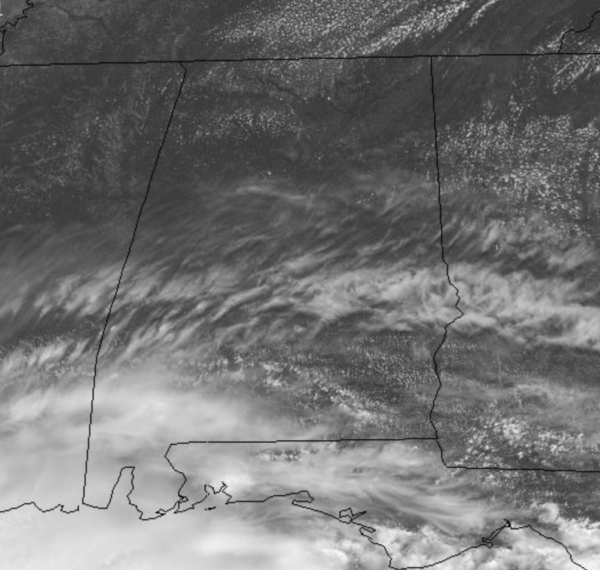
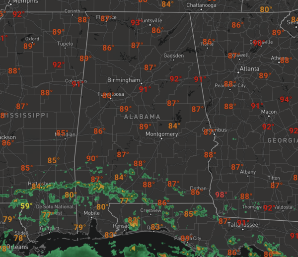
A pretty decent day of weather is underway across Alabama with gradually increasing clouds from south to north. Temperatures are generally in the low 90s this afternoon, and while North/Central Alabama is dry, we are seeing showers and storms across southern portions of the state this afternoon as the system in the Gulf moves closer to shore. Rain will spread northward overnight.
LATEST UPDATE FROM NHC: Potential Tropical Cyclone Three was was centered near latitude 26.5 North, longitude 91.1 West. The system is moving toward the north-northeast near 14 mph and this general motion is expected for the next day or so. On the forecast track, the system will make landfall along the north-central Gulf Coast tonight or early Saturday.
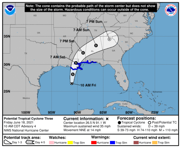
A slow northeastward motion across the southeastern United States is likely after landfall through the weekend. Maximum sustained winds are near 35 mph with higher gusts. Some strengthening is forecast, and a subtropical or tropical storm is likely to form over the central or northern Gulf of Mexico later today.The estimated minimum central pressure based on data from the Air Force Hurricane Hunters and surface observations is 1007 mb (29.74 inches). The tropical low is forecast to become a minimal tropical storm tonight before moving onto the Louisiana coast (the name will be “Claudette” if it reaches tropical storm strength).
WET WEEKEND WEATHER: Rain overspreads the state tomorrow and will continue into tomorrow night and early Sunday, the rainfall will be heavy at times. Rain amounts over the weekend will be in the 2-4 inch range for much of Central Alabama, with 3-6 inches for the southern counties and even some isolated higher amounts.
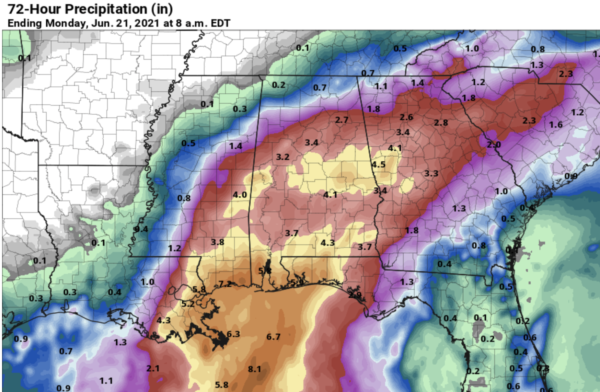
This could lead to flash flooding and a Flash Flood Watch is in effect for much of Alabama, areas along and south of the Interstate 20 corridor from Tuscaloosa, Birmingham, and Anniston. Much lower amounts are expected across North Alabama.
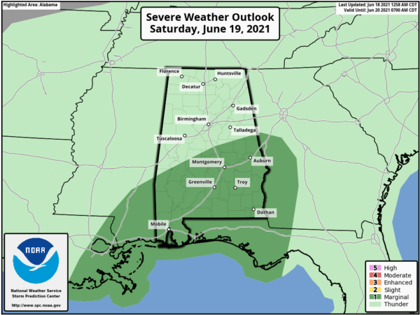
With any landfalling tropical system, if you’re east and south of the center of circulation, there is a conditional tornado threat. A few brief, isolated tornadoes are possible tomorrow and tomorrow night, mainly over the southern half of Alabama, and the SPC has the southern half of the state in a “marginal risk” (level 1/5) for severe weather tomorrow for this threat. Keep in mind these tornadoes associated with a tropical system usually last for only a few minutes, and often warnings can’t be issued.
The core of the system will move northeast of Alabama Sunday, but it will leave behind a tropical air mass which will continue to allow for scattered to numerous showers and thunderstorms during the day. With the clouds and rain, highs this weekend will be in the 70s, and it will be extremely muggy due the tropical air mass.
FOR NEXT WEEK: The tropical system should be exit the area by late Sunday, but again, due to the very moist air mass in place, that will continue to allow for showers and storms Monday, but a cold front will drop into the state on Tuesday and should bring drier air into North/Central Alabama for the rest of next week.
BEACH FORECAST CENTER: Get the latest weather and rip current forecasts for the beaches from Fort Morgan to Panama City on our Beach Forecast Center page. There, you can select the forecast of the region that you are interested in visiting.
WORLD TEMPERATURE EXTREMES: Over the last 24 hours, the highest observation outside the U.S. was 120.7F at Joba, Oman. The lowest observation was -109.1F at University Dome, Antarctica.
CONTIGUOUS TEMPERATURE EXTREMES: Over the last 24 hours, the highest observation was 128F at Death Valley, CA. The lowest observation was 25F at Stanley, ID.
Category: Alabama's Weather, ALL POSTS
About the Author (Author Profile)
Macon, Georgia Television Chief Meteorologist, Birmingham native, and long time Contributor on AlabamaWX. Stormchaser. I did not choose Weather, it chose Me. College Football Fanatic. @Ryan_StinnetSubscribe
If you enjoyed this article, subscribe to receive more just like it.


