A Look at our Weather and PTC#3 at 6:20 p.m.
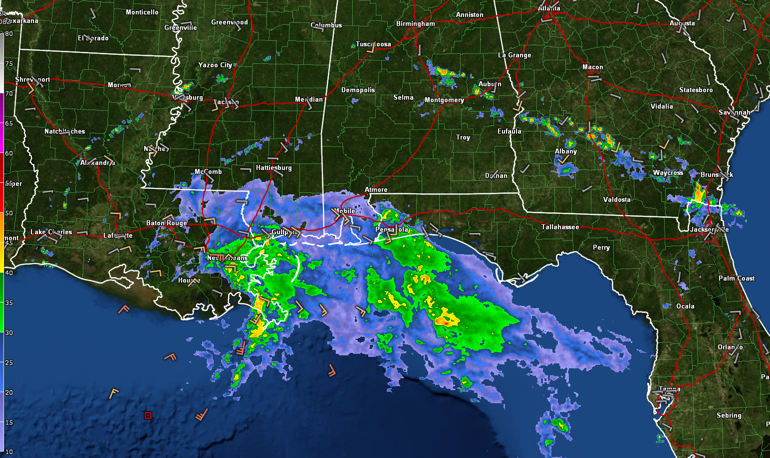
An outer feeder band from our potential tropical cyclone is moving across Central Alabama right now. It is approaching Rockford, Dadeville, and Auburn. The western end over Bibb and Chilton Counties fizzled out. The storms will produce quick downpours. They also are producing lightning and gusty winds.
An outflow boundary is moving through Shelby County.
Potential Tropical Cyclone #3 remains disorganized. It continues to have a difficult time because its low-level center is exposed from the widespread convection.
The third Air Force recon flight is making its way through the storm for the first time right now.
It is running out of time to be classified as a tropical storm. The system will be on land within the next several hours if it isn’t already.
But classified or not, it is going to produce heavy over a wide area. Heavy rain is already covering the coast from Fort Walton Beach westward across the Alabama and Mississippi Coasts into southeastern Louisiana around Houma and New Orleans.
The plane is finding some tropical storm force winds offshore in the northern and northeasterly sides of the system. The peak wind on the run around the northeastern side of the system turned up one 45 knot flight level wind, which translates to about 45 mph at the surface. These winds will be coming onshore along the Mississippi, Alabama, and Northwest Florida coasts this evening.
There will be issues with storm surge. The surge at Waveland, MS is currently around 3 feet above normal. This is where the water sort of funnels together there between Southeast Lousiana and the western Mississippi coast. At SHell Beach, LA the tide is climbing, already nearing 3 feet above normal. Tides are running 1-1.5 feet above normal on the Alabama and Northwest Florida coasts.
Rip currents will be a big problem as well all along the Gulf Coast. Please stay out oft eh water if you are vacationing on the Alabama and Northwest Florida coasts.
So far, the tornado threat has not been an issue, although it may come more into play later tonight and especially tomorrow. It may not be as big of a threat since the system is not very organized. We will have to wait and see.
We will have a new advisory here in about 30 minutes. Be back with that.
Category: Alabama's Weather, ALL POSTS, Tropical
About the Author (Author Profile)
Bill Murray is the President of The Weather Factory. He is the site's official weather historian and a weekend forecaster. He also anchors the site's severe weather coverage. Bill Murray is the proud holder of National Weather Association Digital Seal #0001 @wxhistorianSubscribe
If you enjoyed this article, subscribe to receive more just like it.


