News and Notes on Claudette at 9 a.m.
If you’re just getting up on this Saturday morning, here is the latest on Tropical Storm Claudette.
WELL, GOOD MORNING CLAUDETTE
While you were sleeping, Potential Tropical Cyclone Three was designated as Tropical Storm Claudette on the 4 a.m. Advisory early this morning. The National Hurricane Center was convinced that it finally had acquired the missing piece of becoming a tropical cyclone when it developed a decent circulation center and sufficient convection. There had been tropical-storm-force winds to the east of the center much of the day on Friday, so it was designated Tropical Storm Claudette.
INLAND
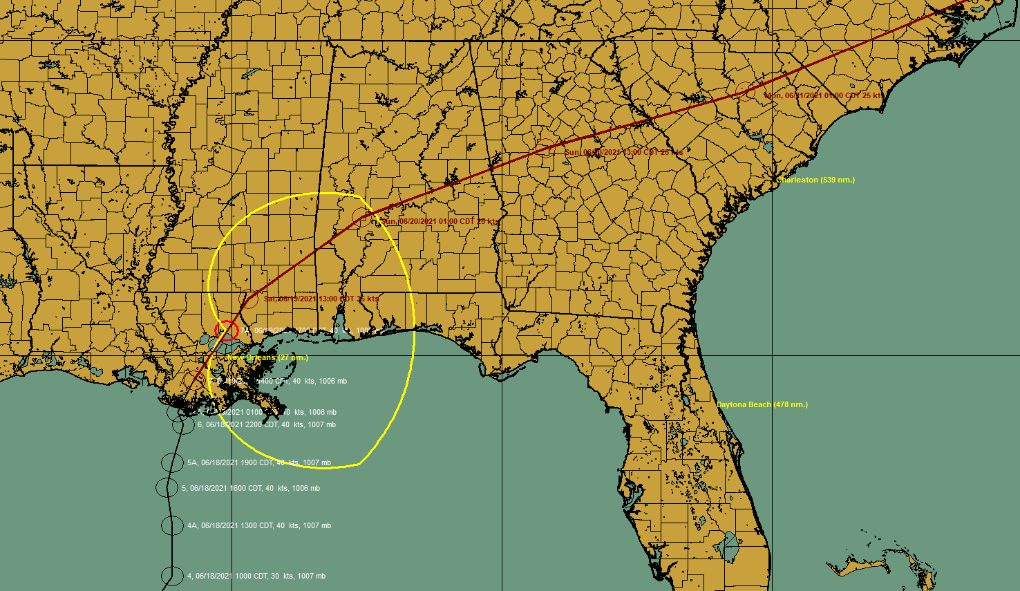
By 7 a.m., Claudette was inland over southern Louisiana, about 30 miles north of New Orleans or 120 miles west of Mobile, moving north northeast at 15 mph. Top winds still 45 mph. Claudette will slowly weaken today, but probably will still be a tropical storm into this afternoon. By 1 p.m., it should be southwest of Hattiesburg and by 1 a.m. it will be over western Alabama near Thomaston.
TORNADO THREAT
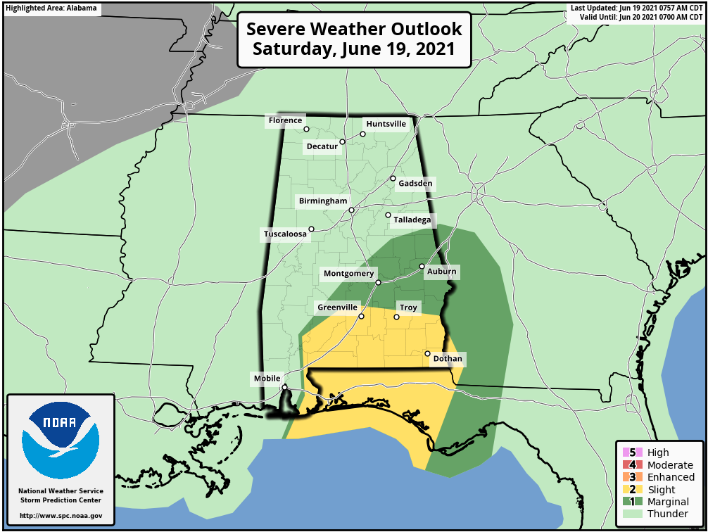
A tornado apparently touched down just east of Brewton just after 7:30 this morning. A tornado debris signature was observed just northeast of Brewton a short time later as well. As readers of the blog know well, this is a typical threat during landfall tropical cyclones. A tornado watch remains in effect until 11 a.m. for a large part of South Alabama and the western Florida Panhandle. Additional watches will likely be needed later further into South Central Alabama. Here is the SPC Day One Outlook:
WATCHING FOR WIND ACROSS DALLAS AND LOWNDES COUNTIES
The cells that produced the tornadic circulations in Wilcox County will move up into Dallas and Lowndes Counties. They seemed to have weakened a bit as lightning rates have decreased, but unstable air is moving northward along with the storms so there still could be a tornado threat. At the very least, winds could reach 40 mph and cause some issues, so be alert.
STRONG BAND OF STORMS MOVING INTO 30A/PC AREA
An outer band of storms is working its way slowly northeastward across the area from Seagrove to Panama City Beach. Winds could reach 60 mph.
RAINFALL
…Mobile picked up 4.37 inches of rainfall over the past 24 hours through 7 a.m. and another 0.38 through 8 a.m. Most of the rain has ended for Mobile.
…Gulfport/Biloxi Airport picked up 5.63 inches.
…Water was covering the right lane of the Causeway at I-10 in Mobile shortly before 7 a.m.
WIND REPORTS
…MOB reported a 49 mph wind gust at 6:06 a.m.
…The Naval Air Station in Pensacola reported a 51 mph gust at 6:30 a.m.
…A tractor-trailer was overturned on the I-10 Bay Bridge east of Pensacola just before 7 a.m. by an apparent tornado.
…Winds gusted to 60 mph at Gulf Breeze around 6:40 a.m.
…Damage was reported near Pace FL with 5-6 buildings damaged by what may have been the same tornado.
PTC SYSTEM WORKED WELL
The Potential Tropical Cyclone designation worked to a tee. The NHC was able to give this system a designation on Thursday and start issuing watches and warnings on it, even though it had not fully formed. Remember that possibility only became a reality a few years ago. The NHC would have continued to track it, but wouldn’t have been able to issue products on it. This would have forced them to designate it prematurely, potentially.
Category: Alabama's Weather, ALL POSTS, Tropical
About the Author (Author Profile)
Bill Murray is the President of The Weather Factory. He is the site's official weather historian and a weekend forecaster. He also anchors the site's severe weather coverage. Bill Murray is the proud holder of National Weather Association Digital Seal #0001 @wxhistorianSubscribe
If you enjoyed this article, subscribe to receive more just like it.


