Large Mass of Rain Moving Northward, Tornado Watches and Warnings in South Alabama
As expected the mass of rain and storms associated with Tropical Storm Claudette is moving north and northeastward this morning over eastern Mississippi and southern and Central Alabama.
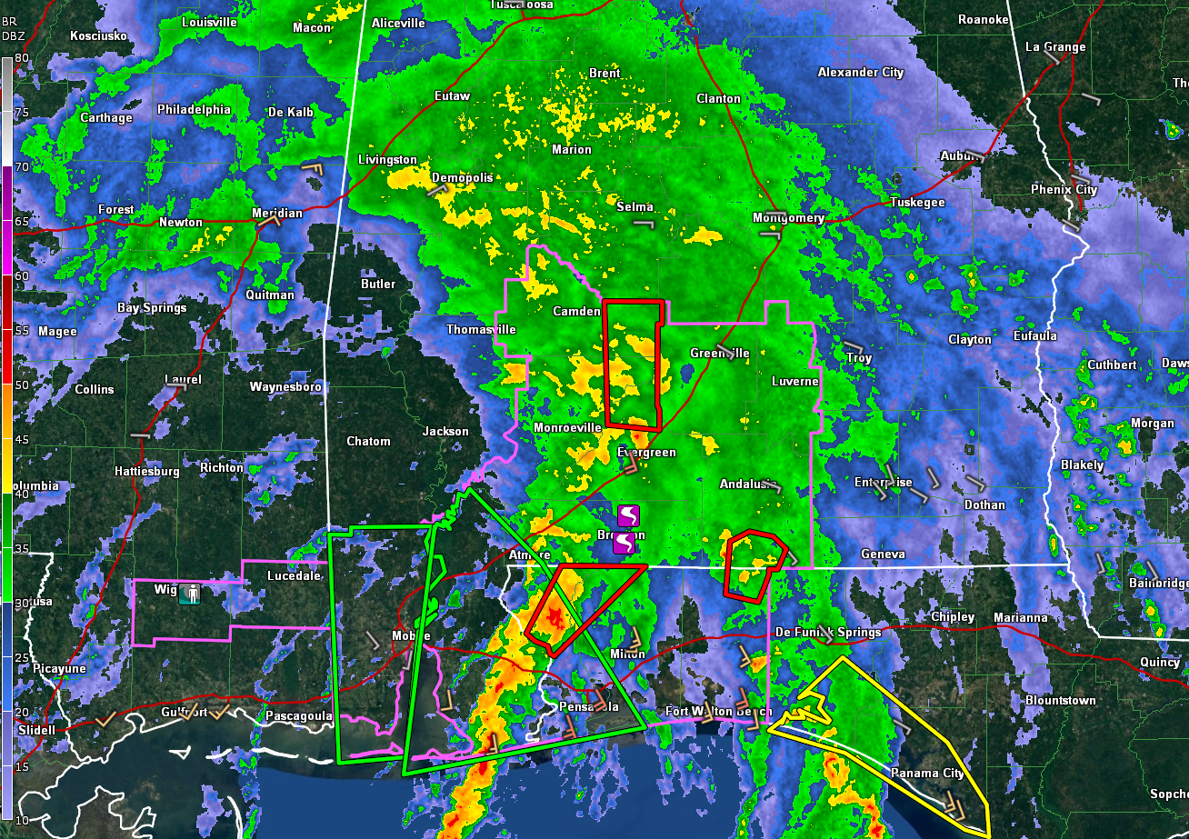
The leading edge of the heavier rain is now approaching Fayette, Birmingham, Montgomery, and Troy.
Over south Alabama, tornado warnings are in effect for…
…Monroe, Wilcox, and Conecuh Counties for a storm currently north of Evergreen moving north. A tornado signature was observed on radar in Conecuh County around 7:43. Muliple trailer homes were reported damaged near East Brewton around 7:35.
…Covington County AL and northern Okaloosa County FL for a storm on the border just west of Florala.
Another tornado warning is in effect for northern Escambia and Santa Rosa Counties in Florida for a possible tornado approaching Century, FL, which is on the Alabama border southwest of Brewton. So tornado warnings may be required again shortly for Escambia County, Alabama.
A tornado watch is in effect for parts of South Alabama until 11 a.m.
Flash flood warnings are in effect for parts of Mobile, Baldwin, and Escambia Counties. There will be more reports of flooding and additional warnings throughout the day as Claudette slowly moves north northeast into Alabama later.
Flash flood watches are in effect for much of Central and Southern Alabama.
Category: Alabama's Weather, ALL POSTS, Tropical
About the Author (Author Profile)
Bill Murray is the President of The Weather Factory. He is the site's official weather historian and a weekend forecaster. He also anchors the site's severe weather coverage. Bill Murray is the proud holder of National Weather Association Digital Seal #0001 @wxhistorianSubscribe
If you enjoyed this article, subscribe to receive more just like it.


