First Barbour County Tornado Warning Expired, But New One to the North
UPDATE 2:51 PM
Possible tornado crossing AL-51 just northeast of Louisville. People in Louisville should be in safe shelter for a few more minutes. There is tornado warning for Clayton yet, but one may be forthcoming.
UPDATE 2:41 PM
Radar indicates a tornado just east of Clio. Rotation is increasing with this cell and a tornado could occur at any time if not already occurring.
ORIGINAL POST
Radar indicated tornado near Blue Springs headed in the general direction of Clayton.
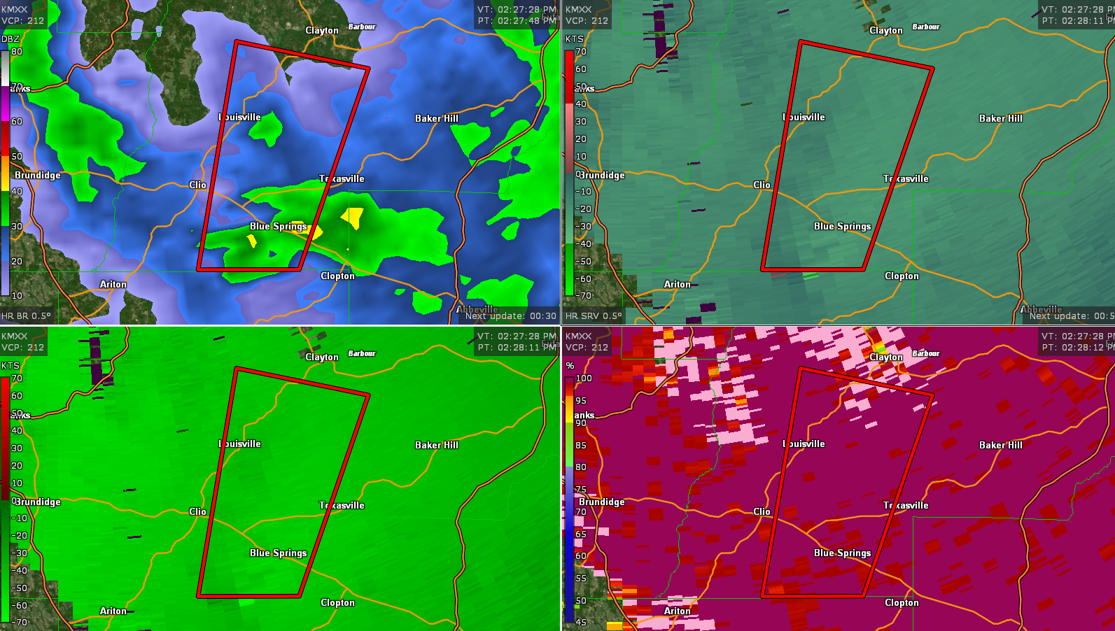
The National Weather Service in Birmingham has issued a
* Tornado Warning for…
Southwestern Barbour County in southeastern Alabama…
* Until 300 PM CDT.
* At 227 PM CDT, a severe thunderstorm capable of producing a tornado
was located near Blue Springs State Park, or 7 miles southeast of
Clio, moving north at 35 mph.
HAZARD…Tornado.
SOURCE…Radar indicated rotation.
IMPACT…Flying debris will be dangerous to those caught without
shelter. Mobile homes will be damaged or destroyed.
Damage to roofs, windows, and vehicles will occur. Tree
damage is likely.
* Locations impacted include…
Clio, Louisville, Tyler Crossroads, Blue Springs State Park and
Millers Ford.
Category: Alabama's Weather, ALL POSTS, Severe Weather
About the Author (Author Profile)
Bill Murray is the President of The Weather Factory. He is the site's official weather historian and a weekend forecaster. He also anchors the site's severe weather coverage. Bill Murray is the proud holder of National Weather Association Digital Seal #0001 @wxhistorianSubscribe
If you enjoyed this article, subscribe to receive more just like it.


