CANCELED Tornado Warning Continues for Parts of Barbour and Bullock Counties Until 3:45 p.m.
UPDATE 3:06
The rotation has weakened. Storm is not currently a threat to produce a tornado. Will be monitoring it.
UPDATE 2:59
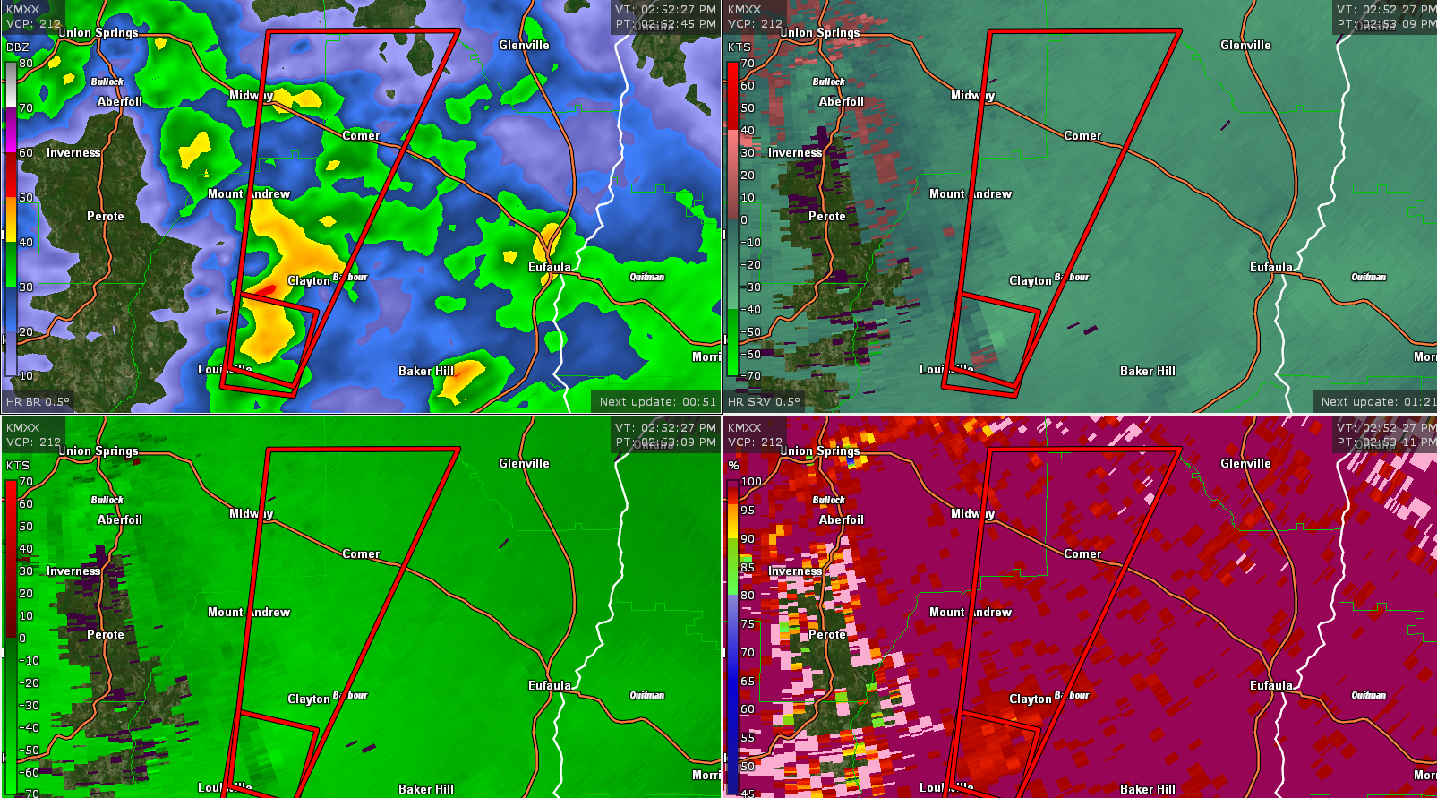
Most dangerous part of the storm is just west of Clayton. Rotation has been increasing on this storm and it could produce a tornado at any time.
BE alert in Clayton and Comer. Will cross US-82 near Comer.
ORIGINAL POST
This tornado will move near Clayton and Comer.
The National Weather Service in Birmingham has issued a
* Tornado Warning for…
East central Bullock County in southeastern Alabama…
North central Barbour County in southeastern Alabama…
* Until 345 PM CDT.
* At 252 PM CDT, a severe thunderstorm capable of producing a tornado
was located near Clayton, or 10 miles northeast of Clio, moving
north at 35 mph.
HAZARD…Tornado.
SOURCE…Radar indicated rotation.
IMPACT…Flying debris will be dangerous to those caught without
shelter. Mobile homes will be damaged or destroyed.
Damage to roofs, windows, and vehicles will occur. Tree
damage is likely.
* Locations impacted include…
Clayton, Louisville, Spring Hill, Comer, Barbour County Public Lake
Dam, Clayton Municipal Airport and Mount Andrew.
Category: Alabama's Weather, ALL POSTS, Severe Weather
About the Author (Author Profile)
Bill Murray is the President of The Weather Factory. He is the site's official weather historian and a weekend forecaster. He also anchors the site's severe weather coverage. Bill Murray is the proud holder of National Weather Association Digital Seal #0001 @wxhistorianSubscribe
If you enjoyed this article, subscribe to receive more just like it.


