Elsa a Little Stronger at 10 a.m.: Official Forecast Brings it into the Gulf by Early Next Week
Here is the latest on Tropical Storm Elsa:
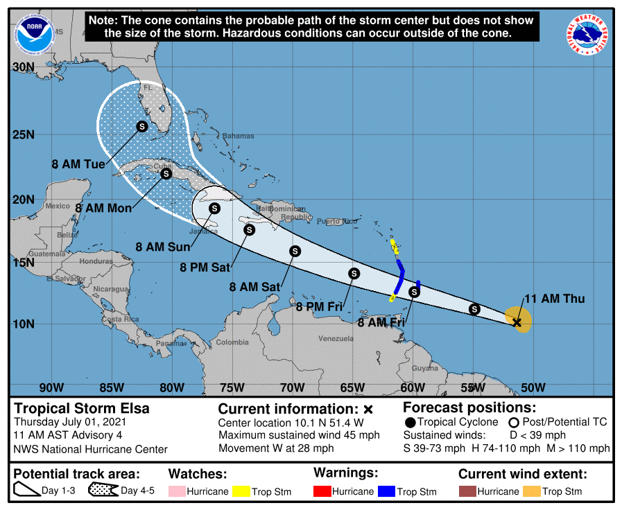
10 am CDT Quick Stats
Location: 10.1 North Latitude, 51.4 West Longitude
About 680 miles to the east-southeast of the Windward Islands.
Maximum Winds: 45 mph.
Minimum Central Pressure: 1006 Millibars or 29.71 Inches.
Forward Movement: West at 28 mph.
Elsa has become the earliest “E” storm on record surpassing the record set just last year by 5 days.
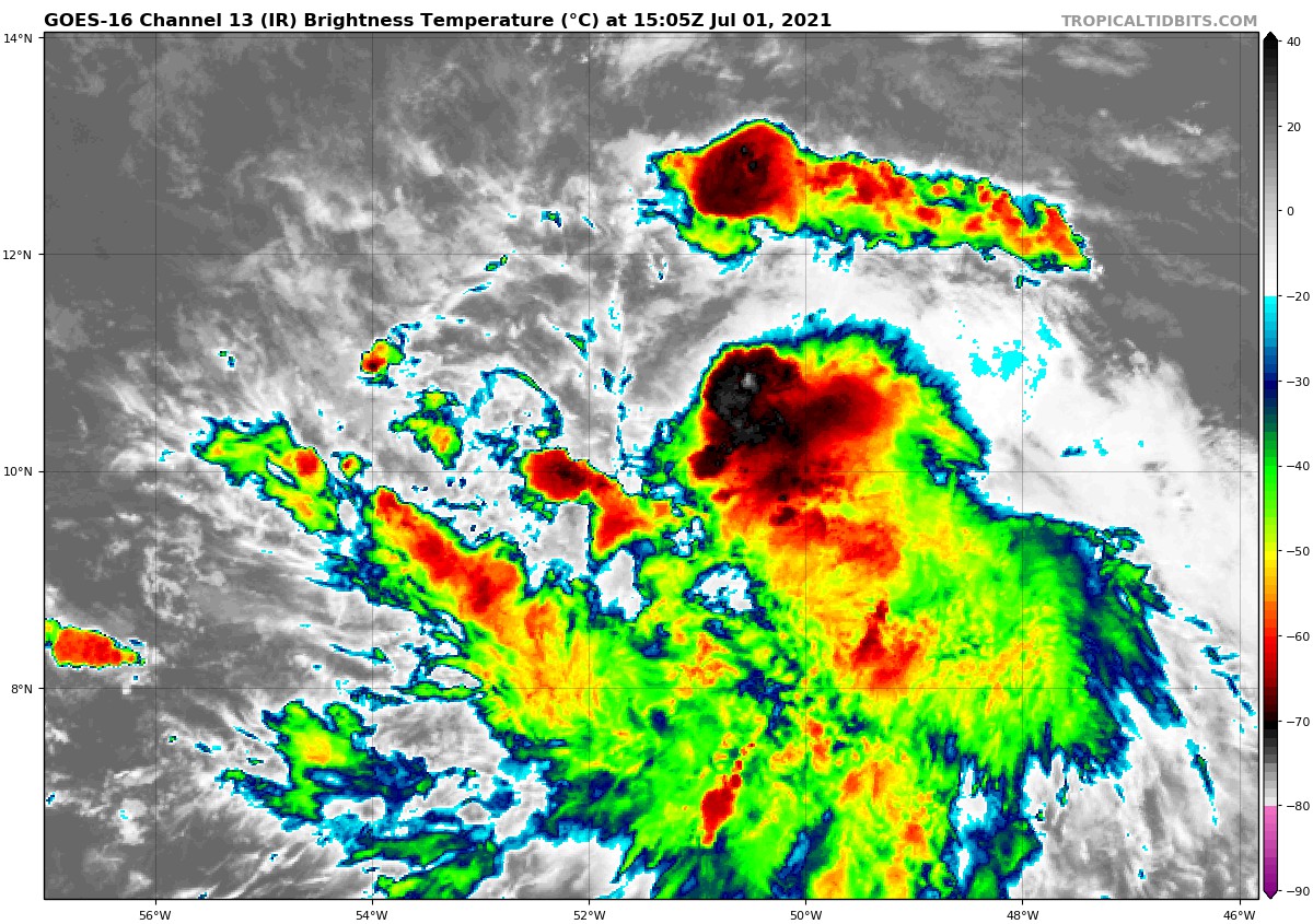
Satellite imagery today indicated that Elsa is becoming better organized. It is still undergoing some wind shear, but that should lessen over the eastern Caribbean.
The forecast track of Elsa will hinge a lot on how much it strengthens over the next couple of days or so. The overall weather pattern features a strong upper-level high-pressure system that’s located to the north of the storm. This will push the storm on a west-northwest track over the next 60 hours or so.
Beyond Saturday, the forecast track may depend on how strong the storm is. A smaller, weaker storm might be pulled northward more quickly. A stronger storm would be pushed further westward.
The GFS brings it into the eastern Gulf after brushing Jamaica, the Caymans, and western Cuba. It then brings it into the western coast of Florida. The European has been showing a weaker storm that would be pulled further north.
Here is the latest official forecast:
With the favorable environment for strengthening, Elsa should become a tropical storm before reaching the Windward islands. It will move across Barbados and the Windward Islands as a 60 to 70 mph tropical storm tomorrow.
The strength of Elsa in the Caribbean will depend on what sort of track it takes. A track from east-southeast to west-northwest across the entire length of the Caribbean would mean a gradually strengthening storm. Any interactions with the Greater Antilles would eventually lead to a much weaker storm. If it avoids the islands of the Greater Antilles, it could become a hurricane. It is a concern that the SHIPS intensity guidance does give the storm a 28% chance of rapid intensification to a 115 mph hurricane in 3 days.
Windward Islands & Barbados – Tropical storm-force winds, including bands of heavy rainfall (rain amounts of 4 to 8 inches are expected) and wind gusts of up to 70 mph are expected throughout Friday and Friday night across Barbados and much of the Windward Islands. There is some chance it could become a hurricane before reaching the islands.
Jamaica & The Cayman Islands – Tropical storm and possibly hurricane conditions are a possibility from about Sunday through Monday.
After that, it is too early to tell what the impacts will be, but we will be watching.
About the Author (Author Profile)
Bill Murray is the President of The Weather Factory. He is the site's official weather historian and a weekend forecaster. He also anchors the site's severe weather coverage. Bill Murray is the proud holder of National Weather Association Digital Seal #0001 @wxhistorianSubscribe
If you enjoyed this article, subscribe to receive more just like it.


