Midday Nowcast: Hot and Humid; Elsa Gaining Strength
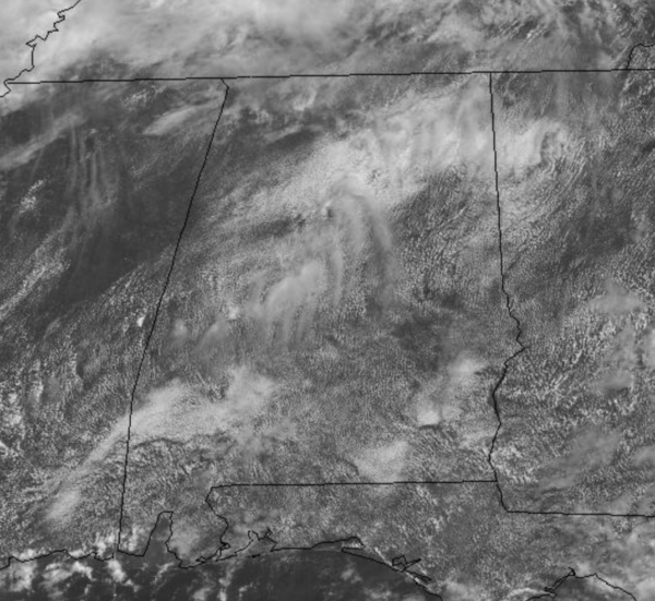
New month, same forecast..It is another muggy day, with a mix of sun and clouds and temperatures are heading into the upper 80s and lower 90s. For the rest of today, we will be watching the radar as scattered to numerous showers and thunderstorms develop, producing heavy rainfall and lightning; pretty routine for the first day of July in Alabama
FRIDAY FRONT: A surface front will drop into Alabama tomorrow, increasing our rain chances and tomorrow looks to be a rather wet day for the state. It will be cloudy with periods of rain and storms, with rain amounts over an inch in most locations. Due to the clouds and rain, highs tomorrow will struggle to reach the 80s across North/Central Alabama.
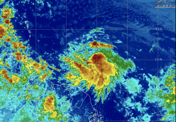
TROPICAL STORM ELSA: New update shows Elsa a bit stronger: The center of Tropical Storm Elsa was located near latitude 10.1 North, longitude 51.4 West. Elsa is moving toward the west near 28 mph.
An even faster motion toward the west-northwest is expected over the next 24 to 36 hours. On the forecast track, Elsa will pass near or over portions of the Windward Islands or the southern Leeward Islands on Friday, move into the eastern Caribbean Sea late Friday and Friday night, and move near the southern coast of Hispaniola on Saturday. By early Sunday Elsa is forecast to move near portions of eastern Cuba. Then by early Tuesday, off the Southwest Coast of Florida near Sarasota.
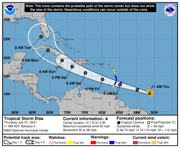
Recent satellite wind data indicate that maximum sustained winds are now near 45 mph with higher gusts. Some additional strengthening is forecast during the next 48 hours. Tropical-storm-force winds extend outward up to 90 miles, mainly to the north of the center. The estimated minimum central pressure is 1006 mb (29.71 inches). The current forecast keeps the system below hurricane strength over the next five days due to the quick forward motion, and potential interaction with some of the islands along the path.
We have plenty go time to watch this system and know the forecast can, and probably will change over the next few days. It is simply too early to know if Elsa will move into the Gulf of Mexico, through the Florida Peninsula, or recurve east of Florida.
BEACH FORECAST CENTER: Get the latest weather and rip current forecasts for the beaches from Fort Morgan to Panama City on our Beach Forecast Center page. There, you can select the forecast of the region that you are interested in visiting.
WORLD TEMPERATURE EXTREMES: Over the last 24 hours, the highest observation outside the U.S. was 127.0F at Jahra, Kuwait. The lowest observation was -105.9F at Vostok, Antarctica.
CONTIGUOUS TEMPERATURE EXTREMES: Over the last 24 hours, the highest observation was 114F at Death Valley, CA as well as Omak and Richland, WA. The lowest observation was 33F at Peter Sinks, UT.
Category: Alabama's Weather, ALL POSTS
About the Author (Author Profile)
Macon, Georgia Television Chief Meteorologist, Birmingham native, and long time Contributor on AlabamaWX. Stormchaser. I did not choose Weather, it chose Me. College Football Fanatic. @Ryan_StinnetSubscribe
If you enjoyed this article, subscribe to receive more just like it.


