

A Great 4th of July So Far at Midday; Elsa Continues to Churn Toward the Florida Keys
HAPPY INDEPENDENCE DAY
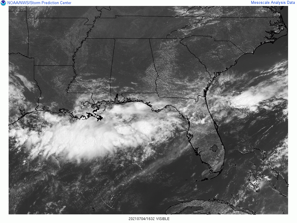
It is a very nice day across Central Alabama as we approach the midday hour on this July 4th. Skies are mainly sunny across much of the area, with a few fair-weather cumulus clouds over the southeastern parts of the area. As of the 11 am round-up, temperatures were in the upper 70s to the mid-80s. Troy was the warm spot at 86 degrees. The cool spots were Pell City and Talladega at 77 degrees.
Skies will continue to be mostly clear to partly cloudy across Central Alabama throughout the afternoon to the early evening hours, with only a very small chance of an isolated shower or two for locations south of the I-85 and US-80 corridors. Highs will be in the mid-80s to the lower 90s. For tonight, skies will be mainly clear, and any shower activity will dissipate early, allowing for nearly perfect conditions for the fireworks shows that will take place tonight. Temperatures will be in the 70s at 9 pm and will eventually drop into the lower 60s to the lower 70s for the overnight low.
NEXT WEEK
Moisture will pull back up into Central Alabama on Monday, which will bring back the mugginess and a small chance of a few isolated to scattered afternoon showers and storms, mainly over the southern half of the area. Highs will be in the upper 80s to the lower 90s. More moisture on Tuesday means even more mugginess and 50/50 odds of scattered showers and storms, mainly during the afternoon and early evening hours, across the area. Highs will be in the mid to upper 80s.
Showers and storms will be likely at times across Central Alabama on Wednesday, with the activity being most active during the afternoon and evening hours. Highs will be in the lower to mid-80s. It’s pretty much the same story on Thursday, as increased moisture will keep showers and thunderstorms likely at times, especially during the afternoon and evening hours. Highs will be in the mid to upper 80s. And really no change for Friday as well… Showers and storms will be likely at times, especially during the afternoon and evening hours. Highs will be in the mid to upper 80s.
NEXT WEEKEND
The scattered shower and storm chances will drop back to around 50/50 odds on Saturday during the afternoon and evening hours, but a surface front looks to push into the area on Sunday that will make those rain chances likely at times once again, especially for the northern half of the area. Saturday’s highs look to top out in the lower 80s to the lower 90s, but dropping way back to the upper 70s to the mid-80s across the area on Sunday.
TROPICAL UPDATE
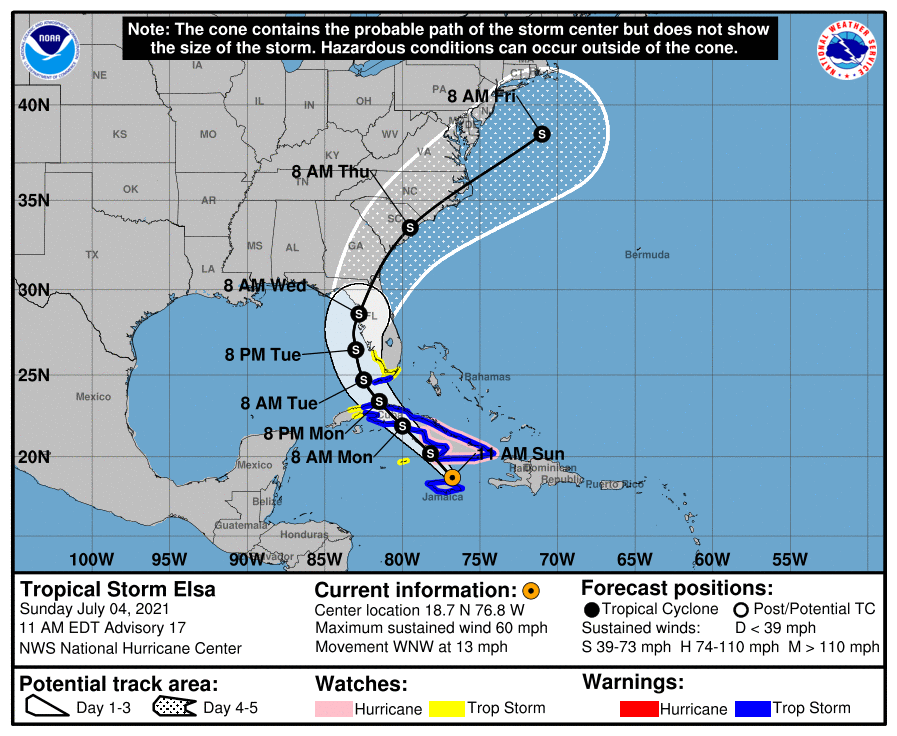
Unless there is a major shift in the forecast track on now Tropical Storm Elsa, we will see no effects on our weather from her. The rest of the North Atlantic Ocean, Caribbean Sea, and the Gulf of Mexico is free from any tropical mischief and no new tropical cyclones are expected over the next five days.
As of 10 am, Elsa’s maximum sustained winds were down to 60 mph with gusts up to 70 mph, and was moving to the west-northwest at 13 mph. The center was located around 50 miles to the north of Kingston, Jamaica. A turn toward the northwest is expected today or tonight. On the forecast track, Elsa will continue to move near Jamaica and portions of eastern Cuba today, and approach central Cuba tonight and early Monday. Elsa is expected to move across central and western Cuba and head toward the Florida Straits on Monday and pass near the Florida Keys late Monday. Elsa is then forecast to move near or over portions of the west coast of Florida on Tuesday and Wednesday. Some strengthening is possible today and tonight as Elsa approaches the south-central coast of Cuba. However, gradual weakening is forecast to occur on Monday when Elsa moves across Cuba. After Elsa emerges over the Florida Straits and the southeastern Gulf of Mexico, some slight restrengthening is possible.
Storm surge of 1-3 feet will be possible for portions of Florida as Elsa moves toward the west coast of the Florida Peninsula, especially from Bonita Beach to Flamingo, and for Ocean Reef and Florida Bay. Tropical storm conditions will be possible on Monday for the Florida Keys and the southwest coast of Florida. Rainfall from Elsa will impact portions of the Florida Keys and Florida Peninsula Monday through Wednesday. Amounts of 2 to 4 inches with localized maximum amounts up to 6 inches will be possible, which may result in isolated flash, urban, and minor river flooding.
ON THIS DAY IN WEATHER HISTORY
1776 – Thomas Jefferson paid for his first thermometer, and signed the Declaration of Independence. According to his weather memorandum book, at 2 PM it was cloudy and 76 degrees.
1956 – A world record for the most rain in one minute was set at Unionville, MD, with a downpour of 1.23 inches.
Category: Alabama's Weather, ALL POSTS, Tropical
About the Author (Author Profile)
Scott Martin is an operational meteorologist, professional graphic artist, musician, husband, and father. Not only is Scott a member of the National Weather Association, but he is also the Central Alabama Chapter of the NWA president. Scott is also the co-founder of Racecast Weather, which provides forecasts for many racing series across the USA. He also supplies forecasts for the BassMaster Elite Series events including the BassMaster Classic.Subscribe
If you enjoyed this article, subscribe to receive more just like it.


