Midday Nowcast: One More Dry Day for North/Central Alabama
The northern half of the state continues to be rain free today, but down to the south more showers and storms are ongoing in a more humid air mass.
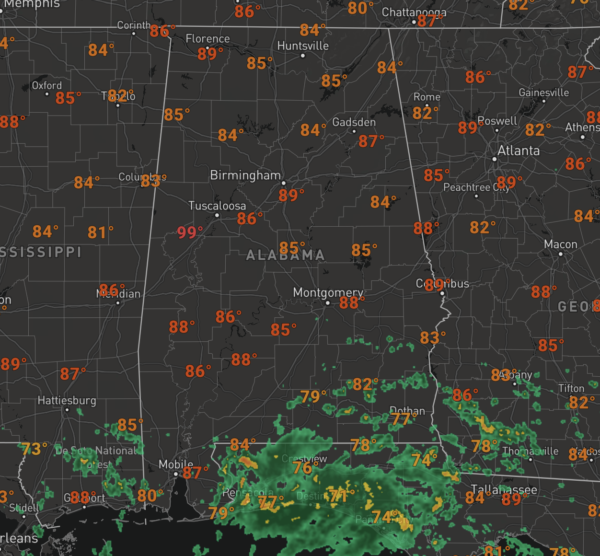
That air mass will surge north this week, which will increase our rain chances statewide tomorrow. For the rest of today, we are seeing more sun than clouds with high flirting with 90° in many locations.
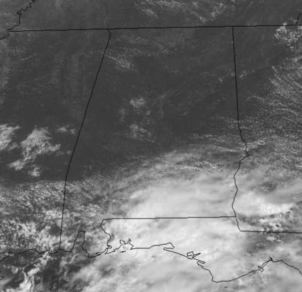
BETTER RAIN CHANCES: Moisture levels will be on the rise tomorrow, and we will have to bring scattered showers and storms back to the forecast tomorrow afternoon and evening. The moisture will continue to increase by midweek, and with an approaching upper trough, clouds and rain become the main feature in our weather. Tomorrow expect a mix of sun and clouds with highs in the upper 80s, but by Wednesday and Thursday, we will see more clouds than sun with scattered to numerous showers and thunderstorms. Due to the clouds and rain, highs will be in the lower to mid 80s, which are below average for July in Alabama. By Friday, rain chances should decrease a bit, but we will continue to mention scattered showers and storms in the forecast.
LATEST ON ELSA: The center of Tropical Storm Elsa was located near latitude 21.5 North, longitude 81.2 West. Elsa is moving toward the northwest near 14 mph, and this general motion is expected to continue today, followed by a turn toward the north-northwest on Tuesday. On the forecast track, Elsa is expected to move across central and western Cuba later today and pass near the Florida Keys early Tuesday. Elsa is then forecast to move near or over portions of the west coast of Florida on Tuesday and Wednesday.
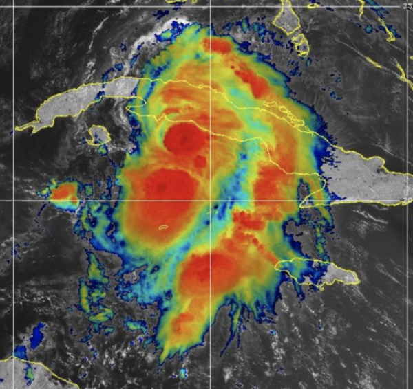
Maximum sustained winds are near 65 mph with higher gusts. Some weakening is expected while the center moves over land. Slight restrengthening is forecast after Elsa moves over the southeastern Gulf of Mexico. Tropical-storm-force winds extend outward up to 70 miles from the center. The minimum central pressure estimated from NOAA Hurricane Hunter observations is 1006 mb (29.71 inches).
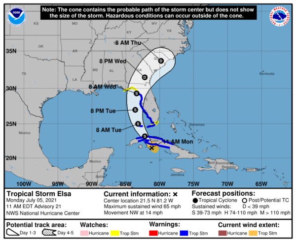
Though Elsa will remain east of Alabama, and we expect little to no impacts from the system, we will mention rip currents in the Gulf will be running high this week, with the system in the Gulf. Just be mindful of that and pay attention to the flag warning system along the Gulf.
BEACH FORECAST CENTER: Get the latest weather and rip current forecasts for the beaches from Fort Morgan to Panama City on our Beach Forecast Center page. There, you can select the forecast of the region that you are interested in visiting.
WORLD TEMPERATURE EXTREMES: Over the last 24 hours, the highest observation outside the U.S. was 121.3F at Ahwaz, Iran. The lowest observation was -94.9F at Mid Point, Antarctica.
CONTIGUOUS TEMPERATURE EXTREMES: Over the last 24 hours, the highest observation was 120F at Death Valley, CA. The lowest observation was 37F at Mount Washington, NH.
Category: Alabama's Weather, ALL POSTS
About the Author (Author Profile)
Macon, Georgia Television Chief Meteorologist, Birmingham native, and long time Contributor on AlabamaWX. Stormchaser. I did not choose Weather, it chose Me. College Football Fanatic. @Ryan_StinnetSubscribe
If you enjoyed this article, subscribe to receive more just like it.


