Convective Blow-Up Moving Onshore & Across the Florida Peninsula Tonight
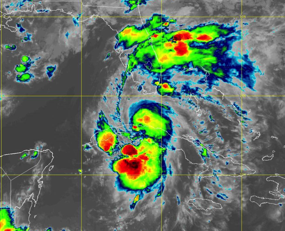
The latest infrared satellite image shows a mass of convection that is moving onshore and across the Florida Peninsula this evening, which is bringing scattered to numerous shower activity to the area.
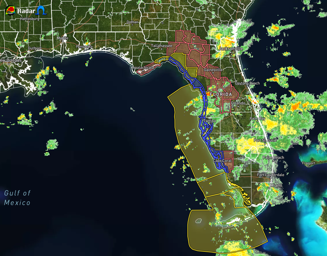
Radar shows this rain activity moving onto the peninsula from the Atlantic Ocean, drenching places such as Port St. Lucie, Miami, Palm Bay, and Cape Canaveral. So far, no reports of any strong wind gusts or brief spin-up tornadoes, but that threat will start to build throughout the late-night and overnight hours as the center of Elsa moves closer.
A Tropical Storm Warning (yellow polygons) is in effect for the Florida Keys from Craig Key westward to the Dry Tortugas, and for the west coast of Florida from Flamingo northward to Ochlockonee River.
A Storm Surge Watch (blue polygons) is in effect from west of the Aucilla River to the Ochlockonee River.
A Tropical Storm Watch (red polygons) is in effect from west of the Ochlockonee River to Indian Pass, Florida.
Tropical storm conditions are expected in the warning area in the Florida Keys beginning tonight and along the Florida west coast beginning Tuesday, then spreading northward into the Florida Big Bend region within the Tropical Storm Warning area Tuesday night and early Wednesday. Tropical storm conditions are possible in the watch area beginning late Tuesday night.
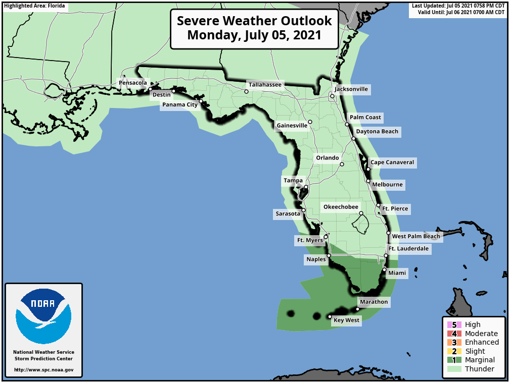
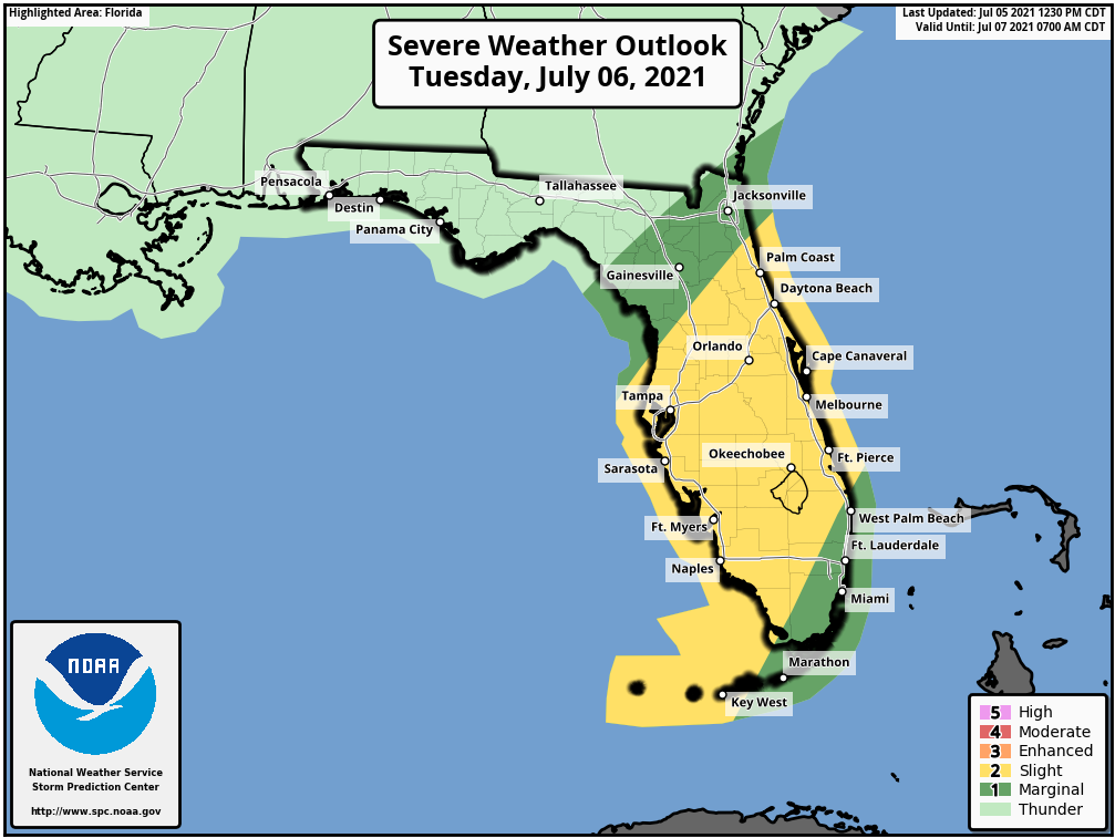
A few tornadoes are possible across south Florida tonight and across the Florida Peninsula on Tuesday. A Marginal Risk for severe storms is up for the extreme southern tip of the Florida Peninsula and the Florida Keys through the rest of tonight until 7 am, then a Slight Risk goes into effect for nearly all of the central portions of the peninsula, while a Marginal Risk immediately surrounds the slight risk.
For Central Alabama, we’ll have virtually no impact from Elsa itself, but the pull of tropical moisture from the south will invade Central Alabama. That will bring back higher rain chances through the rest of the work week and higher humidity levels. Same for the Alabama Gulf Coast, with the exception of dangerous rip currents occurring this week.
Category: Alabama's Weather, ALL POSTS, Severe Weather, Tropical
About the Author (Author Profile)
Scott Martin is an operational meteorologist, professional graphic artist, musician, husband, and father. Not only is Scott a member of the National Weather Association, but he is also the Central Alabama Chapter of the NWA president. Scott is also the co-founder of Racecast Weather, which provides forecasts for many racing series across the USA. He also supplies forecasts for the BassMaster Elite Series events including the BassMaster Classic.Subscribe
If you enjoyed this article, subscribe to receive more just like it.


