

Midday Nowcast: Heat, Humidity, Storms Developing
Little change in the forecast today through Sunday as we are going to be seeing with a mix of sun and clouds, hot and humid conditions with highs in the mid-80s to mid-90s across the state each day, and heat index values will be in the upper 90s and low 100s at times.
Each day will feature those random, daily showers and storms, mainly during the afternoon and evening hours, and they could be quite numerous at times through the Sunday. Rainfall totals will vary greatly with many locations staying dry, while others could get way too much and cause flash flooding. There is no way of knowing when and where these storms will occur, we just have to watch the radar. As we have seen in recent days, we could see a few severe storms with gusty winds and hail mixed in as well.
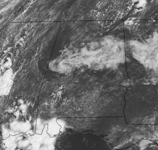
RADAR CHECK: There are a few showers showing up across the state as we approach the midday hour, but the more widespread showers and storms are down along the Gulf Coast, around Mobile Bay, and there are heading north. More activity across Mississippi is spreading east, so over the next few hours, the radars will be getting very active across the state. Also, showers and storms will also be developing across the state.

NEXT WEEK: The pattern won’t change much, and therefore our weather won’t change much for Monday and Tuesday with the continued higher rain chances. For the second half of the week, showers and storms will become more scattered in nature. Each day expect partly sunny, very warm and humid days with highs mainly in the upper 80s…which are still below average for July in Alabama.
IN THE TROPICS: For the North Atlantic, Caribbean Sea, and the Gulf of Mexico: Tropical cyclone formation is not expected during the next 5 days.

BEACH FORECAST CENTER: Get the latest weather and rip current forecasts for the beaches from Fort Morgan to Panama City on our Beach Forecast Center page. There, you can select the forecast of the region that you are interested in visiting.
WORLD TEMPERATURE EXTREMES: Over the last 24 hours, the highest observation outside the U.S. was 121.6F at Jahra, Kuwait. The lowest observation was -106.8F at Mid-Point, Antarctica.
CONTIGUOUS TEMPERATURE EXTREMES: Over the last 24 hours, the highest observation was 119F at Death Valley, CA. The lowest observation was 33F at Toponas, CO.
Category: Alabama's Weather, ALL POSTS
About the Author (Author Profile)
Macon, Georgia Television Chief Meteorologist, Birmingham native, and long time Contributor on AlabamaWX. Stormchaser. I did not choose Weather, it chose Me. College Football Fanatic. @Ryan_StinnetSubscribe
If you enjoyed this article, subscribe to receive more just like it.


