

Flash Flood Warning Issued for Parts of Limestone, Madison, Morgan, & Lawrence Co. Until 12:15 am
The National Weather Service in Huntsville has issued a
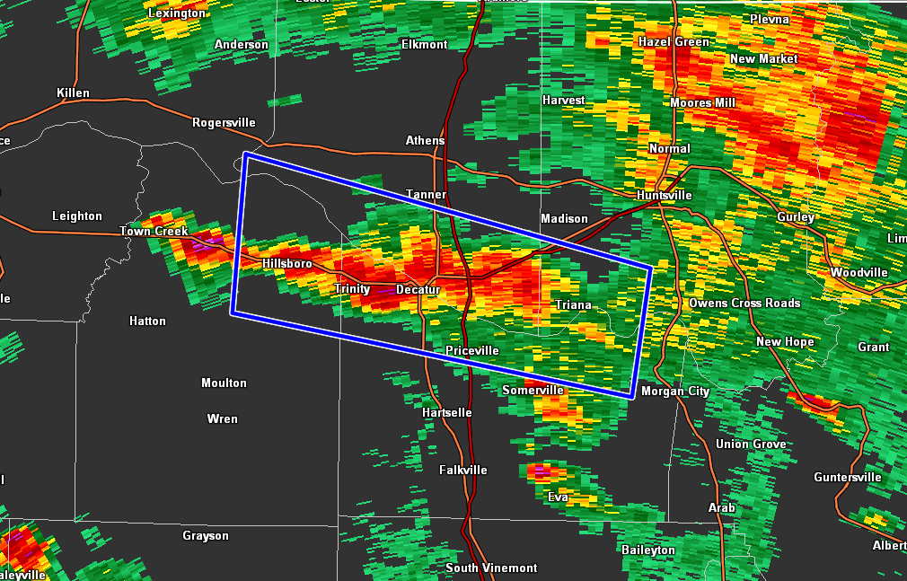
* Flash Flood Warning for…
Southern Limestone County in north central Alabama…
Southwestern Madison County in north central Alabama…
Northern Morgan County in north central Alabama…
Northeastern Lawrence County in northwestern Alabama…
* Until 1215 AM CDT.
* At 907 PM CDT, Doppler radar and automated rain gauges indicated
heavy rain falling across the warned area. Between 2 and 3 inches
of rain have fallen. Additional rainfall amounts of 1 to 2 inches
are possible in the warned area. Flash flooding is ongoing or
expected to begin shortly.
HAZARD…Flash flooding caused by heavy rain.
SOURCE…Radar and automated gauges.
IMPACT…Flash flooding of small creeks and streams, urban
areas, highways, streets and underpasses as well as
other poor drainage and low-lying areas.
* Some locations that will experience flash flooding include…
Decatur, Madison, Redstone Arsenal, Priceville, Trinity, Triana,
Tanner, Huntsville International Airport, Hillsboro, Mooresville,
Belle Mina, Caddo, Wheeler and Valhermoso Springs.
PRECAUTIONARY/PREPAREDNESS ACTIONS…
Turn around, don’t drown when encountering flooded roads. Most flood
deaths occur in vehicles.
Be especially cautious at night when it is harder to recognize the
dangers of flooding.
Category: Alabama's Weather, ALL POSTS, Severe Weather
About the Author (Author Profile)
Scott Martin is an operational meteorologist, professional graphic artist, musician, husband, and father. Not only is Scott a member of the National Weather Association, but he is also the Central Alabama Chapter of the NWA president. Scott is also the co-founder of Racecast Weather, which provides forecasts for many racing series across the USA. He also supplies forecasts for the BassMaster Elite Series events including the BassMaster Classic.Subscribe
If you enjoyed this article, subscribe to receive more just like it.


