Weather Xtreme: Very Hot with a Few Isolated Showers or Storms Possible This Afternoon
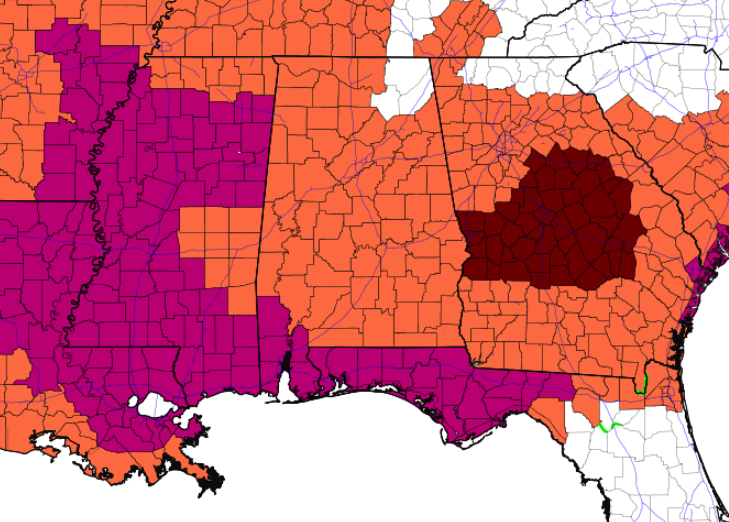
HEAT ADVISORIES: Heat Advisories are once again in effect today for all of Central Alabama and for the west and central parts of North Alabama. NWS Birmingham has already extended the Heat Advisory for Central Alabama until Saturday evening. NWS Huntsville will probably extend the advisory for North Alabama later today.
TODAY’S WEATHER: Today will be very hot and dry, with plenty of sunshine. A few isolated showers or storms may be possible for the extreme northern portions of the area. Highs will be in the mid to upper 90s across the area.
THIS WEEKEND: On Saturday, moisture will start to move back into the mid-levels as a cold front will begin to approach the area from the north. Skies will be mostly sunny, but we’ll have a chance for a few isolated to scattered showers and storms across the area. Highs will be in the mid to upper 90s. Rain chances start to rise on Sunday as the front starts to move into the area and stalls out over the northern parts. We can expect a few scattered showers and storms during the afternoon hours, with highs reaching the upper 80s to the upper 90s.
NEXT WEEK: Showers and thunderstorms become more likely on Monday as the front continues to hang out over the northern parts of the area. Skies will be mostly cloudy and highs will be in the 80s. The front finally starts to move southward on Tuesday and will push much of the shower and thunderstorm activity over the southern half of the area. However, we still can’t rule out a few scattered showers and storms over the northern half. Highs will be in the 80s.
Wednesday looks like we return to more of the typical summertime weather we expect to see in Central Alabama. Mostly sunny with a slight chance of a few isolated to scattered afternoon showers and storms. Highs will be in the mid to upper 80s. Thursday and Friday will be pretty similar as skies will be mostly sunny with a slight chance of a few isolated to scattered afternoon showers and storms. Highs will be in the mid to upper 80s on Thursday, into the upper 80s to the lower 90s on Friday.
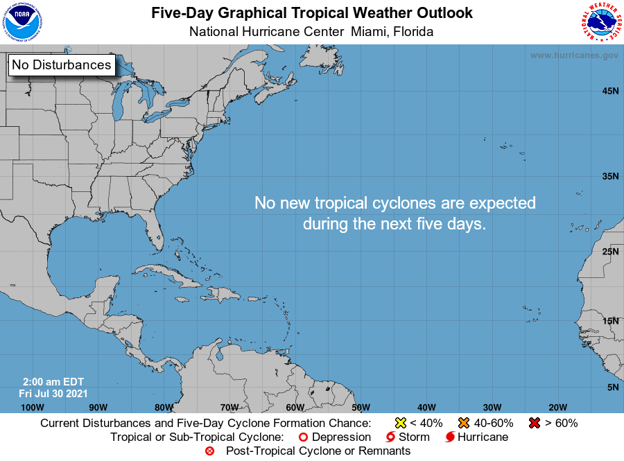
THE TROPICS: All is quiet across the Atlantic Basin, and tropical cyclone formation is not expected within the next five days.
Category: Alabama's Weather, ALL POSTS, Weather Xtreme Videos
About the Author (Author Profile)
Scott Martin is an operational meteorologist, professional graphic artist, musician, husband, and father. Not only is Scott a member of the National Weather Association, but he is also the Central Alabama Chapter of the NWA president. Scott is also the co-founder of Racecast Weather, which provides forecasts for many racing series across the USA. He also supplies forecasts for the BassMaster Elite Series events including the BassMaster Classic.Subscribe
If you enjoyed this article, subscribe to receive more just like it.


