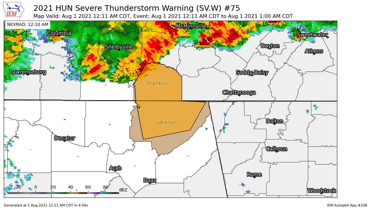
CANCELED – Severe T-Storm Warning for Parts of Jackson Co. Until 1 am
The National Weather Service in Huntsville Alabama has issued a
* Severe Thunderstorm Warning for…
Jackson County in northeastern Alabama…
Franklin County in Middle Tennessee…
* Until 100 AM CDT.
* At 1210 AM CDT, severe thunderstorms were located along a line
extending from near Manchester to near Tims Ford Lake to near
Huntland, moving southeast at 50 mph.
HAZARD…60 mph wind gusts.
SOURCE…Radar indicated.
IMPACT…Expect damage to roofs, siding, and trees.
* Locations impacted include…
Scottsboro, Winchester, Bridgeport, Decherd, Estill Springs,
Stevenson, Cowan, Hollywood, Huntland and Skyline.
PRECAUTIONARY/PREPAREDNESS ACTIONS…
For your protection move to an interior room on the lowest floor of a
building.
Wind damage with these storms may occur before any rain or
lightning. Do not wait for the sound of thunder before taking cover.
seek shelter immediately inside a sturdy structure and stay away
from windows.
Torrential rainfall is occurring with these storms, and may lead to
flash flooding. Do not drive your vehicle through flooded roadways.
Category: Alabama's Weather, ALL POSTS, Severe Weather
About the Author (Author Profile)
Scott Martin is an operational meteorologist, professional graphic artist, musician, husband, and father. Not only is Scott a member of the National Weather Association, but he is also the Central Alabama Chapter of the NWA president. Scott is also the co-founder of Racecast Weather, which provides forecasts for many racing series across the USA. He also supplies forecasts for the BassMaster Elite Series events including the BassMaster Classic.Subscribe
If you enjoyed this article, subscribe to receive more just like it.


