Weather Xtreme: Hot & Humid with the Potential for a Few Strong to Severe Storms Today
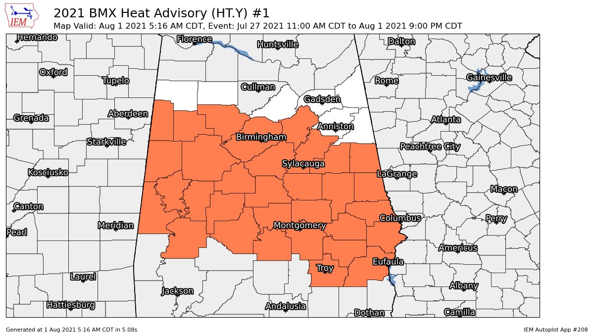
HEAT ADVISORY: Nearly all of Central Alabama remains in a Heat Advisory until 9 pm tonight. After today, heat levels will back off well below advisory criteria for at least the next six days.
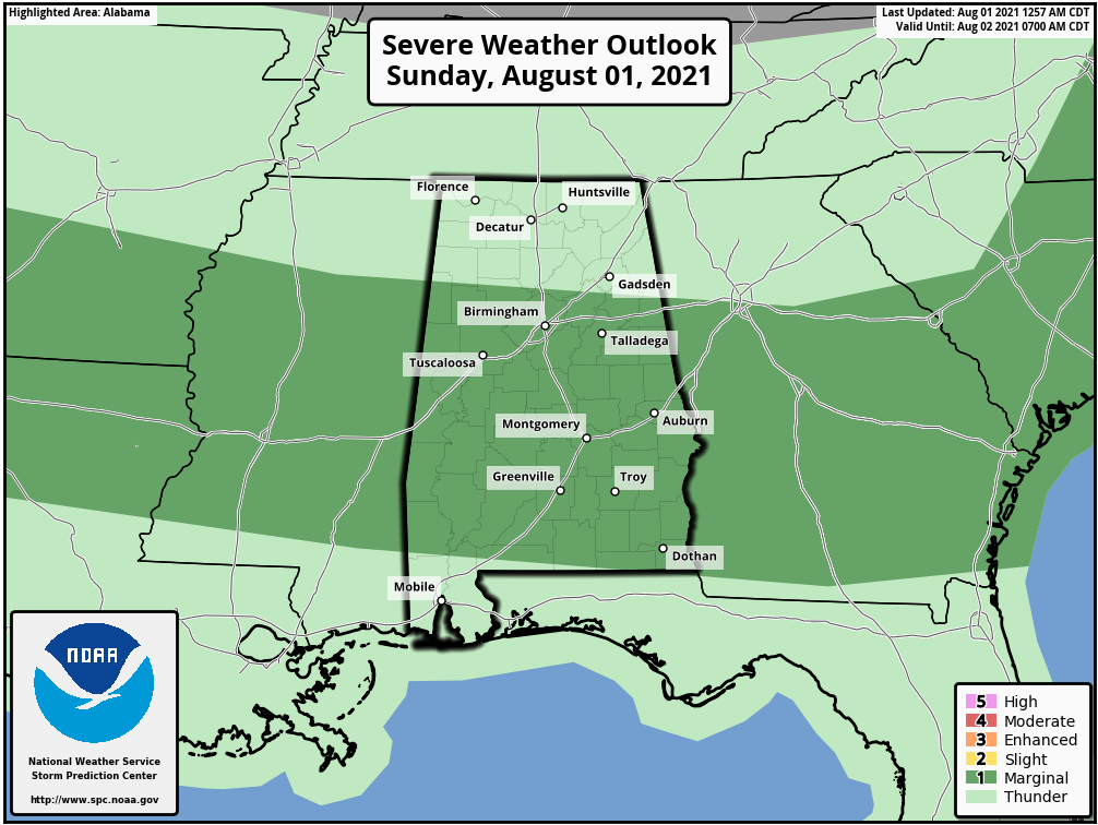
MARGINAL RISK FOR SEVERE STORMS: A Marginal Risk for severe storms is up for much of Central Alabama today, which includes locations along and south of a line from Detroit to Hayden to Jacksonville.
TODAY’S WEATHER: Before showers and storms develop and move across the area during the afternoon and evening hours, we’ll continue to have oppressive heat and humidity levels as heat index values will reach or exceed 105º. We’ll also have to watch the activity that will continue to move southeastward from Tennessee. A cold front will be moving slowly through the area, and with the Marginal Risk up for today, isolated damaging wind gusts up to 60 mph and isolated flooding issues will be possible with the stronger storms throughout the day. Afternoon highs will be in the upper 80s to the upper 90s.
THE WORK WEEK AHEAD: The cold front continues to slowly push southward through the southern half of the area on Monday, that will keep shower and thunderstorm chances elevated for those locations. Only a few isolated to scattered showers and storms may be possible for the northern half. Highs will be in the 80s. Tuesday looks to be a mainly dry day across the area with plenty of sunshine, but we simply cannot rule out an isolated shower or two. Highs will be in the 80s.
Wednesday through Friday look to be pretty similar days as we get back into more of the typical summer pattern we are used to seeing in Central Alabama. Each day will feature plenty of sunshine to start, with a small chance of a few isolated to scattered afternoon showers and thunderstorms. Highs will be in the mid to upper 80s on each day, with a couple of spots hitting 90º on Friday.
NEXT WEEKEND: A good bit of sun can be expected, with the daily chance of a few isolated to scattered afternoon showers and storms. Highs will be in the upper 80s to the lower 90s on both days.
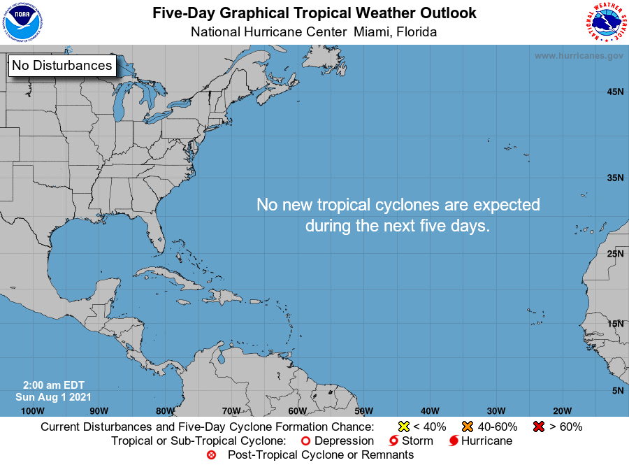
THE TROPICS: All is quiet across the Atlantic Basin, and tropical cyclone formation is not expected within the next five days.
Category: Alabama's Weather, ALL POSTS, Severe Weather, Weather Xtreme Videos
About the Author (Author Profile)
Scott Martin is an operational meteorologist, professional graphic artist, musician, husband, and father. Not only is Scott a member of the National Weather Association, but he is also the Central Alabama Chapter of the NWA president. Scott is also the co-founder of Racecast Weather, which provides forecasts for many racing series across the USA. He also supplies forecasts for the BassMaster Elite Series events including the BassMaster Classic.Subscribe
If you enjoyed this article, subscribe to receive more just like it.


