The Marginal Risk Reduced to Only Include the Southern Half of Central Alabama
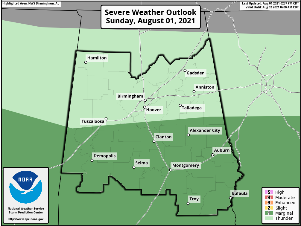
The latest update from the Storm Prediction Center reduced the level 1/5 Marginal Risk for severe storms to only include the southern half of Central Alabama, which includes the cities of Alexander City, Clanton, Auburn, Demopolis, Selma, Montgomery, Eufaula, and Troy.
There is still the potential for a few isolated to scattered showers and thunderstorms this afternoon north of the risk area, some of which could become strong and capable of producing wind gusts up to 50 mph. Outside of the wind threat, the other hazard with any of the strong storms will be from dangerous cloud-to-ground lightning and locally heavy rainfall.
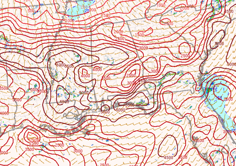
The main window for stronger to severe storms continue from now through 10 pm tonight. Instability values, while lower than earlier results, still remain elevated in the 2,000-4,500 J/kg range, which is plenty of fuel for storms to feed off of. All of Central Alabama continue to have the downdraft potential energy numbers in the 900-1,500 J/kg range, which means there is a good potential for gusty downdraft thunderstorm winds with any storms that form this afternoon and evening.
While the overall outlook for severe storms has diminished somewhat, the potential is still there for a few strong to severe storms over the southern half of the area. We’ll keep you posted.
Category: Alabama's Weather, ALL POSTS, Severe Weather
About the Author (Author Profile)
Scott Martin is an operational meteorologist, professional graphic artist, musician, husband, and father. Not only is Scott a member of the National Weather Association, but he is also the Central Alabama Chapter of the NWA president. Scott is also the co-founder of Racecast Weather, which provides forecasts for many racing series across the USA. He also supplies forecasts for the BassMaster Elite Series events including the BassMaster Classic.Subscribe
If you enjoyed this article, subscribe to receive more just like it.


