4 pm Advisory — Tropical Storm Watch Issued for the Florida Keys & Portions of South Florida
SUMMARY OF 4:00 PM CDT INFORMATION
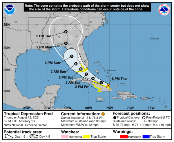
LOCATION…21.3N 75.3W
ABOUT 470 MI…760 KM ESE OF KEY WEST FLORIDA
ABOUT 165 MI…270 KM E OF CAMAGUEY CUBA
MAXIMUM SUSTAINED WINDS…35 MPH…55 KM/H
PRESENT MOVEMENT…WNW OR 295 DEGREES AT 12 MPH…19 KM/H
MINIMUM CENTRAL PRESSURE…1012 MB…29.89 INCHES
WATCHES AND WARNINGS
A Tropical Storm Watch is in effect for…
* The Cuban provinces of Ciego de Avila, Camaguey, Las Tunas, Holguin, and Granma
* The Florida Keys west of Ocean Reef to the Dry Tortugas
* The southwest coast of Florida from Bonita Beach south and east to Ocean Reef including Florida Bay
FORECAST DISCUSSION
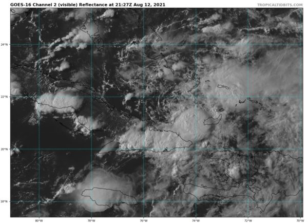
Fred remains poorly organized at this time. While the low-level circulation looks more closed than it did earlier, the center is broad and may have multiple vortices rotating around it. Also, while convection has increased from earlier today, there is only minimal convection near the center and little evidence of banding. The initial intensity remains 30 kt, with those winds likely occurring in squalls to the northeast of the center.
Fred has slowed its forward speed, with the initial motion now 295/10. There is little change to the track forecast philosophy from the previous advisory. The subtropical ridge to the northeast should steer Fred west-northwestward for the first 24-36 h, followed by a turn toward the northwest as the cyclone approaches the western periphery of the ridge. By 96-120 h, a northward motion is expected as Fred moves into a weakness in the ridge. The track guidance has shifted westward since the previous advisory, most notably after about 24 h. Thus, that portion of the new forecast track has also been nudged a little westward, but it still lies to the east of the various consensus models.
Fred remains in an environment of about 20 kt of westerly vertical wind shear. The shear is expected to persist during the next day or so, and this combined with the current disorganization of the system should prevent significant strengthening during that time. After that, there remains disagreement between the global models on the evolution of the upper-level trough over Florida and the upper-level anticyclone southeast of Fred. Some shear is likely to continue, but there may be a period of more conducive conditions from 36-72 h. The new intensity forecast is similar to the previous one in calling for slow strengthening through the first 36 h, with a little faster strengthening from 36-72 h. With that being said, the forecast 45-kt peak intensity is near the high end of the intensity guidance.
KEY MESSAGES
1. From Friday into Monday, heavy rainfall could lead to areal, urban, small stream, and exacerbated river flooding across southern and central Florida, and into the Big Bend of Florida. By early next week, heavy rain and flood impacts could extend into other portions of the Southeast and into the southern and central Appalachians and Piedmont.
2. Tropical storm conditions are possible beginning Friday night and Saturday in the Florida Keys and portions of southern Florida, where a Tropical Storm Watch is in effect. The risk of tropical storm conditions will spread northward along portions of the Florida west coast and to the Florida Panhandle Saturday night through Monday.


